… Autumn, by Lawren Harris
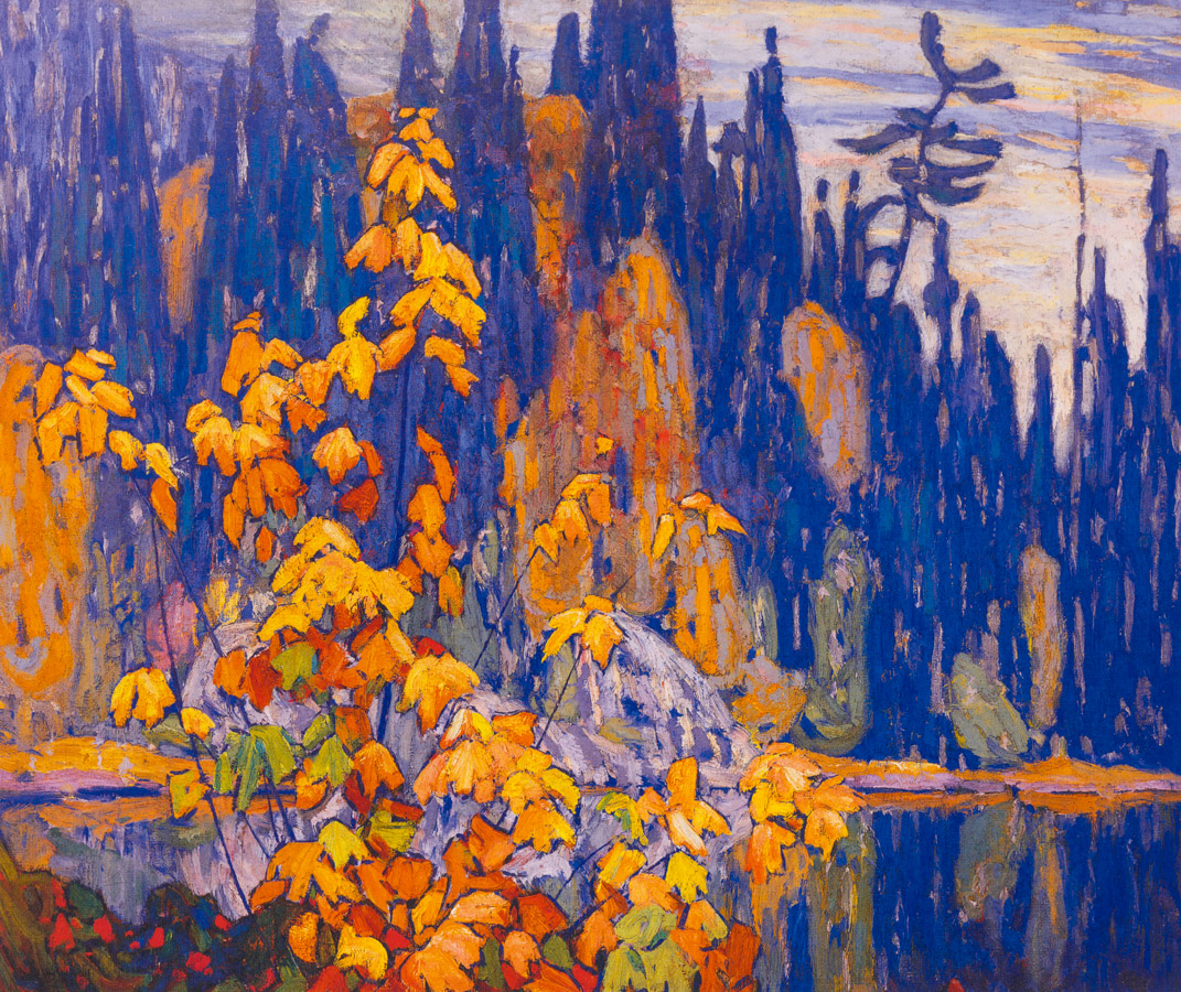
Autumn Algoma, 1920, by Lawren Harris, image via Koyman Galleries
… Autumn, by Lawren Harris
Autumn Algoma, 1920, by Lawren Harris, image via Koyman Galleries
… Luke Fildes
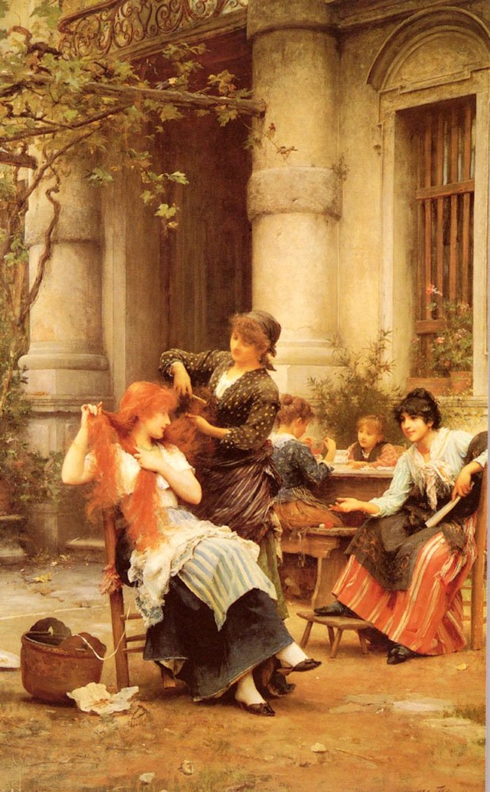
Una toilette al fresco, 1889, by Luke Fildes, image from My daily art display
…Luke Fildes
… Art Deco Architecture (I’m still thinking about Paris)

Paris building in the Paquabot, or ocean liner style (3 Blvd. Victor), designed by Pierre Patout, image via Wikimedia
… maps, by Harold Fisk
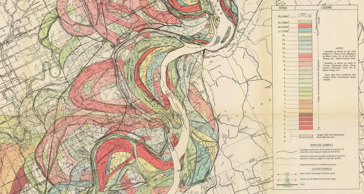
Meander map of the Mississippi, 1944, by Harold Fisk, cartographer and geologist, image via The Public Domain Review
This map is one of a series made to highlight the changes in the flood plain of the Mississippi River. The maps were drawn using information from 1944 and old records from 1765, 1820 and 1880.
All of these alterations, both human and nonhuman, can be seen in Fisk’s wonderfully detailed, wonderfully vibrant maps — further evidence that the Mississippi, as Mark Twain put it, is not at all “a commonplace river, but on the contrary is in all ways remarkable”.
The full story is at The Public Domain Review
… abstract, by Wassily Kandinsky

Jaune Rouge Bleu, 1925, by Wassily Kandinsky, image via Wikimedia
… Guy Pène du Bois

Social Register, 1919, Guy Pène du Bois
… Kitagawa Utamaro
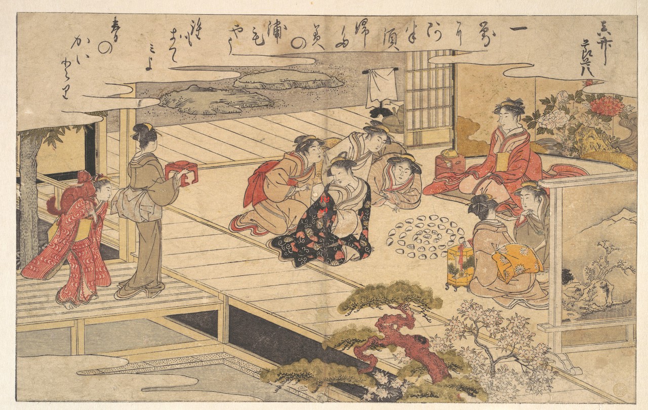
Girls playing a game with shells, 1790, Kitagawa Utamaro. Image via The Met Museum.
… Duilio Barnabe.

Paysage, by Duilio Barnabe, image via Christie’s Auction
… autumn, by Alphonse Maria Mucha
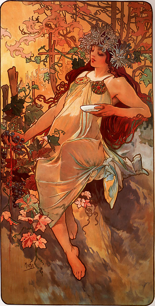
Autumn, 1896, by Alphonse Maria Mucha, image via Wikiart
… Autumn, by Paul Gauguin

By the Stream. Autumn, 1885, by Paul Gauguin, Image via Wikiart
… Maxfield Parrish, one of my favourite artists
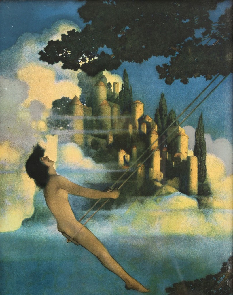
The Dinky Bird, 1904, by Maxfield Parrish. Image via Case Antiques
… Scientific Illustration, by Asa Smith.
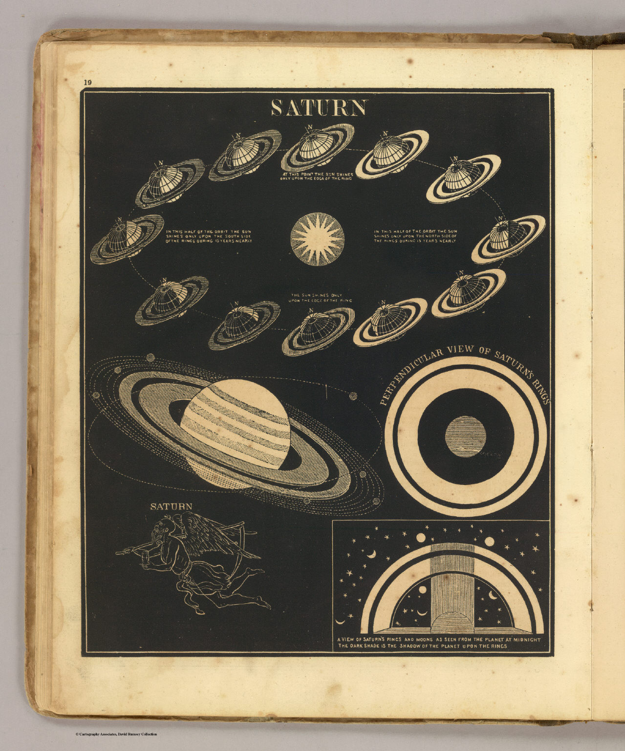
Saturn, 1850, by Asa Smith. Image via David Rumsey Map Collection
