Holidays with Hindrances 4: Muckross House, Farm and Abbey

Welcome back. I hope you’re having a nice weekend before we all go in for another round tomorrow.

While in Killarney we didn’t actually visit Killarney House, but went to Muckross House instead, since that was just 5km from our campsite, so we went there on foot, visiting Muckross Abbey on our way.

View over the lake

©Giliell, all rights reserved

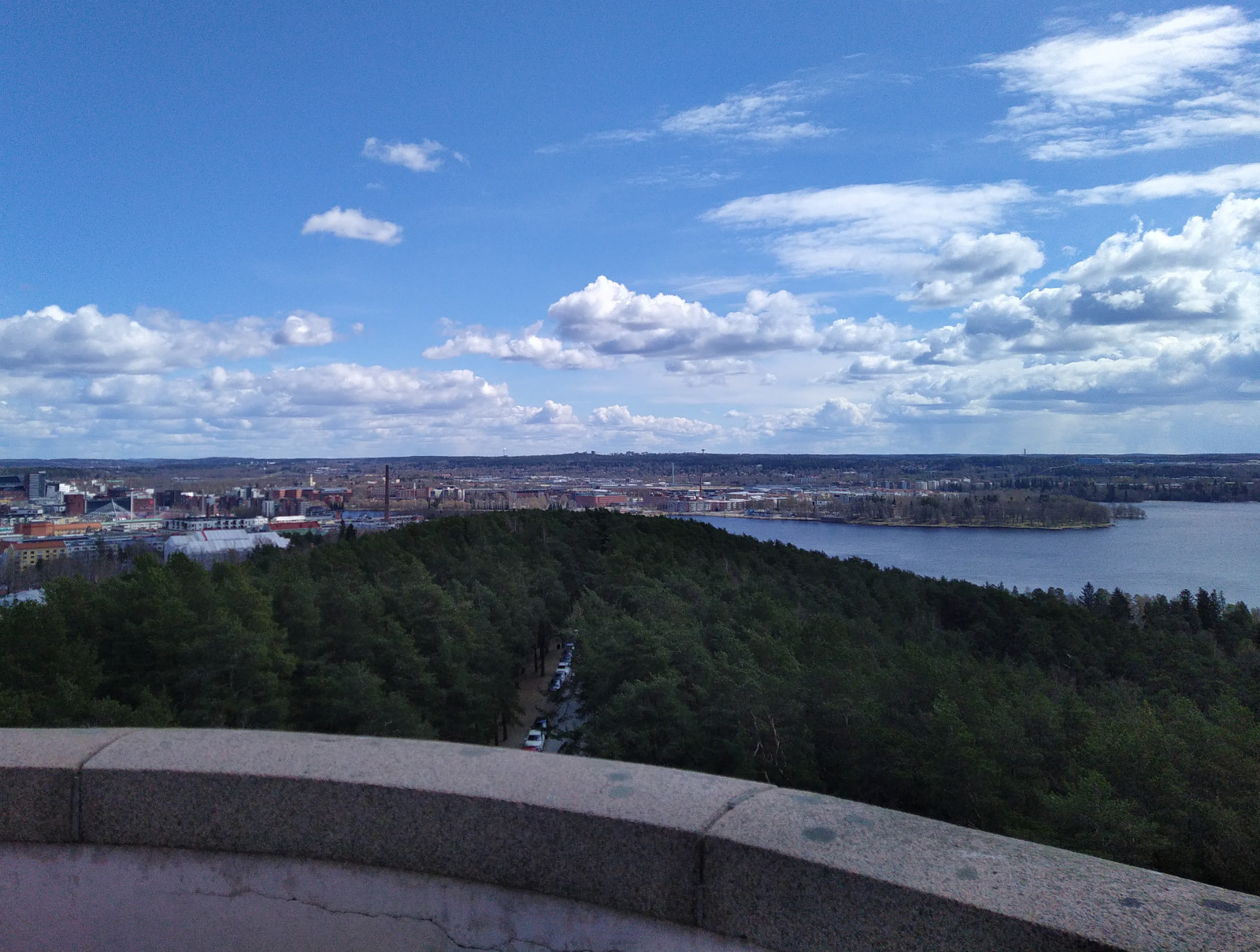
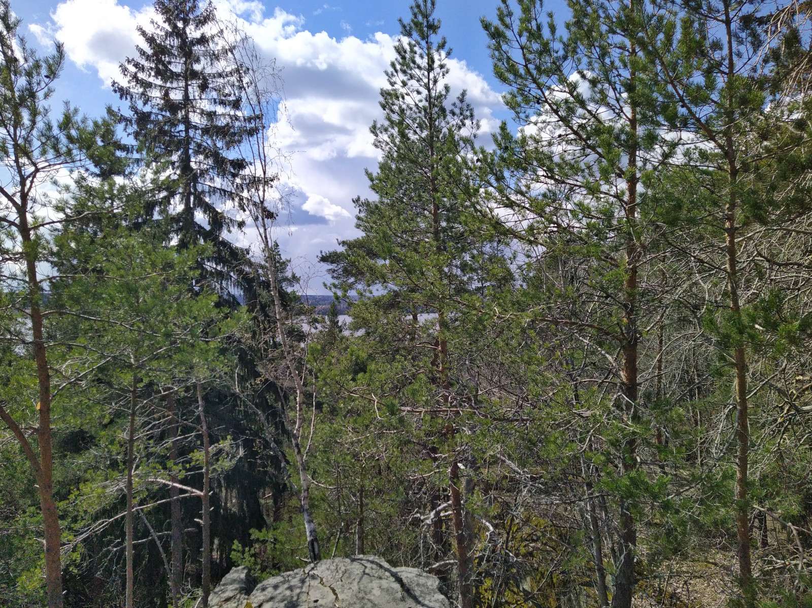
A beautiful hike past the lake.

Ruin of an abbey in between green trees

©Giliell, all rights reserved

Muckross Abbey is a very pretty ruin, but the graveyard has been in use since at least the 2000s.

Tree growing in a small courtyard in the ruin of the abbey

©Giliell, all rights reserved

That one looked amazing. I’m sure there’s a message in the tree long surviving the religious building.

grey brown manor house. On the hedge in front there#s a plush opossum

©Giliell, all rights reserved

Welcome to Muckross House. Our plush of the day is Opossible, who enjoyed his trip a lot.

Richly furnished room with a golden harp

©Giliell, all rights reserved

“Ireland was a poor country” my ass…

Portrait of a strict looking lady

©Giliell, all rights reserved

According to legend, Lady Catherine died at 140 when she fell out of an apple tree. Life goals!

Plae pink cosmea flower

©Giliell, all rights reserved

The gardens were truly beautiful.

Muckross Farm is an open air museum depicting rural life in Ireland in the 1950s. Yes, you read that right. Apart from trades like the blacksmith they have three farmhouses showing a poor family farm, a middle class family farm and a well off family farm. Remember that nice room in the picture above? In the 1950s people in rural Ireland lived like they hadn’t lived on  the continent for at least 50 years. no running water, no electricity. Good old medieval “1 room for sleeping, 1 room for living and sleeping” conditions. But the animals were very cute.

Middle aged fat woman with a horse.

©Giliell, all rights reserved

This year I did something new: I shamelessly took selfies and asked people to take pics of me. Am I young and pretty? No. Am I alive? Yes. the person with the camera rarely ends up in pics themself, but I realised that if I died tomorrow, my family would probably forget what I look like in a week because there’s no pics. Here they are. That horse was amazing.

Tram Depo Graffiti – Part 5

I still have some pretty pictures from that depo, this is not the last post with them. And I did not accidentally publish twice the same picture – two of the graffitis were very similar.

© Charly, all rights reserved. Click for full size.

© Charly, all rights reserved. Click for full size.

© Charly, all rights reserved. Click for full size.

Views of Tampere from Pyynikki

Guest post by Ice Swimmer


Tampere is the second city in Finland. It’s been called many things, including Manchester of Finland (short form: Manse), the City of Women and the Sauna Capital of the World*. Before this spring it was a city I visited in order to have fun with my friends who live here. Now it’s my hometown.

The city was founded on an isthmus between two lakes, formed by an esker. The lakes are connected by a channel of rapids that were dammed and provided power for the textile factories, paper mills and other industry. The textile industry led to comparisons to Manchester and to a lot of girls and women moving to Tampere to work for Finlayson (founded by a Scotsman, James Finlayson) and other factories.

These pictures are from a Sunday walk to Pyynikki Sightseeing Tower and Nature Reserve, which are on the esker, in the middle of Tampere, next to the city centre.

First, we take a look to the east from the tower, towards the city centre.

© Ice Swimmer, all rights reserved. Click for full size.

Then we take a very touristy angle and look northeast. The big tower is Näsinneula (Näsi needle), the highest building in Finland (168 m), the amusement park is Särkänniemi. The lake is Näsijärvi. This picture is taken May 8th and there is still some ice on the shores.

© Ice Swimmer, all rights reserved. Click for full size.

I talked about the two lakes. This is the other one, Pyhäjärvi (Sacred or Holy Lake one of the many lakes with the same name in Finland). We’re looking southeast from the tower and we can see a part of the woods of Pyynikki and parts of the city centre as well as the northeastern corner of Pyhäjärvi.

© Ice Swimmer, all rights reserved. Click for full size.

Then we take a look at the northwestern parts of Tampere. The peninsula is a mostly residential area, parts of which are called Niemi (peninsula), Lentävänniemi (Peninsula of the Flying) and Reuharinniemi (the tip of the peninsula, a free translation could be Cape Rage).

© Ice Swimmer, all rights reserved. Click for full size.

The following pictures are taken from the Nature Reserve.

First, a sign that says on the top “Place for sightseeing” or “Scenic view” and below that “Dangerous slope”.

© Ice Swimmer, all rights reserved. Click for full size.

Both are true. You can see Pyhäjärvi through the trees and yes, taking a few more steps could spoil your day.

© Ice Swimmer, all rights reserved. Click for full size.

This place is a short walk west from the previous place. A bench is safer…

© Ice Swimmer, all rights reserved. Click for full size.

This view is to the southeast from the rocks, over Pyhäjärvi. I bet the apartments in the buildings by the shore are somewhat costly. I think the chimney belongs to the former knitted underwear factory (Suomen Trikoo).

© Ice Swimmer, all rights reserved. Click for full size.

This is a view of one of the roads that go through the woods in Pyynikki. This one is Tahmelantie.

© Ice Swimmer, all rights reserved. Click for full size.

This concludes our trip in Pyynikki. As you were able to see deciduous trees didn’t have any leaves yet. Now, about 2 weeks later the leaves in birches and willows have come out just about fully. I’m hoping you got a little inkling of what Tampere looks like.
__
* = The public saunas in Tampere are popular places, also for the locals.

Tram Depo Graffiti – Part 3

I am very busy and I do not feel like writing. Every day I am cutting wood, cook for two, then rest a bit, then cut wood, then pick strawberries, weigh them, and put them in the freezer. In the evening I make a fire, watch Jeeves and Wooster on my phone while a sausage is sizzling over the flame and then I cut some more wood, put away the tools, and go to sleep. Rinse and repeat.

I often write long SJW posts in my head, but mostly they stay there. I do not seem to be able to find the necessary time to put them on here. But I do have some more graffiti pictures. Lots more, in fact.

There Used to Be a Railway Here…

We had a planned power outage today morning so I went for a long walk instead of working. I did not take my camera with me, but I did snap a few pictures with my phone. let’s start with a picture of “find teh sleeper”.

© Charly, all rights reserved. Click for full size.

Did you find it? What looks like a strangely shaped valley in a forest is a former railway road. The signs are still there if one looks for them. Unnatural basalt gravel (we are on phyllite here, which, btw. is suitable for making natural whetstones). And sleepers buried in the moss and ferns. Look, there is another one, a few meters further.

© Charly, all rights reserved. Click for full size.

And the unnatural valley is suddenly cut short by an earth mound completely overgrown with half-century-old trees today. I forgot to take pictures of their roots. Next is a vestige of the reason why this railroad is now defunct and derelict.

© Charly, all rights reserved. Click for full size.t

This metal pole was upright when I was a kid and a sign “Caution, state border ahead!” was on it. And although this particular border was with Eastern Germany, the sentiments under the communist rule were not conducive to cross-border travel, thus the railroad was blinded and nature was left to take over. If you were to follow the railroad on google maps, on the Czech side you can follow its former route completely to the border, but on the German side, there is no trace of it anymore. I can’t remember if it was ever finished on the German side and it is not information easily to be found on the internet – I would have to borrow the town chronicles again.

So where there used to be a railroad, there are now trees, bushes, and wildflowers.

© Charly, all rights reserved. Click for full size.

© Charly, all rights reserved. Click for full size.

I was a bit surprised by the pale Aquilea, I do not remember seeing that one around here, ever.

For some reason, I thought this dead aspen tree and this particular part of a rivulet were interesting to look at.

© Charly, all rights reserved. Click for full size.

© Charly, all rights reserved. Click for full size.

You can see a mixture of natural, local rocks with pieces of brick and some grey pieces of imported basalt gravel in it. I will write some more about local geology when I am making whetstones.

In my childhood, the end of the railroad also served as a local garbage dump, As kids, we went occasionally there to scavenge some interesting things. There are many interesting things to be found in a garbage dump when one is a kid. This was pre-massive use of plastic bags and similar crap, so most of the things that were dumped there were ceramics, glass and metal. But I cannot even find the site of the dump anymore. It was covered with dirt and I think this is where it used to be.

© Charly, all rights reserved. Click for full size.

Twenty years can mean big-ish trees. I really do not know the exact location of the garbage dump, it is completely overgrown and covered with trees today.

When approaching the still somewhat functioning railroad, I came by this stripped-down, derelict warehouse.

© Charly, all rights reserved. Click for full size.

I hate sights like this, I abhor waste in all its manifestations. When I was a kid, this warehouse was still functional, covered in corrugated sheets, and used to load and unload cargo wagons. Although not very much. The whole town went downhill after the deportation of Suddeten Germans after WW2. It was deliberate – the communist regime had no interest in maintaining a town so close to the Iron Curtain, thus the deported population of over 15.000 was filled in with barely over 2.000 people from all over Czechoslovakia, with some of them being sent here as a punishment for misbehaving. But there was still some industry here and thus some need to move cargo. And there were also personal trains coming by regularly. In fact, the train was the main means of transport for me when I was studying at the university twenty years ago. Oh, how the time flies.

Here you can see the nowadays official end of the railroad. In the growth to the left is hidden the decrepit depo from the previous picture.

© Charly, all rights reserved. Click for full size.

And last is the picture of the current train station. It is the westernmost train station in the Czech Republic. If more than five people were to wait for the train, they won’t be able to keep out of the rain unless they are comfortable being very, very close to each other.

© Charly, all rights reserved. Click for full size.

There used to be a big and beautiful building here, but it was demolished in 2014. The town wanted to renovate it into an apartment building, but the owner (Czech Railroads) declined to transfer the ownership of the building to the town and send in a demolition team instead. It even made the news, something that does not happen to our little town often. The reasons for the outright demolition were never explained, but since the building was carefully disassembled with the healthy wooden boards and timbers from the rafters and the good-quality old-time fired bricks being hauled away neatly packed on palettes, my personal suspicion is that someone rich somewhere greased some palms in order to get cheap building material. Although that might be just my paranoia speaking and the demolition was a simple act of incompetence and not of malice. Either way, it is definitively a legacy of our libertarian-leaning governments that ruled our country since the fall of the iron curtain. That has led to infrastructure being neglected and overemphasis on cars, like in the west.

The EU has stepped in a bit lately to fill the gap in financing rural communities’ infrastructure, but it was too late for the railroad.

Sigh.

TNET 46: In a Highlander’s Shoes

I do not know why the algorithm recommended the Fandabidozis channel to me, but it did. I think (although I am not sure) that it first recommended one of the videos in which he shows the crafting of some of his historically accurate-ish equipment.

I have enjoyed his videos in which he explores 17th-century equipment of the Scottish highlanders and this one is probably his biggest and best video project.

Open thread, you can talk whatever you want, just do not be an a-hole.

Previous thread -click-.

Midsummer Afternoon – Part 4 – Drought and Wetland

Guest post by Ice Swimmer.


These pictures are from the wetland in Harakka. The summer has been dry and the wetland wasn’t as wet as I had seen it before. Still, it looked quite lush.

© Ice Swimmer, all rights reserved. Click for full size.

© Ice Swimmer, all rights reserved. Click for full size.

© Ice Swimmer, all rights reserved. Click for full size.

© Ice Swimmer, all rights reserved. Click for full size.

The Art of…

…Monet.

Water Lilies by Claude Monet. Photo courtesy of Discover Walks Blog/Matthieu

I’m supposed to be in Paris. Today. I should be there right now. It’s been the plan for 5 years to go to Paris in September of 2020. It’s the year a friend retires (she has) and the year I turn 60 (I will soon), and we were going to celebrate both milestones in Paris. We’ve read every guide book twice or thrice and have well-organized lists of what we want to see, do, and eat. We’ve talked endlessly about the trip, and the promise of it has helped us both through some difficult days. Covid doesn’t care about any of that, though, and so we had to cancel our plans.

This Water Lilies mural by Monet is one of 8 panels that grace 2 rooms at the Musee de L’Orangerie and I was very much looking forward to seeing it in person. Instead, I took a virtual tour today which only increased my desire to actually go there. The tour is nice though, and if you’re interested you can take it yourself. The link for the musuem will take you directly to it. The link for the photo has a nice walking tour if you’re looking for a bit more of Paris.

The Duoro Valley – Part 5

From Nightjar,

This is the last set of photos and it shows the olive plantations that are also an important part of the landscape, some wine cellars, and the Pinhão river, a Douro tributary. I hope you enjoyed this series. The Douro Valley is a magical place with a long tradition of wine and olive oil production. Its sustainability is currently threatened by an increase in intensive farming and tourism. In a way, it’s being a victim of its own beauty and of the quality of its products.

Olive plantations, ©Nightjar, all rights reserved

[Read more…]

The Douro Valley – Part 4

It’s time for the next leg of our journey with Nightjar.

The vineyards planted on Douro’s steep hillsides produce grapes with unique properties for wine production. We went in August, middle of the dry season and a little before harvesting starts. This region has been producing wine for nearly 2 millennia and is a UNESCO heritage site. Traditional farming methods are still used for the most part, but lately and due to increased demand, the pressure put on the river has been increasing to worrying levels. In addition to erosion, environmentalists have been denouncing the massive use of herbicides that obviously end up poisoning the river.

©Nightjar, all rights reserved

[Read more…]