The 100 Best Space Photos of 2016.
Click for full size.
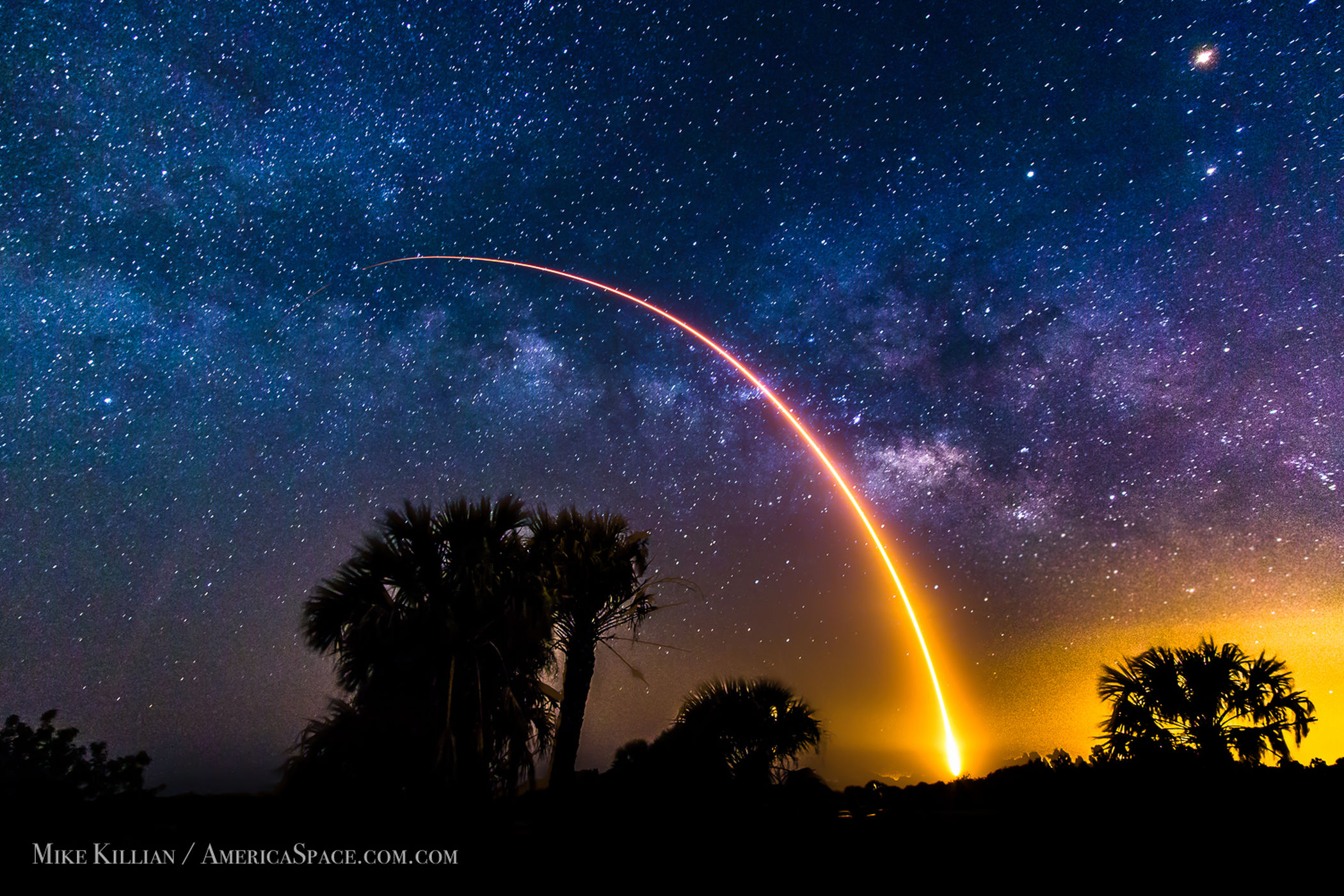
Astrophotographer Mike Killian took this image of SpaceX’s Falcon 9 rocket blasting off on May 6 from Cape Canaveral Air Force Station in Florida.

Greg Diesel Walck took the image from Moyock, North Carolina as a thunderstorm drifted across the horizon on Aug. 5. Read the full story here.
Y’know, we get serious weather here, but it never looks like this. Sigh.
Free Legal Tips!


![]()
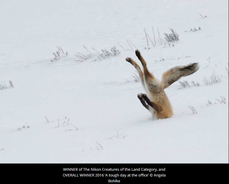
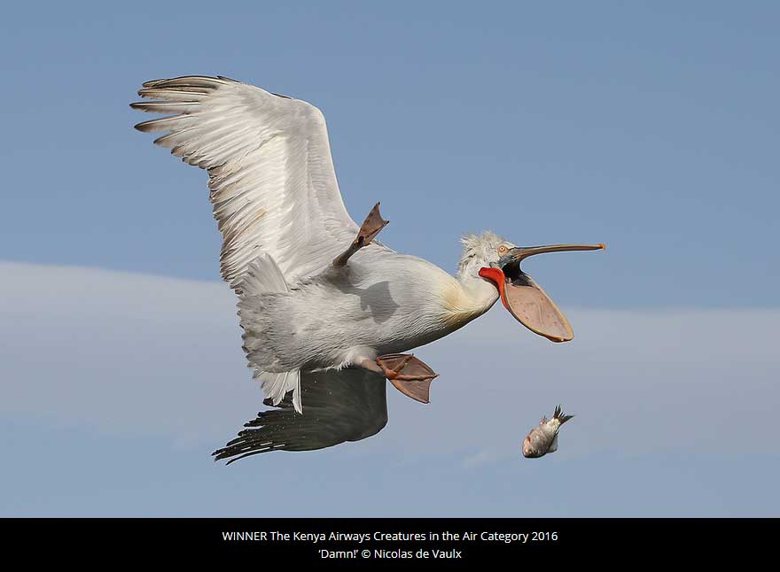
The 2016 Comedy Wildlife Awards.
Click for full size.