NWS track and NOAA sea surface temperatures (19 Aug - 21 Aug). Click image for latest on Irene
Hurricane Irene reached Category 2 status yesterday and may see further intensification today. The current storm track profile is shown above super imposed on next NOAA’s latest sea surface temperature data. Irene is forecast to track over water in the 28° to 30° C range (84° to 86° F) all the way to North Carolina. A small deviation from the centerline to the north and east will bring Irene over the DC metro region in 28° to 29° C water, warm enough to sustain a major hurricane, Saturday to early Sunday.
Forecasting hurricane movement is not an exact science. Eyes wobble, collapse, recycle; five days translates to an average error of 250 miles. In this case, 250 miles means the difference between a major hurricane that makes landfall in Florida, SC and NC and/or buzzes up the east coast, to one that barely brushes the seaboard and curves harmlessly out to sea. It all depends on the magnitude and location of that projected turn off the coast of Florida. The latest premiminary data suggests Irene has slowed down a few miles per hour, and if that continues it could mean she will turn a few dozen miles sooner.
The latest intensity forecast models for Irene will be out shortly and I’ll try to update at that time.
Update 11 AM CDT: Via Jeff Masters:
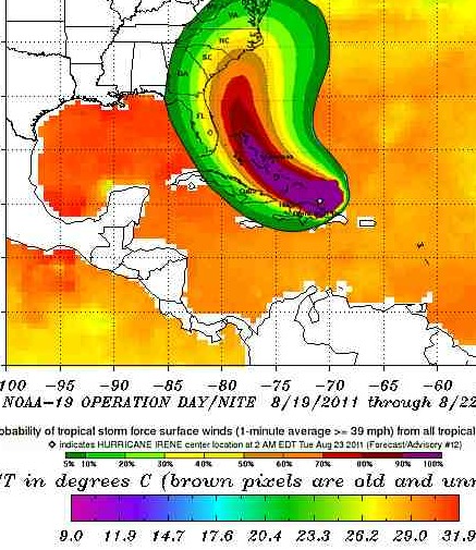
Latest microwave data suggests that Irene does not have full eyewall; a gap exists in the south side. With wind shear now a moderate 10 – 20 knots, Irene may have trouble intensifying today. The hurricane is embedded in a large envelope of moisture, and wind shear is expected to remain moderate, 10 – 20 knots, for the next four days. With water temperatures very warm, 29 – 30°C, these conditions should allow for intensification to a Category 3 storm sometime in the next two days. Satellite loops show that Irene is steadily growing in size, which will protect the storm against major disruption by wind shear. The storm is lacking much development on its southwest side, where the presence of Hispaniola is interfering with development. Once Irene pulls away from Hispaniola tonight, intensification is more likely.
I’ll add, there’s damn near a fleet of aircraft and spacecraft now heading to and from this storm or watching it closely. We’ll have quite a bit of data coming in over the next 48 hours.
Leave a Reply
You must be logged in to post a comment.