The campaign song he’s written might answer that question.
Warning: he rhymes “been” with “team”, or at least tries to. You might not want to actually listen to this.
The campaign song he’s written might answer that question.
Warning: he rhymes “been” with “team”, or at least tries to. You might not want to actually listen to this.

You’d think that after more than a century of being called the “sick old man of Europe”, the country could do better than this. These are pro-Erdogan bureaucrats speaking out against literacy and education.
Our secret is out. Yeah, biology is a cooking class for cannibals — why else do you think we need all those cadavers?

Carson spoke at the Republican convention last night, and of course it was bizarre.
He starts off with an announcement that he’s a proud asshole…that is, he declares that he’s not politically correct. You know, this PC thing was invented by assholes, to justify their persecution complex when they’re called out on being assholes, right?
Then he trots out his claim to credibility, which is that he was a brain surgeon, and treats this as a testimonial that he must be an expert on reason. I’ve dissected fish, I guess that means I know how to breathe underwater.
But then we get to the fun stuff: Carson accuses Hillary Clinton of Satanism, by way of that conservative boogey man, Saul Alinsky.
He wrote a book called Rules for Radicals. It acknowledges Lucifer, the original radical who gained his own kingdom. Now think about that. This is our nation where our founding document, the Declaration of Independence talks about certain inalienable rights that come from our creator, a nation where our Pledge of Allegiance says we are ‘One nation under God.’ This is a nation where every coin in our pockets and every bill in our wallet says, ‘In God We Trust.’ So are we willing to elect someone as president who has as their role model somebody who acknowledges Lucifer? Think about that.
It’s true! Everything he mentioned is a True Fact! Our money does have “In God We Trust” stamped on it, something that was done in the face of the Red Scare in the 1950s. The Pledge of Allegiance does say “One nation under God”…now. Again, that was an addition made in the 1950s. The authors of the Declaration of Independence included a bunch of freethinkers who included a vague mention of a Creator (but of course, elsewhere they carefully divorced themselves from any specific sectarian intention). And yes, Alinsky does include an epigraph that mentions Lucifer.
Lest we forget at least an over-the-shoulder acknowledgment to the very first radical: from all our legends, mythology, and history (and who is to know where mythology leaves off and history begins — or which is which), the first radical known to man who rebelled against the establishment and did it so effectively that he at least won his own kingdom — Lucifer.
—Saul Alinsky
But see, this is where reason comes into play. You can cite a hodge-podge of miscellaneous True Facts, but you have to use your reason to assemble them into meaning. And Carson uses these fragments of facts to imply that Satan is real, Hillary Clinton serves him, and that an imaginary superbeing will turn away from America if we don’t have “In God We Trust” jingling in our pockets, like sublime capitalist prayer wheels.
This makes no sense. This is unreason. Worse, it’s the conservative version of political correctness.
At least it’s nice to know I’ll be voting for Lucifer in November.

This week, Nature has an article on the reconstruction of global tectonics during the past 200 million years.

a–c, Maps are separated by 10 Myr. The shapes of the large plates do not change much, whereas the adjustment of the small plates evolves quickly. d, 90 Myr after the first snapshot (a), the distribution of the large plates and smaller plates has evolved substantially. In a–d, the top panels show the viscosity of the mantle (colour scale); the bottom panels show the different boundary types (coloured lines) and plate sizes (shading) within the boxed regions in the top panels (which focus on longitudes between −30° and 90° and latitudes between −30° and 30°). The arrows indicate the direction and magnitude (represented by arrow length) of the mantle flow.
In Science, we can read about a thorough analysis of a site where a mastodon was butchered by North American hunter-gatherers 14,550 years ago.

(A) Location of Page-Ladson in northwestern Florida. (B) Map of the Page-Ladson underwater excavations, showing the entire sinkhole and previous excavation areas, as well as excavation areas and sediment cores reported in this paper. Core 4A is marked with a blue star. Other cores are marked with blue circles. Previous excavations are marked with yellow. Our excavations are marked with red. Contours are in meters below datum. (C) Detailed map displaying the location of bones (gray), drawn to scale, and artifacts (black) recovered from geological Units 3a to 3c and 4a to 4b
And of course, the big news, scientists have put a probe in orbit around Jupiter.

Meanwhile, in Kentucky…

I was on this panel at the con yesterday, and while we were all civil and polite, I think my fellow panelists, and a few members of the audience, were left feeling a bit peevish. It was the “What Does God Need With a Starship?” panel, and here’s the description.
From the Christ-like figure of Superman to the metaphysical adventures of the Enterprise, fantasy and science fiction have long explored religious and philosophical questions. What is it about SFF that touches our spirituality?
It was fun. I was the odd person out of the group, I think, because I disagree with everything.
The first question came from the moderator, and it played right into my hands, because it was the first thing I would have asked: what the heck is this “spirituality” thing? We got a couple of answers from the other panelists: one was that spirituality is a container for their “love of all people”, which is a wonderful thing to feel, but I had to point out that that’s humanism. God and the supernatural are redundant there. Another answer was that it was a feeling of “connectedness to all things” — well, great. Except that this universe is the domain of science, not religion.
I also pointed out that religion has a tendency to steal credit: there is a lot of good science fiction that explores philosophy and ethics, and that religious people like to turn around and claim that that is “religion”: nope. It’s philosophy and ethics. That you assume all discussion of morality is grounded in god-belief doesn’t make it so.
The other panelists had their revenge, though, and there was a long bit where they were cooing over those wonderful Narnia books by C.S. Lewis, an author I thoroughly detest, and because I’m obnoxious but not that obnoxious I had to chew on my tongue for a while. I did at least state that the open allusions to Christian mythology were not a feature, they were a bug, and they interfered with my ability to trust anything in the books. Crappy fictional plot holes are not rescued by coupling them to crappy religious plot holes.
One discussion that was unresolved but was interesting was the role of science fiction in demythologizing religion — how it could act as a gateway for people with a religious upbringing to explore new ideas and possibly adopt a less restrictive faith. I then learned that there is a whole genre of Christian science fiction which is supposed to go the other way: it draws in secular people and plants the seeds of faith. I’d never even heard of the latter category — I guess CS Lewis did some of that, but he’s the only one I know of — so I don’t think it was very successful, in my case.
I am not done being annoying, though. My next panel today is “Our Place in Space” at 2:00.
What are the dreams and practicalities of colonizing space? How might humanity reach beyond our planet? We’ll discuss the science of human spaceflight in reality and fiction.
My position is that we humans will not be colonizing space, ever. We might build robots that will, though.

A man had a heart attack on a flight, and one man heroically leapt into action and is being praised in all of the news stories now. That man was Tim Tebow, HERO.
What did he do that was so helpful? He prayed. He organized a group of people to pray for the sick man, heroically.
According to people who were there, flight attendants and passengers tried to help: they did chest compressions. They tried to help the man breathe. They started an IV line. These people are not named. The True HERO was Tim Tebow, who is a famous Christian, and who publicly prayed for the man.
The crew on the plane apparently responded with commendably swift action to help the unconscious man, and did merely material things, like chest compressions, starting an IV, helping breathe life into this man
, but then Tim Tebow, HERO, strode up the aisle like a boss and prayed.
I observed a guy walking down the aisle. That guy was Tim Tebow. He met with the family as they cried on his shoulder! I watched Tim pray with the entire section of the plane for this man. He made a stand for God in a difficult situation.
Fuck yeah! Because God was in such a difficult spot here that he needed a cheerleader. And this is the big news, that a pious man stood and did nothing but mumble at an invisible man to come fix a problem. We should all be glad that someone was there to make a stand for a god.
Unfortunately, the sick man died.
The only appropriate thing to do now, of course, is to blame Tim Tebow, FAILURE. He obviously did not pray hard enough. After all, if he was notable enough to get all the attention and credit for doing nothing, he’s notable enough to get all the blame for doing nothing.

Oh, whatever shall I do now?
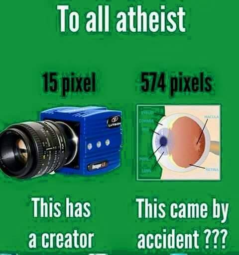
I wonder where I can buy that impressive 15 pixel camera, and how much it costs? I’m thinking it’s got to be a 4×4 array, with just one dead pixel.
You know, maybe some people shouldn’t even try to make these graphical memes.

The NY Times has an article on Ken Ham’s Ark. It always bugs me how the NYT blurs everything down to a bland grey smear (except for the conservatives on the op-ed page, who are encouraged to be stupid), but it’s got a few choice bits served up in their usual neutral, flavorless sauce.
You have to remember that Young Earth Creationism is a freakishly bizarre and recent sect of Christianity — it goes against the grain of the broader beliefs of most Christian denominations, but has grown into de facto popularity because its proponents are really good at claiming that they are the True Bible Believers. Their great trick was to subvert the naive proposition held by most Christian groups that the Bible is a good book, true in every word, by actually pointing to what’s written and saying that you have to believe this sentence fragment literally in order to be Christian. Those of us who actually think about what it says and compare it to the real world become atheists; those who don’t think much at all about science shrug their shoulders and decide they must believe the Earth is only 6000 years old, and no way was my grandpa an ape.
Young earth creationism gained currency only about 60 years ago, and has remained a marginal creed within Christianity. Even many Bible-believers and evangelicals accept the science showing that the universe is billions of years old — some reasoning that each of the six “days” of creation in the Book of Genesis may have lasted millions of years, not 24 hours. And of course, many Christians accept evolution.
Another important thing to remember, besides the fringey nature of the belief, is that their primary message is one of hate. God hates certain behaviors, so it was perfectly all right for God to murder millions of people to eliminate their degeneracy. Ken Ham avoids the spittle-flecking of Pastor Steven L. Anderson, but it’s fundamentally the same story: gays and atheists and women who control their own reproduction are abominations who will be eliminated soon. By god. Not by people, they’re always quick to say, god will judge…and by the way, they’ve judged too, and are quite sure their god will agree with them on who deserves to die.
The ark is also intended to serve as a vivid warning that, according to the Bible, God sent a flood in Noah’s time to wipe out a depraved people, and God will deliver a fiery end to those who reject the Bible and accept modern-day evils like abortion, atheism and same-sex marriage.
We’re becoming more like the days of Noah in that we see increasing secularization in the culture,Mr. Ham said.
Oh, a fiery end. It’s always fun to read about people who think we ought to be set on fire.
They also have a creepy version of Biblical racism — the Hamite theory is alive and well in Kentucky — and again, they’ve got to emphasize the evil morally decadent society
that is righteously wiped out.
Drawings of Noah and his seven family members hung on a wall. Their skin is “middle brown” and their faces are a blend of racial features because, as the only survivors of the biblical flood, all the races and ethnicities on earth would have descended from these eight people, Mr. Chaffey said. But in some of the displays in the warehouse, there were indications of the ministry’s dark vision of humanity. An artist, Stephanie Fazekas, stood at a computer drawing figurines of women in togas. They were prostitutes for a diorama portraying the morally decadent society that the Bible says was wiped out in a flood.
Also, reality is like a lawn full of rakes that keep thwacking them in the face. This is supposed to be a life-sized version of the giant boat that housed thousands of animals for a year, during the most ferocious, world-wrecking storm of all time. But they have to keep scaling back their plans.
They were originally going to have a live animal zoo on the ark. Then they admitted that there were relatively few species represented on the ark, because (they don’t use this word) evolution, which allows varieties to rapidly diversify. And then, well, look what this gigantic building will house:
And there will be only about 30 pairs of stuffed animals on the Ark Encounter because there just isn’t enough space.
We have to have dozens and dozens of bathrooms for visitors. Noah didn’t have to have that,Mr. Chaffey said.
Only 30 pairs of animals? Because bathrooms? It’s true, Noah didn’t have thousands of visitors trooping through his big boat, because his god killed them all in the story, but he did have a gigantic waste disposal problem that Ken Ham’s sanitized and simplified display avoids by using stuffed animals.
Mediocre.

“Again?” you ask. “Isn’t he always awful?” Yes. It’s a permanent state for him.
He’s crowing over the defeat of a bill by the NY legislature that would have extended the statute of limitations on child rape crimes, and as we all know, and as Bill is certainly aware, “End Child Abuse” is code for “Destroy The Catholic Church”.
As The New York Daily News reports, Donohue sent out an email to supporters after the defeat of the Child Victims Act, an act that he said was designed “to rape the Catholic Church.” The bill would have extended the timeframe that victims can bring forward cases by five years and would have opened up a six-month period for victims to revive older cases.
“The bill was sold as justice for the victims of sexual abuse, when, in fact, it was a sham,” Donohue wrote in an email obtained by The New York Daily News. “[It was] a vindictive bill pushed by lawyers and activists out to rape the Catholic Church.”
Oh, no. Really? You just called the prosecution of child rape an act of rape? It’s kind of clear that Donohue has no understanding of what constitutes a violent sexual crime.
The FFRF also has a few things to say.
But the Church’s lobbying and Donohue’s obscene victory dance are admissions of guilt. They are conceding that this problem is far bigger than we know and that, though the new pope talks quite a lot about fixing the problem, the church has no intention of actually fixing it. After more than three years as pope, Francis has done nothing to bring genuine justice to the victims or the rapists to account. Nothing but talk.
Let’s not forget that Bill Donohue is just the easily visible painful boil on the face of a church that continues to protect child rapists.


Pat yourselves on the back. God is dead and has been removed from American politics. And we owe this victory to an unexpected hero, Donald Trump.
You see, the crass, vulgar narcissist who hasn’t shown a hint of piety ever in his entire life has assembled a religious advisory board, and some of the most prominent names in conservative Christianity have stampeded to be on it. Richard Land is on board to to give spiritual counsel and advice
and to speak Biblical truth
. Trump has Robert Jeffress, Jerry Falwell Jr., and Ralph Reed. He’s got Michele Bachmann and James Dobson. Tony Perkins and Mike Huckabee are cheering him on. And don’t forget, he’s also got the majority of the conservative electorate.
Mr. Trump has received widespread support from Evangelical leaders, communities and voters, winning the majority of the Evangelical vote throughout the primaries.
It is absolutely clear that none of this support is thanks to Trump’s lifelong service to their god, and some long-standing, activist evangelical Christians do see right through him.
Today, a candidate whose worldview is greed and whose god is his appetites (Philippians 3) is being tacitly endorsed by this throng.
They are saying we are Republicans no matter what the candidate believes and no matter how vile and unrepentant his character.
They are not a phalanx of God’s prophets confronting a wicked leader, this is a parade of elephants.
In 1980 I believed that Christians could dramatically influence politics. Today, we see politics fully influencing a thousand Christian leaders.
This is a day of mourning.
God beliefs don’t matter any more. The Christian Right has surrendered. We won without really trying!
Of course, then we have to ask, if it isn’t a god that’s uniting these people, what is it?
That’s also clear. Hatred of others — the LGBTQ community is still in their sights. Controlling everyone’s personal life — they need to tell everyone what they’re allowed to do in the bedroom. Keeping women shackled and oppressed — that women dare to control their own reproduction is an abomination to them. Immigrants, brown people with strange accents who don’t sound like their grandparents, are the enemy. Hell, if you don’t say “Merry Christmas” with sufficient fervor, you’re in need of scourging. The Christians who don’t share these repressive views are not lining up behind Trump.
I’ll also disagree with Michael Farris, who is mourning the end of the Christian Right: this is no surprise and no change. The Christian Right, the Moral “Majority”, have always been about a kind of social tyranny. All that’s happened now is that the godly mask has fallen off, and we see their faces clearly. These are the witch-hunters and parasites and con artists and prudes and puritans who have plagued us forever — not the shining champions of a benign deity, but narrow-minded, frightened zealots.
Thanks, Donald, for helping.
Of course, now that the mask has slipped, atheists aren’t actually done — we have to wake up to the fact that fighting an illusion isn’t particularly useful. Maybe, just maybe, we should change our targets to the reality of the oppression of women, minorities, sexual minorities, and all the things that the god-botherers were actually doing, and still are doing, while they pretended to be doing God’s Work.
You’re not really going to go on imagining that Donald Trump is a sincere Man of Faith, are you?
