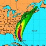
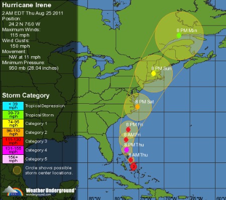
Via the National Hurricane Center Hurricane Irene is near landfall at North Carolina’s outer banks as a Category 1 storm with maximum sustained winds of 90 mph. Some regions along the east coast will see moderate wind damage. But for now, Irene’s greatest danger to life and proprtery is flooding. Because the system is so large and has been spinning for so long, the surge will be similar to a much stronger storm, possibly as high as 15 feet in some places, and this will happen during a new moon high tide greatly amplifying the effect. Cheseapeake Bay and the entire mid eastern seaboard could experience massive flooding over the next 24 hours. In addition the western edge of this giant system could inundate the entire DC region. Creeks, drainage ditches, and rivers could overflow into urban and suburban neighborhoods.
Use this Wundermap to keep track of how the winds are behaving around the North Carolina coastline. Within the hurricane warning area in North Carolina, storm surge is expected to be 6-11 feet above ground. This is our storm surge forecast map. To see how high the tides are running, NOAA has an excellent page collecting all of the relevant tide gauges.
Irene’s intensity after passing to the east of the bay depends on how much time, if any, the storm’s eye spends over dry land and the effect of predicted wind shear. Sea surface temperatures are plenty warm enough to sustain a hurricane all the way to New Jersey. As of about 8 AM EDT, the NHC forecasts Irene to strike Long Island, NY, as Category 1 beginning early tomorrow morning. The full brunt of the northeast eye wall may pass over parts of Conneticutt or Rhode Island Sunday afternoon, bringing a record storm surge and potential for widespread wind damage to the upper New England coast.
Technology allowing, I’ll be on Daily Kos radio, with special guest Dr. Jeff Masters from the WeatherUnderground, discussing Irene around 11 AM EDT.


