When media color code the map of the US by which party wins a state or congressional district with red being for Republicans and blue for Democrats, they tend to do it by state (for statewide results as in the electoral college) or by district (for congressional seats). The resulting map tends to be largely blue on the east and west coasts with vast swathes of red in the middle, giving the impression that the country is dominated by Republicans. Conservatives like to use such maps to bolster their claim that the US is largely a right-wing conservative country.
That is misleading because some of the big states in the middle are largely rural and sparsely populated so that a big red splotch for Montana, for example, will not reflect that fact that they have just one congressional seat. Take this map of the results of the last election in California.
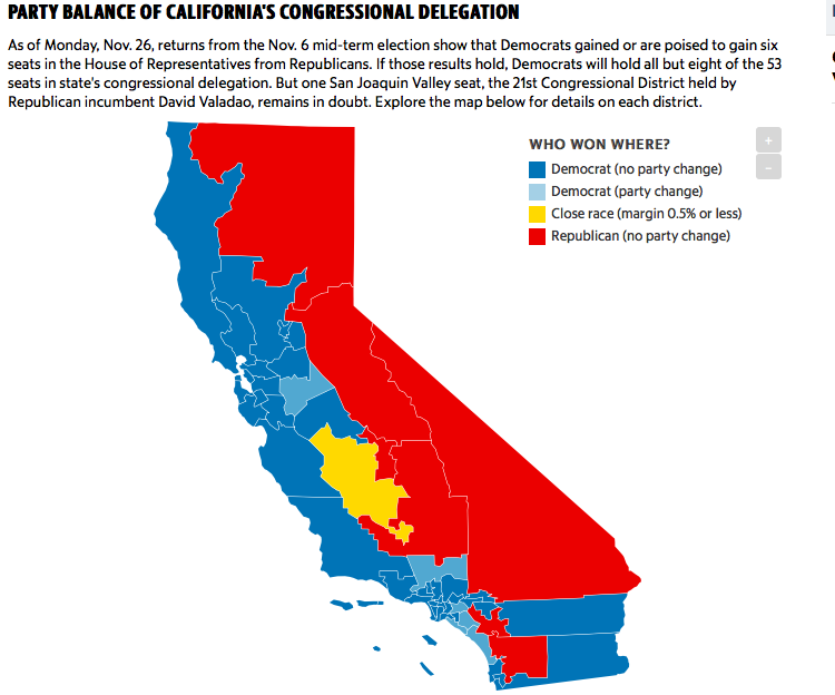
It is more than 50% red but that hides the fact that Republicans got a shellacking in the state with Democrats winning by a margin of 45-7 with even the one remaining undecided seat leaning towards the Democrat. But since the Republican seats are in large rural areas, it look like they are more successful than they are.
A better way of color coding the maps is to use colored areas that are proportional to the size of the delegation, as in the map below which gives a much better way of showing the true balance between the parties.
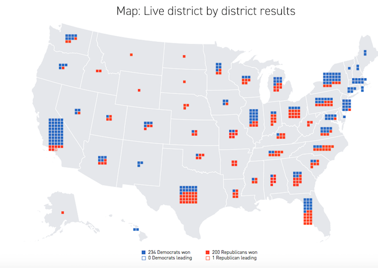
Look at California on this map compared to the one above.
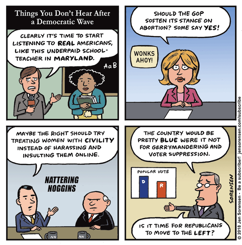
Meanwhile Jen Sorensen makes a good point. After the 2016 election, media pundits were falling over themselves saying that we need to listen more to the angry white men, gun nuts, xenophobes, and others who voted for Trump. Now that there was a blue wave in 2018, can we expect similar pushes in the opposite direction? Nah. This is a right wing conservative country, remember? Just look at the color map.
Xkcd (as always, there is an xkcd for that) did a very similar map about a year or so ago, that was commented on in a Vox article.
https://www.vox.com/policy-and-politics/2018/1/8/16865532/2016-presidential-election-map-xkcd
I wonder if it would be easier to visualize as a 3d map with elevation by population. There would be a lot of wide red valleys but the mostly blue spikes or mesas would show what was going on. Who knows, it might even resemble some of the rugged Western geography. How could they complain about that? 🙂