River Walking Parte the Third: Wild Water

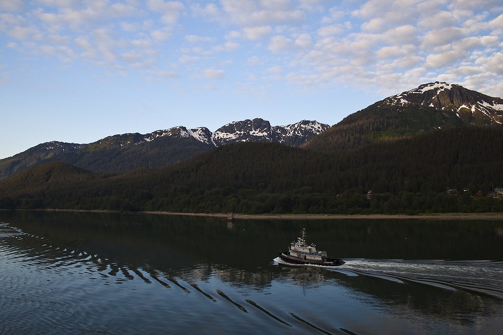
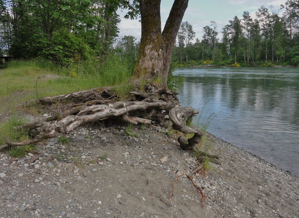
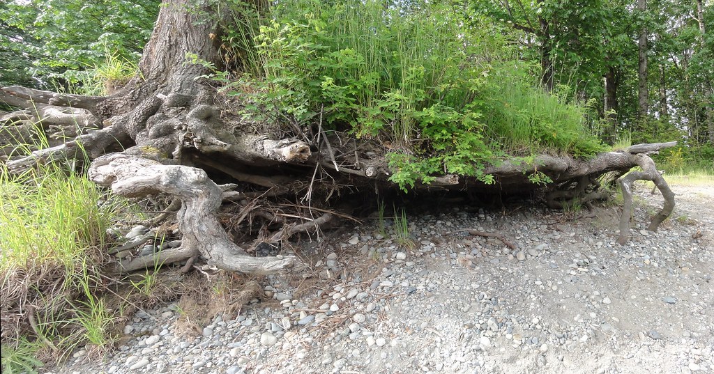
When last we left the Skykomish River, it was chillin’ in the basin.  You could zip up it in a speedboat, and the rocks were wee little things, most of them no bigger than the size of a fist.  Unless you visited at flood stage, you could be forgiven for thinking it’s a tame, sweet thing.

Those rocks should give you pause, however.  They’re far-traveled, and they’ve been tumbled and polished and rounded.  That’s our first clue the Skykomish isn’t always placid.

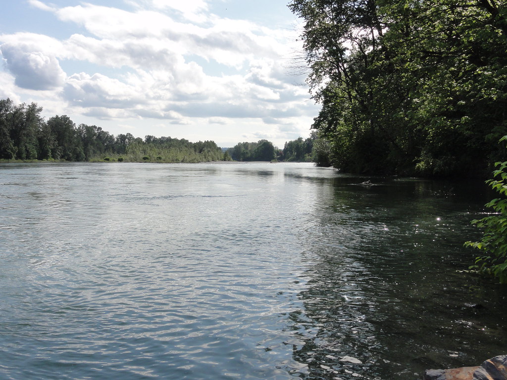
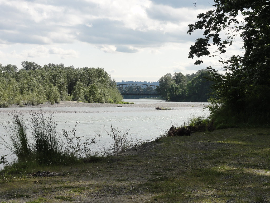
Our second clue comes when we head up the highway, past the small towns of Sultan and Gold Bar.  The gently rolling basin lands give way to mountains.  And these are serious mountains, people, mountains that rise from the earth like they mean it, mountains that don’t shrug off their snow until summer’s well under way.  Go just a few miles outside of Gold Bar, and the mountains fold around you, shutting out the rest of the world.  There’s a bridge over the Skykomish River, and just beyond it a parking area with river access.  Walk down to the river, and you’ll think you’ve come to a different river entirely.

View Larger Map

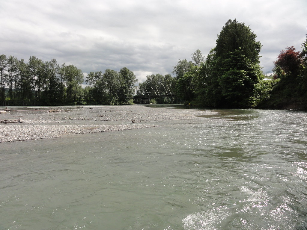
There’s where we are now, between the highway and the railway bridge.  A few miles further up the road, the Skykomish splits into its North and South forks, vanishing into the mountains where it’s born.

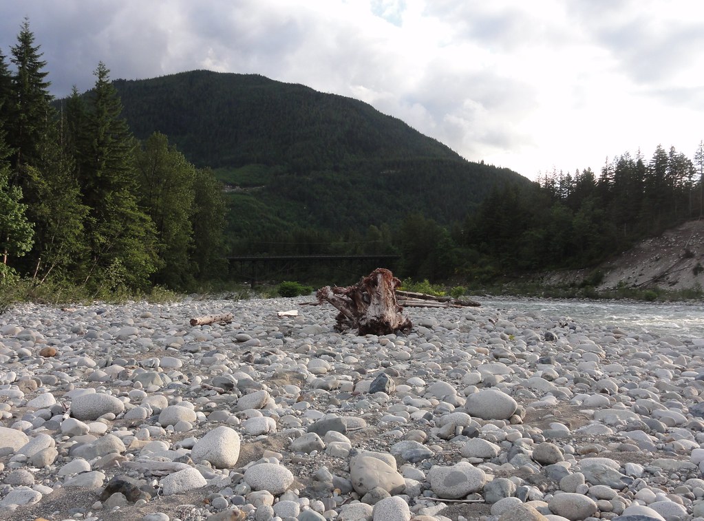
These are wild waters.  You get the first hint when you reach the river from the parking area, and notice you’re having to thread your way through quite a few rather large boulders.  Looking downstream, the river vanishes into an aspiring canyon.

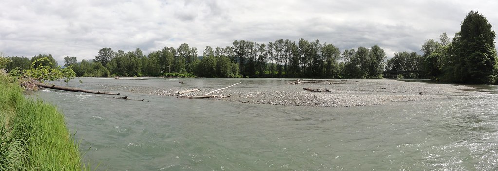
Skykomish River, looking downstream

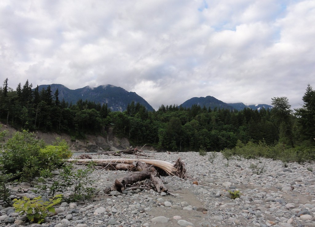
Look upstream, and you get a sense of just how powerful the river is here.  None of these namby-pamby low banks, nossir.  No, here, it’s carved out something a bit more respectable:

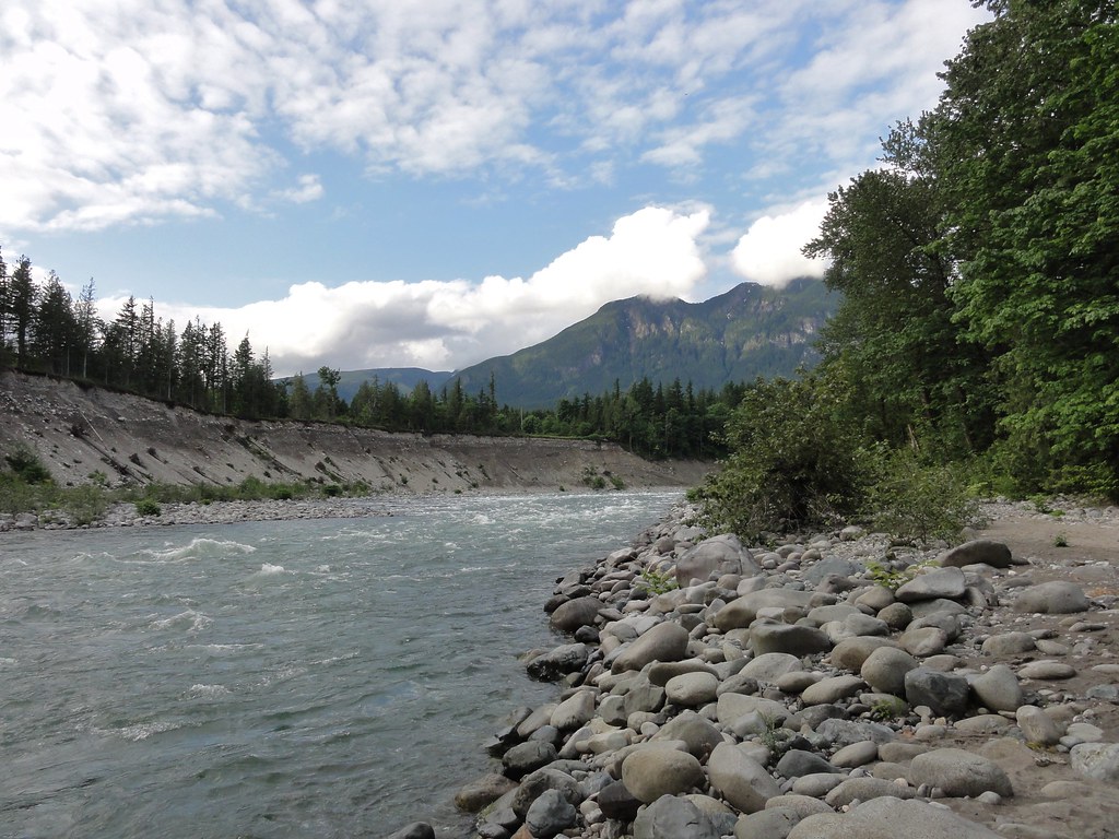
Skykomish River, looking upstream

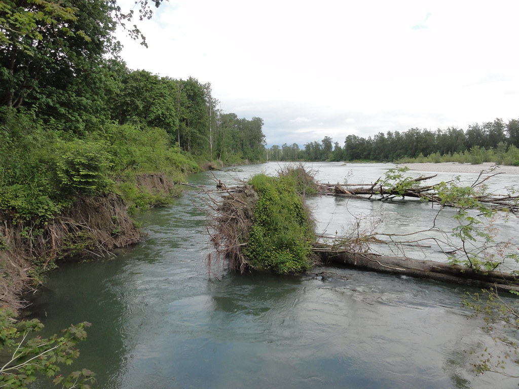
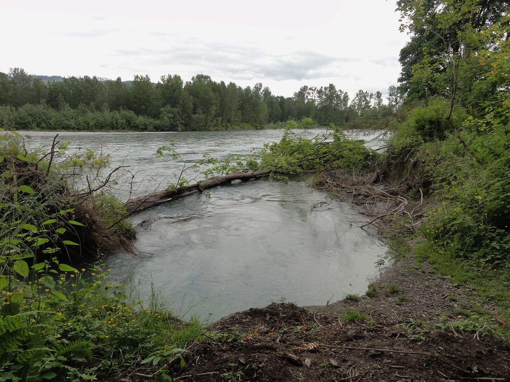
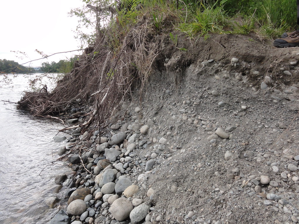
And you notice how it’s plastered its banks with boulders.  People go through a lot of effort to pile stuff like this along some of its lower banks in an effort to reduce erosion.  Here, the river does its own rip-rap, and does it in style.  We’ll see more of that later, and get intimate with them in a forthcoming post.  Let’s just say if I had a large yard and a forklift, the banks would be rather a bit less rocky.

Let’s turn our attention to that opposite bank, though.  Here’s a panorama of it:

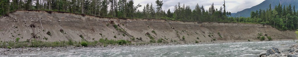
Nice, isn’t that?  Look at all those lovely layers!  I think an argument can be made that rivers are natural-born geologists.  They like to collect pretty rocks, and they sometimes like to cut down through a sequence so that all the nice depositional layers are on display.  We shall have a closer look:


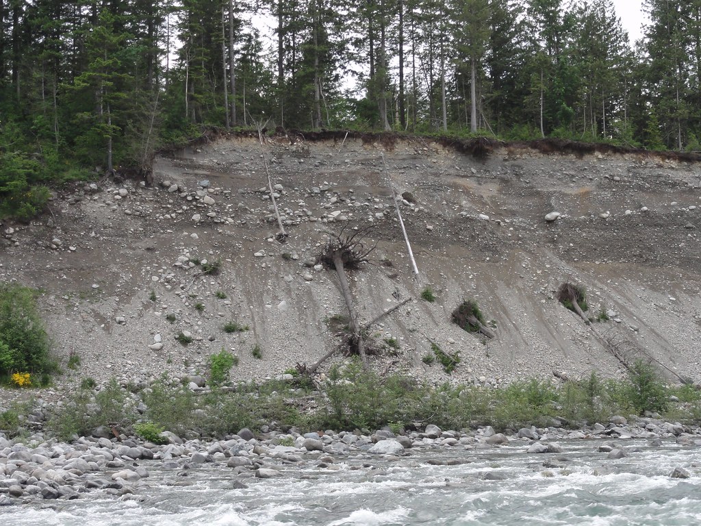
Look above the debris fans, and you’ll see some lovely horizontal deposits.  Those look like river deposits, don’t they just?  And while I can’t swear to it, they might be fine examples of the fining upward sequences Karen talked about when we first went river-walking.  I need to read up on rivers before I can speak with any sort of intelligence here, but Karen did us the favor of a short description:

Here’s a phrase you can add to your geologic lexicon (if you haven’t already): “fining upward sequences”. As you pointed out, there’s a flood strong enough to carry cobbles, and then pebbles come down, and the sediment in the exposure fines upward into sand and mud… and then the whole thing repeats. Flows of various geologic sorts produce fining upward sequences in sediment; it’s a good phrase to know. 

It’s about this time when I wish they’d hurry up with the implants that will allow me to download things directly into my brain.  But I digress.

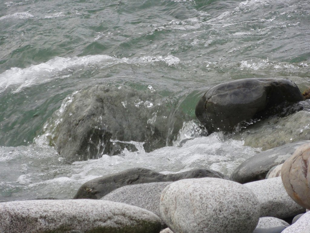
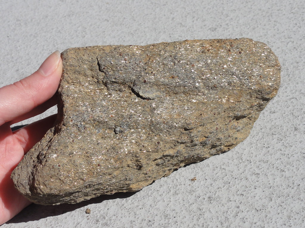
One of the things I wanted to show you was the power of this river.  It can and has carried boulders.  It’s dropped boulders off when it’s done with them, and now amuses itself flowing over them.


 And if you’re like me, you could sit on a boulder and watch the river play for absolute hours.

No still photograph can capture the power of it.  So I shot some video.  First, we’ll pan up and down the river:

That gives you a general overview and some sense of how fast those waters flow.  And in this one, I give you a close-up of some particularly interesting rapids.  Pay especial attention to the fact there’s a person talking for a bit there.  That’s my intrepid companion, and you can’t hear a word he says.  Neither could I. The river drowned out everything except for itself.

And even that doesn’t really capture the magnitude of it.  The deep roar of rushing water is something you feel as much as hear.  It’s on the same order as standing right beside a freight train.

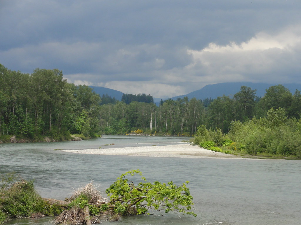
Right.  So here we are, further up the river, and we can turn to look downstream back the way we came.  Hard to believe we navigated all of those boulders:


Not easy walking, I can assure you.  I’ve heard of gravel bars, and cobbles, but I think this has to be dubbed a “boulder bar.”

Looking upstream, we now have a better view of the mountains:


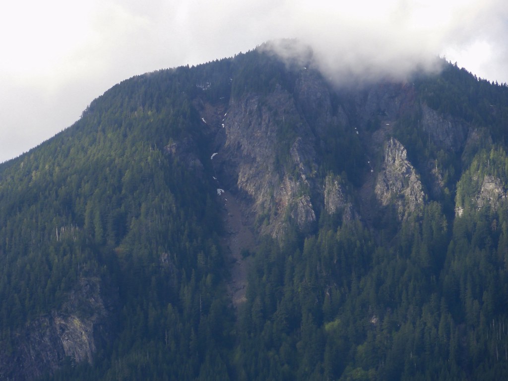
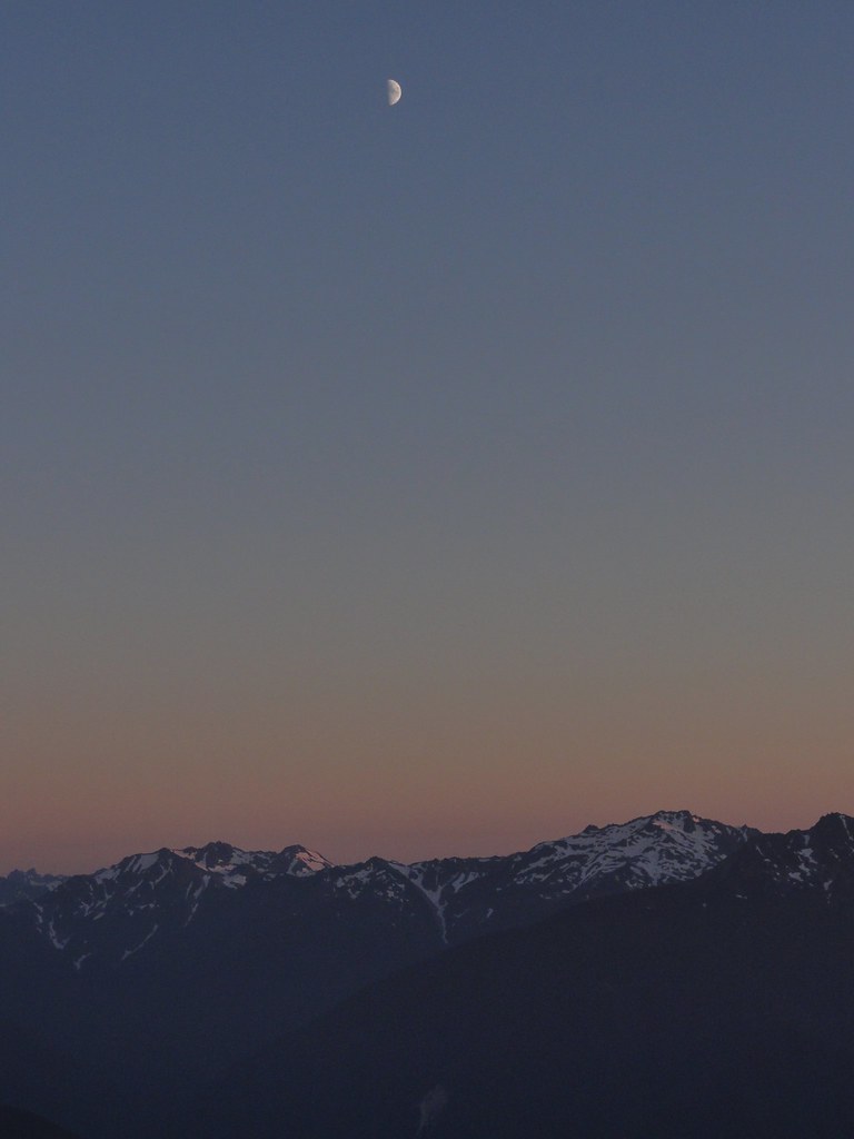
Okay, well, aside from the clouds trying to eat them, but this is the Pacific Northwest, people.  We’re lucky we can see the mountains at all.

If you look closely at the center-left of the bank, you’ll notice a gap in the trees, and a house that’s about to have a whole new definition of riverfront property.  It might have had a back yard once, but the river ate it.

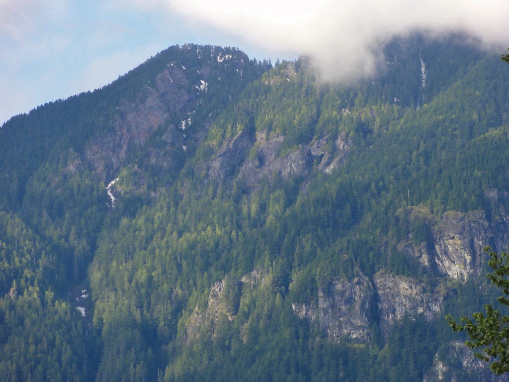
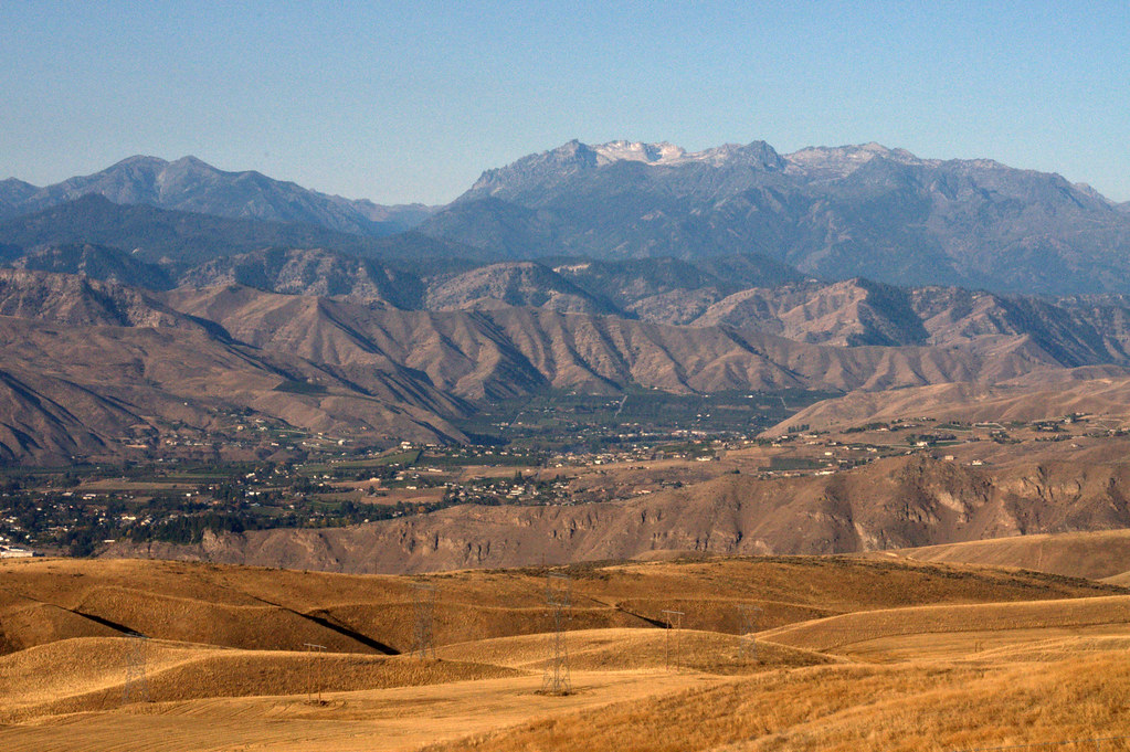
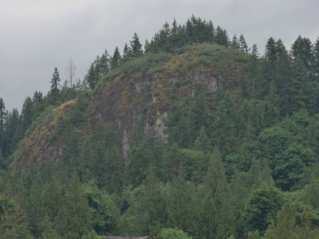
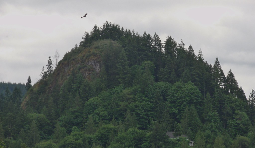
The clouds weren’t feeling particularly cooperative, but I did get a couple of close-up shots of the mountains.  Here’s one where you can see just how precarious slopes can be:


And this:


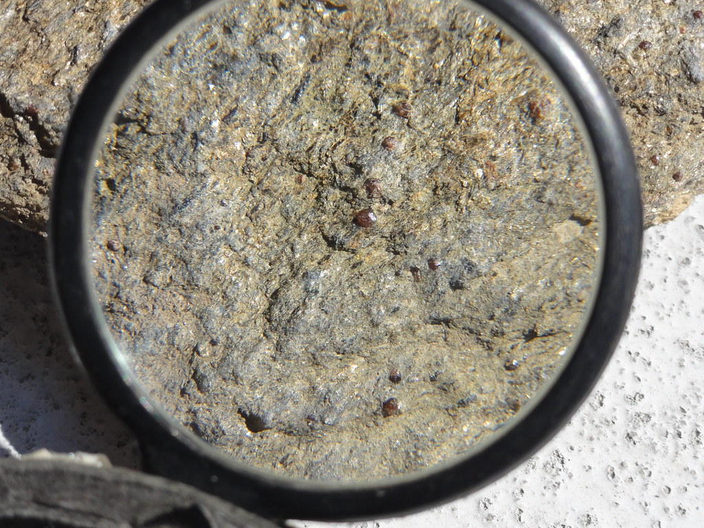
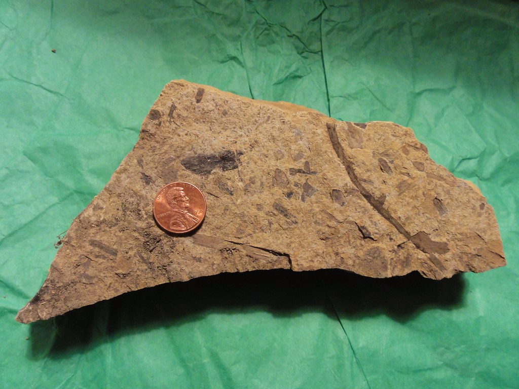
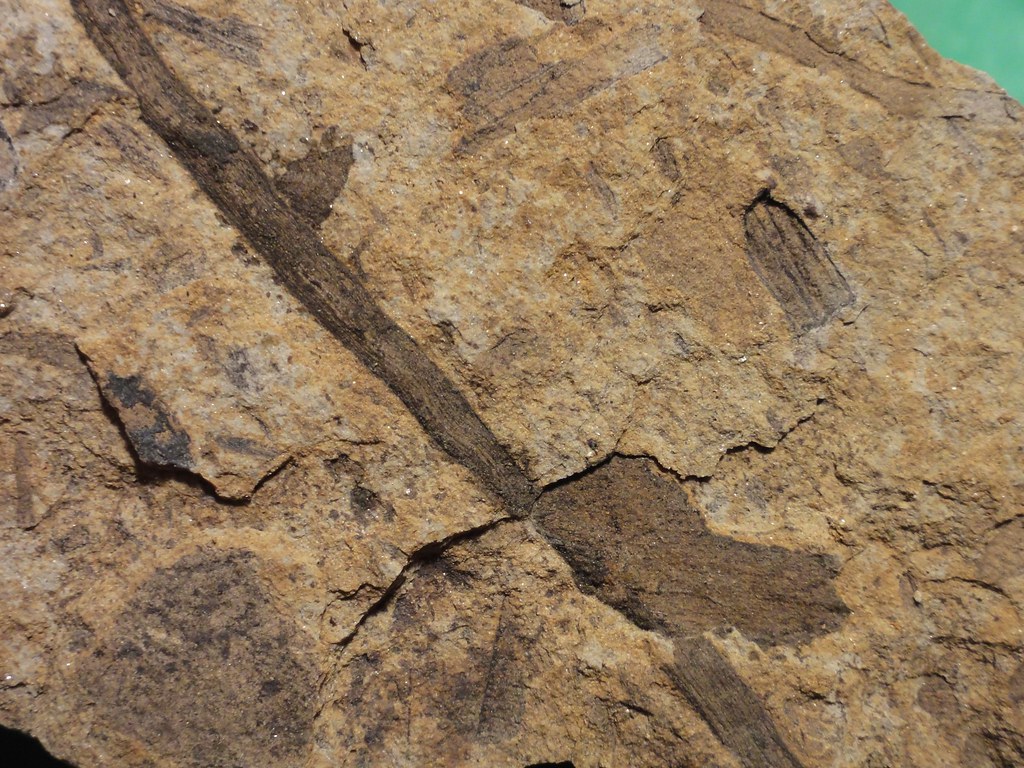
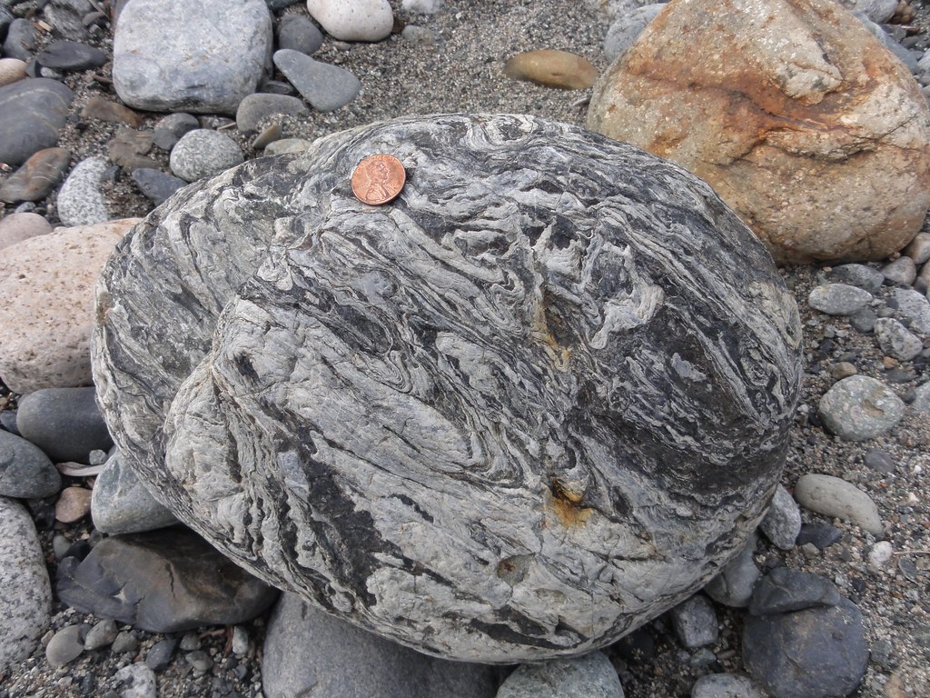
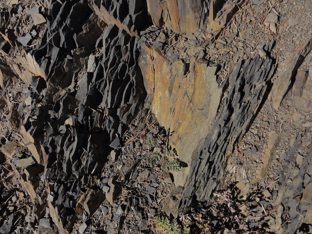
If we’d got deeper into the Cascades, you would have seen quite a lot more snow, and possibly some glaciers, but this will do.  Cliffs and crags with a bit of sunlight on are nice.

In our next segment, I’ll be introducing you to some of the rocks that didn’t come home with me, and you will see some lovely examples of what being stuffed into a subduction zone can do to stone.

River Walking Parte the Third: Wild Water
{advertisement}

River Walking Parte the Second: What I Have Against the Skykomish

Every time we go out on a new adventure, I tell myself very sternly, “Dana, you have already got rocks.  You have got lots of rocks.  Rocks are, in fact, threatening to outnumber the books.  You will have to move someday.  It will cost you roughly $4,000,000,000 dollars to move the books and the rocks you already have.  So stop picking up rocks.  Okay, maybe just one rock, but only one.”

And when we went to Al Borlin Park, I thought, “Oh, good.  It’s the lowland part of the river.  Should be mostly mud and sand.  No chance of rocks there.”


Sigh.

The number I ended up with has a one in it.  Unfortunately, the one is followed by an eight.  And it’s only in the teens because a) I asserted some self-control and b) because some of them would have required a forklift.  I didn’t have a forklift with me.

The Skykomish River drains the Cascades, which are a wonderful mish-mash of metamorphic and igneous goodness.  It is a powerful river, which you’ll see in our next installment.  And its drainage area and power combine to bring down crazy cobbles of the most delightful kinds, many of which I’m at a loss to identify, but this does not stop me from coveting them.  Loaded with geologic treasures, the river then hits that nice lowland, loses the energy to carry anything larger than sediment and pebbles, and dumps the lot in its bed and along the banks and in enormous gravel bars full of cobbles.  During their journey, the rocks have become nicely tumbled, and when they’re wet all their colors and textures really pop, and all of this combines to weaken far stronger wills than mine.

Below the fold, I present to you pretty rocks.  I cannot with confidence identify 90% of them, so I’m just going to emphasize pretty rocks!!  If you see one and say, “Ooo, I know that one!” please do enlighten me in comments. 

And remember: in science, three of the most important words are, “I don’t know.”  Three of the most exciting are, “Let’s find out!”


I actually left some rocks behind.  This is one.  But I really liked the texture of it and that big black blotch.


This one would seem to be a member of the granite family.  I didn’t bring it home, either – I’ve got a ton of granite – but I loved the texture of its crystals.  All sort of sugary and large and sparkly.  Something had whacked it, exposing the unweathered interior.  Just lovely.


This one did come home with me.  Obviously metamorphic, lovely swirls and folds, and check out its other side:


Somebody was all like, “I will not be compressed, nossiree!”  I like its defiance.


I suspect this of being another member of the granite family, but might also be something subjected to a desultory bit of metamorphism.  I suppose breaking it in half and studying a fresh face might have been more informative, but I didn’t bring the rockhammer on account of believing there wouldn’t be enough rocks to pound on.  And I honestly don’t know if I could’ve brought myself to whack it.  I’d make a terrible professional geologist: “But it’s too pretty to break!”


Speaking of too pretty, just look at that beauty!  Another one where I can’t even hazard a guess beyond “something metamorphic,” but the colors and textures of it are just mesmerizing.  And yes, it followed me home, and I am keeping it.


This is green.  I mean, really green – the photo couldn’t quite capture its greeny goodness.  No idea what it is, but it’s quite hard and extremely friendly.  In fact, it’s sitting beside my chair in a very friendly manner as we speak.


This one isn’t.  I probably should have brought it home, because it’s sort of red, and I could have put it out with the green one at Christmas and been all holiday-spirit.  Ah, well.  I’m sure I shall find lots of red rocks this summer.

I think you can see the hazards of this stretch of the river for a geology buff.  And this is merely a small sampling of all the temptations set before me.  It would have gone very badly for me indeed if I’d been able to wade out to the gravel bars.

Just you wait until we get out by Gold Bar, where the river has left ginormous chunks of the most astonishing rocks, some of which I can even identify.  In our next installment or two, we’ll be discussing where all this metamorphic stuff comes from and what sorts you can find.  I’m also going to show you the power of a mountain river.  Prepare for whitewater and very wild geology, people.

River Walking Parte the Second: What I Have Against the Skykomish

Alaska, or How My Mind Was Completely Blown

Hi!  My handle on this-here blogthing is Steamforged.  I am here by grace of wonderful happenstance, and I could not be more honored.  Dana and I encountered each other in line for Neil Gaiman’s Seattle visit (which occurrence she wrote about in such glowing terms as to make me blush), and we hit it off so famously that about ten minutes into the conversation she asked if I’d guest blog about my Alaska trip for you awesome folks.  She’s seriously a special person, but you already knew that since you’re here too.  Thank you in advance for welcoming me here, and I hope you enjoy my posts!

A quick disclaimer: I am not a geologist, though I dearly hope to be one someday.  I’ve recently started self-teaching as I can by reading books and blogs and really anything I can get my grubby mitts on, but I’m no expert.  I might get things wrong, and if I do please PLEASE correct me!  That way I can keep on learning.  With that said, on to Alaska!

There’s this story I used to tell people by way of explaining why I wanted to visit Alaska, and I’ll share it with you folks too.  I used to work tech support for Canon, their cameras more specifically.  I talked to a lot of people, and many of those people traveled heavily; amongst all the troubleshooting I’d often hear about their vacations.  The one constant, the opinion I heard from everyone echoed as if from a vacationers’ hivemind, was that Alaska was the most beautiful place they’d ever seen.  It’s really quite the recommendation.

Finally made the trip myself and I am here to tell you that Alaska is the most beautiful place I’ve ever seen.


Right near Juneau.  And I thought I woke up to great views, living east of Seattle…  These folks totally have me beat.

I took hundreds of pictures, saw countless naked and wild natural wonders, and got my mind completely blown away by it all.  It’s not possible to convey everything adequately, and besides which, a lot of it isn’t really relevant to our topic here–wait, what?  There’s a topic beyond “Alaska is so super-rad,” you ask?  Sure!  I’m narrowing things down to GEOLOGICALLY RELEVANT beauty.  Otherwise I’d never shut up.  Trust me, this is for everyone’s benefit.
My visit was via cruise ship up the Alaskan Inner Passage.  There are three locations I’ll be writing about: Mendenhall Glacier, Tracy Arm, and the Klondike Highway between Skagway and the Yukon.  Three locations, three posts, simple enough!  They’ll be image-heavy, which is good, since I’m no John Muir (I just started reading his Travels in Alaska, oh wow) and can’t hope to successfully demonstrate Alaska without some photographs to help me out.  It’s just that, well…  mind-blowing.
Glacier time!
Mendenhall Glacier: my first river-of-ice, down-to-the-water, massive for-really-real glacier.  I know, Mt Rainier not only counts, but counts heavily.  Still, there’s something special about seeing an ancient flow of blue-white ice calving icebergs into the water.  It has all the bells and whistles, too.  The nearby rock faces bear parallel gouges from long years of glacial scouring; erratics litter the terrain, ranging from the size of a Volkswagon Beetle to the size of a Hot Wheels Volkswagon Beetle.  It was a beautiful day.  In fact, it was a little too beautiful.  I’m embarrassed to say that I managed to overheat myself running around near a glacier.  S’what I get for not drinking enough water!


Mendenhall Glacier in all its glory.  According to the excellent Visitor’s Center, the place I stood when taking that picture was beneath the glacier’s ice within this last century.  It’s receded quite a bit.


Even if Mendenhall Glacier wasn’t looming over my shoulder, I’d know this was glacier country.  Look at those grooves!  If memory serves, the Visitor’s Center was built directly atop the rock in this picture.  Also, I am a bad wannabe geologist, having not provided anything for scale.  This will be rectified in coming photos.


There’s so much going on in this picture!  In the foreground we have a beach made of erratics, casually dropped unsorted as Mendenhall made its slow retreat.  Then there’s Mendenhall Lake with its summer flotilla of icebergs, and further back there are the sloping hills at the foot of the mountains that cradle the glacier itself.  It really was a beautiful day.  Cloud provided for scale.


Then there are the human-sorted rocks.  I came across rock stacks wherever there were sufficient rocks to support such endeavors.  Maybe people just like to leave their mark, something to say I WAS HERE.  And check out these rocks!  You can see the striations, perfectly linear and parallel.  SO glacial.  Mountain provided for scale.


Now we’re getting close.  Those lucky folks had the money for the fancier shore excursions; I relied upon my trusty zoom lens.  That remarkable glacier blue shines through.  I love the jagged crevasses and spikes in the face of the glacier.  There’s so much texture there.  Boat provided for scale.

And finally, Mendenhall is ready for its close up.  The color is simply brilliant, down in the cracks.  I feel like there is so much going on there, in the ripples and crevasses and other ice formations, and I don’t understand any of it.  I want to, though!  Some of the smoother surfaces almost have the look of wind-sculpted sandstone formations.  …the glacier IS the scale, darnit!

The Mendenhall Glacier Visitor’s Center was really quite nice, with dioramas and a viewing deck and rangers on site to answer all kinds of questions.  I cannot recommend them highly enough.  That’s actually where I bought my copy of Travels in Alaska, which is written in such poetic language that I suspect I’ll be quoting it for years.  It doesn’t hurt that, after I commented on the formation of the nearby mountains, one of the rangers asked if I was a geologist.  TOTALLY made my year.
That’s it for my introduction and Mendenhall Glacier!  Next time: Tracy Arm, a journey into awe, my sense of self (rendered tiny) provided for scale.
Alaska, or How My Mind Was Completely Blown

Happy Birthday, America! The Reprise, With Esplodey Thingies and Geology

Upon getting off work on July 4th, I hurried home and hied me up the hill behind my house.

I love the hill behind my house.  For one thing, I suspect it’s a drumlin.  For another, I found my garnet mica schist there.  And for the third, I can see a whole bunch of fireworks displays from all over the Seattle area from it.  Not perfectly, mind, but well enough.  And there are no crowds.  Just lotsa ba-booms.

As I was headed for the hill, I saw the lovely crescent moon shining in the last of the sunset:


And then, once I’d got up the hill, I discovered something outstanding. 

You see, when it’s cloudless here (which is like two days out of the year), you can catch a teensy little glimpse of the Olympics from that hill.  And there was one of the higher peaks, silhouetted against the twilight, with things blowing up nearby:


Okay, so the mountain’s nearly hidden behind a tree, but still.  Besides, I have this nifty video that gives a better view – and lotsa splodey things.

Is that or is that not sweet?

Speaking of sweet, folks launched fireworks in the valley down by the river, so the whole huge drumlin opposite my drumlin would be lit up like, well, the 4th of July.  I didn’t catch the really gorgeous explosions, alas, but I managed to catch this one in the act:


Watching those enormous blooms of sparks against the dark forested hill, lighting up the entire valley for just an instant, made my heart leap.  So did the ones someone on the hill above me launched – I mean, full-size fireworks going off right above my head, now, that was intense.  And more fun than I care to admit.

After a while, the entire valley filled with smoke and the faint smell of cordite.  Surreal.  I would’ve stayed out there for the finale, but there was this ridiculous long lull in the displays that allowed my extremities to clear their respective throats and say, “You know, Dana, it may be July, but we’re fairly far north, and it is frickin freezing out here, and we’d really like to go back inside.”  So we did.  I couldn’t feel my fingers or toes for about an hour afterward, but it was worth it.

Evelyn put up red, white and blue rocks in honor of the holiday, which got me to thinking about the Fourth of July and geology. There’s definitely geology involved.  Take the whole Battle of Bunker Hill thing.  That was fought on drumlins.  Having one right behind me, I can understand why the rebels wanted to be on top and why the British had a hard time assaulting those positions.  They may not be all that tall, in the relative scheme of things, but when you’re running up a hill in a hail of bullets, they probably seem very tall indeed.  And they command a fair view of the surrounding area.

Breed’s Hill, courtesy of McDee

That’s where most of the battle was fought, actually, right up there on Breed’s Hill.  We rebels wouldn’t have had such a sweet setup if it hadn’t been for the Laurentide Ice Sheet.  Somewhere between 80,000-90,000 years ago, this whole area got invaded by Canadian ice.  It carved the Boston Basin and dumped some drumlins when it left around 14,000-11,000 years ago.  Boston, it seems, aside from not having lovely mountains forced up by a subduction zone, is quite similar to Seattle: glacial outwash and drumlins and moraines, oh my.  They’re even similar in age, and for good reason: the Laurentide Ice and the Cordilleran Ice Sheet actually connected to each other.  Ice from sea to shining sea.

Most of the glaciers we associate with now are so small it’s hard to believe something as prosaic as a lot of ice left such enormous mounds of gravel, sand and clay, but they did.  We’re talking continental glaciers that were hundreds of thousands of square miles in extent and three thousand feet thick.  Even wee glaciers make good bulldozers: you can just imagine what these behemoths were capable of.  But you don’t have to imagine it.  You can go walk around and see the results for yourself, all over the northern bits of North America.

If you go, make sure you pick up a copy of Written in Stone by Chet and Maureen Raymo.  ‘Tis handy and slim.

Oh, just one more, then, because a famous drumlin close to sunset is lovely:

Breed’s Hill, courtesy of Via Tsuji

And, for the curious, a shot at the drumlin across the Sammamish River valley, taken from my own dear drumlin and favorite fireworks-watching hangout.


Drumlins are cool.

Happy Birthday, America! The Reprise, With Esplodey Thingies and Geology

Garnet Mica Schist, People!

Some photos of that glorious piece of garnet mica schist I found on the hill behind my house:


There she is!  Kitteh for scale.


So sparkly!


And a shot through ye olde hand lens.  Look!  Garnets!

I have no idea where this thing actually came from.  The hill behind my house seems predominately outwash, and there isn’t bedrock around so far as I know.  Certainly not bits of the metamorphic core.  I’m wondering if someone just abandoned it, like people do puppies.  No matter, it’s got a happy home now.

Elli Goeke wrote the definitive series of posts on garnet schist.  If you want to know more about this beauty (and you do, you know you do!), see:

Metamorphic reactions — the basics

Mud to cordierite – sillimanite hornfels — contact metamorphism at work

Mud to garnet schist — regional metamorphism at work

I will be eternally grateful to her for writing these.  A round of applause, please, my darlings, and if you’re ever lucky enough to meet her IRL, be sure to buy her a drink.  I owe her a few gallons, so I hope she’s thirsty when we finally meet.

Don’t be surprised if I post more photos of this find.  These were shot in haste on my lunch break, and it deserves better.  But several people have wanted to see it, and I just couldn’t wait anymore.

Garnet Mica Schist, People!

In Which I Answer Reader Questions, and Request Expert Assistance

I really owe Evelyn Mervine serious thanks.  She’s the one who inspired “The Seduction of Subduction,” which has proved to be one of the most popular posts ever to appear in ye olde cantina.  Without her, it wouldn’t have happened, so all of you who liked it please pause your reading for a round of applause.

The comments thread contains some questions and points of especial interest, which I shall take in order.  But not before telling you all that I appreciate every comment and compliment more than I can ever express.  Thank you!

Suzanne says my blog has now taught her enough that she can recognize some features and formations.  This, I have to say, is one of the most rewarding comments I’ve ever received here.   Then again, she’s one of the most rewarding people I know.  I’m glad I can give her something of some worth in return for all she’s given to me!

Karen’s anecdote is a shining example of how you can tell a geologist from a non-geologist.  Geologists (and geology buffs) are the ones who get super-excited over the seemingly-dull rocks when something shiny and valuable is also present.  You can be certain you’ve identified a geologist if they wax enthusiastic over the phyllite and then suggest everybody go for a beer.

George A posts the following photo and question:

Wenatchee, Ridge View, by George. Do not filch this photo like I did because it’s All Rights Reserved.

We stayed in East Wenatchee on a visit to Washington last year. Our host told me that the mountains in the background of the linked picture are on the Juan de Fuca, while the nearer ones are on the NA plate. I gather from this post that he is correct?

ZOMG that’s tasty.  I’ll have to head out there.  Alas, it appears George’s host was mistaken.  The Juan de Fuca plate currently ends at the Cascadia Subduction Zone, which is offshore:

Filched from Wikipedia.  It’s a USGS image, so we technically paid for it anyway.

The heavy black line with arrows in that looks rather like very somber bunting marks the subduction zone.  You can tell from the seismic activity that it has influence far inland, but no, those mountains and hills aren’t actually on the Juan de Fuca plate.  They belong to the North American plate, now.  They didn’t always.  I’d have to do quite a lot more reading up before I could speak with any confidence as to the details, but basically, North America’s been filching from the Kula and Farallon (and now Juan de Fuca) for many millions of years.  What you see in Wenatchee did indeed once belong to another plate, but it’s solidly North American now. 

Ron Blakey has some very good paleomaps that give an idea of how insane this region is.  Here’s one of North America ca 50 million years ago, and one showing some hot terrane action.  I also found this University of Alabama site, with a wonderful geologic map and a nice write-up of some of the areas you likely were in.

Right.  There’s something of an answer, and any geologists with knowledge of Wenatchee should feel free to pile on in comments.

Nick suggests Northwest Exposures and Roadside Geology of Washington.  As do I, without reservation.  I have got them both sitting beside me as we speak, in fact.

Bra says, ” If I had it to do all over again, I’d be a linguist instead, but if I had to do over TWICE, I’d be a geologist!”  Strangely enough, so would I…  I almost went back to school for a degree in linguistics before I decided my time would be better spent writing, and just lately, I’ve had a hankering to get a geology degree.  Alas, little time and absolutely no money.

Christian Renggli believes one of my unidentified rocks is a migmatite, and after looking at examples on the Wikipedia page, I have to say I believe he’s on to something.  Nicely done!  You see, this is why I love my readers.  Well, one of a great many reasons.  Anyway, I found lots more where that came from, so perhaps a post on migmatites is in order, once I’ve read up on them.  Suggestions?

Shane Evans has a good question:

Thanks for the info on phyllite! It was new to me. Would a bit more squeezing make it schist? Just wondering. 

The answer, simply, is yes.  Mica schist would be next on the list had the heat and pressure stayed on.  The more complex answer has to do with Barrovian metamorphism, which is a fascinating topic in its own right and one I should also research more deeply.  One o’ these days, I’ll have visited the entire sequence from shale to gneiss, and then we shall have a proper treatment of the subject, complete with delicious photos.

And, finally, SocialMike has some comments on the economics of subduction zones that would repay a perusal. 

Now on to the request for expert assistance: my soon-to-be-coblogger would like to know more about the geology of the Cascades as seen from Seattle, specifically the bit in the middle-right of this photo that sticks up like a cock’s comb.  The one book I have that gets into the specifics of Cascades geology focuses only on the bits to the north of Seattle, so I’m at a loss.  Anyone got the answer?

That, I have to say, was a lot of fun.  We should do this more often.  Consider this an open thread.  Pitch your questions, comments, observations, and bad geology puns, and we shall have another in the very near future.

In Which I Answer Reader Questions, and Request Expert Assistance

River Walking: Skykomish

Let me show you a sight that is frankly astonishing to someone from dry country:


This is the Skykomish River.  It has got water in it, all the time.  Where I come from, a river is defined as a linear depression in the ground that is too wide to jump over and is occasionally moist.  This goes a long way toward explaining why I’m bloody ignorant about rivers.  But ignorance is not bliss, and I’m using this visit to the Skykomish River to continue my education about rivers.

Absorb the above photo for a moment.  You’re looking at a prime example of a riparian zone.  I first heard the word “riparian” in my physical geography class, and immediately fell in love with it.  It’s just got this certain ring.  And for me, it’s associated with scent: sweet water and luscious plants, damp earth and, sometimes, just a hint of fish.  It’s got a particular feel: a cool, damp world unto itself, small and yet somehow expansive.  It’s got a look: green.  (Mind you, everywhere I go is green now, but that wasn’t so back home, so riparian is the quintessential green.)  It’s got a sound: trickling, rushing water and rustling leaves and insects and birds and unseen things rattling around in the bushes.  Riparian isn’t so much a zone as an experience.

And experience it we shall, but not before I force you to delay gratification a moment while we indulge in an overview.

Skykomish River

The Skykomish River is short, sweet and to the point.  It’s only 29 miles from its origin in the Cascades to its end at the Snohomish River.  But it drains nearly a thousand square miles.  It played a large role in the economy of this bit of Washington State.  It’s certainly not inconsequential.


Here’s where we’re adventuring today:

View Larger Map

That forested strip just to the top left there under the city of Monroe is Buck Island.  It’s more peninsula than island, but we won’t quibble.  It’s very nearly surrounded by water, and sometimes it’s completely covered in water, so if it wants to be known as an island, we’re good with that.

We’ll be walking down there in just a moment, but right now, let’s have a closer look up the river.


You can see the Cascades there in the distance, doing their best to hide behind the clouds.  We’re in the Skykomish River Basin here, and just to our left is the Woods Creek Sub-Basin.  Note the word “basin.”  We’re in the down-low here.  This area was once underneath about 3,000 feet of ice, which did interesting things to the topography, and the river’s been playing with it ever since.

I don’t think a lot of people think of rivers when they think geology, but as we meander along like the river meanders through its basin, we’ll see that it’s got a lot to do with geology.  It’s making geology right before our eyes.  Check out, for instance, that sexy little gravel bar in the middle of the above photograph.  If it’s very good and very lucky, it shall one day become a lovely conglomerate.

Let’s go down on Buck Island and have a look at matters from the picnic area.


Looking toward the bridge, here, you can see the river take a bit of a turn around its gravel bar.  It looks like it’s trying to carve its way through to Woods Creek, which is just behind all those very tall trees to the right, there.  And as it takes that turn, it’s undercutting its bank on this side.


In fact, it had just recently finished carving off bits.


It may not be riverbank collapse on the scale of the Missouri River, but it’s along the same continuum.  The river gaveth sediments to Buck Island, and now it taketh them away. 

Here’s a nice closeup of those sediments, which other people call mud:


I think I see some mica glittering in there.  It’s all full of minerals, and the plants seem to love it.

Here’s a nice view of the opposite bank, where you can see all the layers laid out:


Someday, those might become sandstones and mudstones and conglomerates that will tell far-future geologists that a river once ran through here.

Right now, the river seems lively, even frisky, but not particularly wild.  Don’t let it fool you.  It carries an average of over 24 million gallons of water past this point per day.  I’m not sure how much flows past in flood stage, but considering Buck Island goes under and we’d have to swim for it were we standing at this spot during a flood, it is, to put it mildly, a hell of a lot of water.

And it is powerful.


This is what is known as “large woody debris,” or “holy shit the river just ripped those trees right off the bank and dumped them in!”  Big trees, very tall trees, which had been happily growing with a nice riverfront view for years, and they are now sleeping with the fishes.  In fact, fish quite like having them round.  But pretty damned catastrophic for the trees.  Think of that before you start thinking of building a nice riverside home.

Before we head up river, let’s have a good look round, take in the whole scene.


Large woody debris, undercut banks, gravel bars filled with rather large (and, take it from one who schlepped a few out, heavy) cobbles, and an enormous amount of water.  Amazing, when you think of it, that we had the chutzpah to put a bridge over it.  That’s the tiny little human structure toward the top right, there.

All right, let’s head on up river.  Here we have a slightly muddier little cove, and oh, look, more large woody debris.


One of my sources for this post notes that “LWD provides physical habitat for plants and animals, alters in-stream habitat by creating pools, riffles, shade, and hiding places, adds nutrient and energy sources, and can decrease erosion.”  Here we have a fine example of LWD doing its level best to create a nice pool.  If it doesn’t get hauled downstream in a big ol’ flood, it might even trap enough sediment to create more land at some point, depending on how things go.  I find that fascinating.

Here’s another thing I found fascinating:


Inland from the river, you can find these banks of sandy sediment and pebbles.  I didn’t know at the time that the Skykomish sometimes turns Buck Island into Buck Riverbottom, but I could guess, just from these deposits.  I love this stuff.  I love seeing how rivers create land.

There’s a very nice bank further along that exposes the layers of river-deposited sediment nicely:


Look at all the cobbles!  And if I’m not much mistaken, we’re seeing variations in energy here: at times, the river was powerful enough to carry gobs of cobbles.  At others, it managed pebbles and sand.  Someday, I’ll know more about how rivers flood and sediments settle out, and this will make exquisite sense.

Did I just hear you say, “Please, Dana, may I have another?”  Why, yes.  Yes, you may.


Isn’t that wonderful?  And you’ve even got my Intrepid Companion’s boot for scale!

And as we walk upriver, we notice one of the most fabulous examples of erosion ever.


It seems there was a lot more riverbank here at some point, because this tree had a chance to grow a very gnarly root system.  Now the river’s carving it out.  Check this from another angle:


This baby’s got “Future LWD” written all over it, but for now, it’s clinging on with stubborn determination.  It seems almost grumpy about it, like it’s muttering, “durned river, get off my lawn!”

When you get further up river, away from the gravel bar and undercut banks, you can look back down along it and think it almost looks placid.


It’s anything but.  Oh, and did I mention it’s bloody freezing frickin’ cold?  It’s fed by snow.  It’s very, abundantly clear that it carries a lot of snowmelt, and that it’s been snowing in the Cascades, and that snow has been, above all, cold.

Let’s have a look from upstream at the gravel bars, shall we?


Really, seriously amazing and beautiful things, rivers are.  And just you wait ’til you see what it’s like when it’s not ambling along a nice, gentle gradient, but dashing down the mountains.  But before that, you’ll see what I have against it. 

River Walking: Skykomish

Need to Know

I’m sure I’ve mentioned this before, but my own ignorance drives me crazy.

That’s really been driven home these past couple of weeks, in a few different ways.  There’s the research I’ve been doing for Nyaanovos, which has occasionally caused me to scream and yank out hanks of hair.  Ron mentioned that Mediterranean geology is a mess, and he wasn’t wrong.  What a hodge-podge!  It’s like somebody took a sledgehammer to that region while other people were busy cramming it together and another few teams, all at cross-purposes, were trying to pull it apart.  And I know it makes sense.  It’s just hard to make sense of it.  There are people who’ve dedicated their careers to teasing some order out of the mayhem, and the work is ongoing.  We’ve got bits of the puzzle sorted, but nothing approaching the whole.  And there are times when I wonder what possessed me to stick a region like that on Xtalea, rather than staying with the simple stuff.  But simple doesn’t lead to fantastic landscapes suitable for awe, so forget simple.  We’ll go with complex, and curse our ignorance every step of the way.

I need to know.

Then there was the little day trip we took up the Skykomish River.  Just one single afternoon.  Just a few pretty pictures.  Okay, around 500 pretty pictures, but still.  Quite a few people would be content to exclaim over the scenery and pick out the really nice ones and put them up with a few words about how pretty the region is.  Me?  I’ve got to know.  My ignorance of the place drives me crazy.  I want to know how the river works, where it comes from and where it goes and how it behaves.  I want to know where all those interesting rocks came from, and what they are, and how they got to be so interesting.  I want to tie everything together with what I know of all the terranes that got stitched together to create Washington, and I want to understand how subduction made the Cascades rise, and why things are the way they are.  I want to know what the flowers are, and what their lives are like, there on the banks of a mostly untamed river.  Someday, I might go beyond identification into evolution, because knowing how they got to be what they are fascinates me.

I don’t understand how people can stand not knowing.  I have no idea why some folks can look over a landscape and think, smugly, that God made it and that’s all they need to know.  And I have absolutely no idea how they can stand beside a wild river and think they can rule it, or have the right to.  Beside that river, I feel nothing but humility and respect and delight and awe.  Imposing my will on it is a laughable concept.  Understanding its origin and moods, knowing how to live peaceably beside it, those strike me as good things to know.  Knowing how to break its spirit, believing it was put there for my benefit, those things aren’t so good.  And living in ignorance of it, that’s just tragic.  Especially if said ignorance leads you to believe you can live in one of the flat bits beside it without getting your ass flooded out.

So I’m grievously ignorant of Mediterranean geology and local geomorphology.  That’s okay.  These are things I can come to understand, in time, and with help from my geotweeps, books and the intertoobz.  But there are other regions of ignorance that hurt me worse, because I can’t even begin to shake them.  Not yet.  I’m reading a book on crystals right now, one written by folks at MIT, 100% woo-free.  And they’re talking about concepts I can’t get my mind wrapped around.  I am appallingly bad at imagining in the abstract, so when they go on about imagining the ideal crystal and then start spouting geometry, I’m lost at sea.  My ignorance of chemistry is abysmal, as well, despite the wonderful book I just read on that subject, and it’s painfully obvious I don’t know nearly enough. 

So why even bother with it?  Because, damn it, I need to know.

Even if I gave up writing tomorrow, never set down another word on book or blog, I wouldn’t stop learning.  It’s passed a point of no return now.  The pleasure I get from knowing something real about the world around me is just too great to give up.  The world is so much richer with the things I know.  I don’t know much, but I know enough to know that knowing more will leave me staring at the most ordinary things with my mouth wide open in wonder, laughing at the magnificence of it all.  Chemistry and physics and geology and biology, all of these things come together in sometimes incredibly unexpected ways to create the most joyous little tableaux.  I’ve got a bit of sandstone full of fragments of fossil plants that I picked up while journeying with Lockwood last summer that combines all of those things.  I can hold four disciplines in my hand.  It’s just a chunk of dirty brown sandy rock with dark bits of unidentifiable plant matter in.  I mean, look at it – it doesn’t look like anything special, does it?


But this is outstanding.  It’s an incredible little rock, a bit of a turbidite.  An avalanche happened under the sea one day, and a slurry of rock and sand and mud and plant fragments all went sailing merrily downslope, came to rest, and as time went on, got compressed into stone and hoisted up on land, where a wondering layperson got it pointed out to her by someone who knows more than the Dick-and-Jane version of how it came to be.  Lockwood can explain it properly.  I can’t, not just yet, but I know enough about it to know that when I hold it in my hand, I’ve got a whole story representing several major branches of the physical sciences.  This little bit of stone has a very interesting history.  And if you look, really look, at it, get your nose right in and study it:


It’s got a lot to say.  It’s talking about erosion, with all of those lovely sparkly bits of mica mixed in with the more prosaic sediments, all of them eroded from parent rock long ago.  It’s speaking of a plant community living by (or in) the sea.  And it’s talking about a big shakeup, one day, maybe an earthquake or maybe just too much sediment deposited in one place, and gravity pulling it down into the deeps, and how the dense current of sediment-filled water settled down and deposited its load in a graded bed, heaviest stuff first, because that’s the way physics works.  It’s talking about chemistry, both biological and inorganic, and pressure and time.  It’s talking about upheaval, and plates colliding, and about how you can stand on dry land and still be standing on the floor of the deep ocean.  It’s a voice from deep time.  I don’t understand most of what it says, but the little I do understand fascinates me.  I want to know more.

I need to know.

This is why I won’t waste my time on woo, why I don’t sacrifice precious moments to a god that’s distinctly surplus to requirements and obviously imaginary to boot.  I was religious once.  For a while, I believed in god, and I thought the world was wonderful because it was his, but when my faith ebbed away because the nonsense of it all became blindly obvious, when I turned from religion to science, that religious awe palled.  Religion never made the world anywhere near as awe-inspiring as science can.  It was an empty wonder, polished brass and a glass bauble someone tried to pass off as a diamond ring.  It didn’t even have the benefit of imagination, because others had done the imagining already and all that was left was dogma.  It pretended to be real, but had nothing to do with reality. Thank reason I wasted only a tiny proportion of my life on it, because there’s too much of the real world to know, too many wonders I would have missed if I’d stayed faithful.  And I know that some people manage to have faith and enjoy science, but looking at science through faith seems to me too much like trying to get a clear view of something majestic while peering through the bottom of a poorly-made glass bottle. 

It frankly amazes me that some people never bother looking at all.

I don’t know how to end this post, because there is no end.  No end to the things I need to know.  No bottom to the chasm.  I’ll spend the rest of my life pouring science and philosophy and history and other bits of knowledge into it, and it’ll never fill.  I can’t say I’m empty – some days, I feel like I’m filled to bursting, but I’m never sated.  There are moments, like those pauses between courses, when I can savor what I’ve just had, but soon I’ve got knife and fork in hand and I’m watching the dining room doors eagerly, salivating as I anticipate what’s coming next.  It’s the best kind of hunger, this hunger to know.  It’s such a sweet starvation.

And the best part, the absolute most sublime bit, is that even if someone invented an implant that allowed the whole of human knowledge to be loaded into my brain, so that I instantly knew the whole of every science, I’d still have so much more to know.  I’d still have that need, because we don’t know it all.  Fill me up right to the cutting edge of science, and it would be barely a drop.  Give me a hundred lifetimes, and there would always be something new.  So many discoveries, so many frontiers, some we probably don’t even know are there but will have us screaming with joy when we find them out, all out there, all waiting.

We’ll always need to know.  And this universe, in all its immensity, will always ensure there’s something more.

Need to Know

The Seduction of Subduction

This:

Cascades from Skykomish River, near Gold Bar

This is why I love the word subduction.  Every time I’m reading about the geology of a region, when I come across that word, I get a tingle down ye olde spine.  Because I know we’re in for it.  I know the landscape’s going to be exciting.  I know we’re in for volcanoes and earthquakes and some really wild metamorphism, accretionary wedges and the whole shebang.  It’s all there.  Tell me we’ve got a subduction zone on our hands, and you’ll see me bounce like a Jack Russell terrier who’s just eaten its owner’s entire stock of No Doz and chased it down with a case of Full Throttle.

In a subduction zone, you get some really wild rocks, rocks that’ve been through it, rocks that have been chewed up and spit out, rocks that, were they a letter, would get the post office in deep trouble for the amount of folding, spindling and mutilating they’ve endured. 

Metamorphic Rock, Skykomish River

A subduction zone takes your basic rocks and makes them sublime.  It pushes them down and raises them up.  It takes bits of the seafloor and chucks them up on land.

Pillow Basalts, Olympic Mountains

It takes your basic quiet marine shales, which had been resting peacefully in nice horizontal layers on the sea bed, and squeezes and cooks them into phyllite.  And then it hoists them high, standing them on end, and makes mountains of them.

Phyllite, Olympic Mountains

Right now, right beneath me, the Juan de Fuca plate is subducting beneath the North American continent.  That subduction is the reason I’ve got land to sit on: over millions of years, subduction zone after subduction zone has formed around here, as oceanic plates meet continental, and as the seafloor goes down, bits of island arcs and seafloor sediments and appreciable chunks of the seafloor itself have gotten plastered on, creating the majority of Washington state, and the mountains that lured me here.  It’s a dangerous place to live.  This beauty does come with risk: chains of violent volcanoes, the certainty of an eventual megathrust earthquake.  But it’s worth the risk. 

I’ve been seduced by subduction.  Looking at the result, who wouldn’t be?

Olympic Mountains
The Seduction of Subduction

I Want a Ranch. With Horsies. In the Cascade Foothills.

My Intrepid Companion and I ventured forth despite threatening clouds on Monday.  I’ve been shut in with the Muse for months now, aside from occasional local escapes, and since my hormones had knocked her over the head and stuffed her in a closet, bound with duct tape and zip ties (bit of overkill, there, but it’s a bad hormone month), this seemed like a bloody good time to do more than retread the same ol’ ground.

Besides, I had a hankering.  I kept quoting Bilbo: “I want to see mountains again, mountains!”  So we headed east.  I’m only half an hour from Monroe, where one can begin to see evidence that something massive’s happening to the continent.

You go from the roly-poly drumlin-riddled and glacial-deposit draped lowlands up a very gentle grade, and then suddenly there’s a road cut with solid rock in (which, alas, I didn’t get a chance to stop and photograph), and then a little past that you reach Monroe, where, on a day with fewer clouds, you can actually see the Cascades.

Even on a day with clouds, you can drive down little country lanes there and see what we call “foothills.”


Some foothills, right?  There are places in this country where those would loom over the local mountains like a basketball player over moi. 

I like this foothill.  I have no idea what its name is, but it looks vaguely South China karst landcape, what with that conical shape and all the greenery.  Mind you, it’s not karst.  Not sure what it is, but it’s most likely volcanic, perhaps even a bit scraped off the ocean floor and plastered to the North American continent.  I’ll look into it and get back to you.  In the meantime, I want you to follow me after the jump and live my dream.

You see, I have decided I want a ranch.  With horsies.  In the Cascade foothills.  It’s so lovely and peaceful, and the mountains make such a delightful backdrop to the horsies.


I liked this one a lot.  He, or she (I didn’t bend down to look) was a friendly little bugger.  Made a beeline over to us to say “Hey, hello, got any treats hidden away somewhere?  No?  No matter, pet me anyway!”  And so I did.  Which reminded me how much I miss having horses in my life.  I need to work on this whole riches-and-fame thing so I can have one or two.


One very much like this one, actually.  A beautiful baby with some pizzaz and a liking for people.

What’s that?  You’ve had enough horsies?  You want rocks?  Okay, right, here we are, then:


There’s a nice close-up of the cliff on the “foothill” for ye.  I know, I know, there’s a lot of biology in the way, but you have to admit, it’s wonderful, the way the cliff laughs at all that lovely green.  Like “Ha!  See if you can hide me!”

I’ll even give you rocks and raptors:


Okay, admittedly, that is a raptor.  But I swear to you there were three there just two seconds before I got the camera aimed.  Little buggers buggered off as fast as they could fly, didn’t they, but this bugger was too slow.  And so we have a nice eagle (I think) soaring over our lovely rocks.

Speaking of rocks, oh, my darlings, just you wait until you see what I’ve found for you.  We’ve got a river for Anne, with lots of amazing erosion, and sediments for Karen.  I’ve got new bebbes that will make you drool.  Pretty rocks that may be just what Evelyn needs.  And one of the most incredible boulders I’ve ever had the pleasure to squee over, which is going to require Callan to get to the bottom of.  I’ve got mountains soaring over raging rapids, and some truly nice gneiss, and confections of conglomerate, and I think we’ve even got serpentine.  We’ve got stuff I just have to identify as fuckifIknowite, so hopefully some of you will step in and identify, however tentatively.  Yes, I know what it’s like trying to identify from photos, but still.  And wait till you see the folds in some of these puppies.  We’re talking rocks that’ve really been through it.  We’re talking subduction zone veterans that have been pushed, pulled, squished and squeezed, put under pressure, had their metaphorical feet held to the metaphorical fire, been chewed up and spit out, and basically demonstrate to even the casual geology buff how intense it gets out here on the edge of colliding continents.

And the schist.  Holy shit, the schist I found…

I’ve got flowers, too.  Bleeding hearts and lupines and others, oh, my.  Not to mention a double-winged dragonfly.  So stay tuned.

I Want a Ranch. With Horsies. In the Cascade Foothills.