Great Scarp! Seattle Has Faults!

You know how I promised you a tour of one of Seattle’s most prominent fault scarps a few months ago?  You’d probably given up hope I’d ever get round to it.  But here we are at last, taking a trip through the southern end of the Seattle Fault Zone, and seeing some pretty dramatic evidence of what happens when the ground rips.

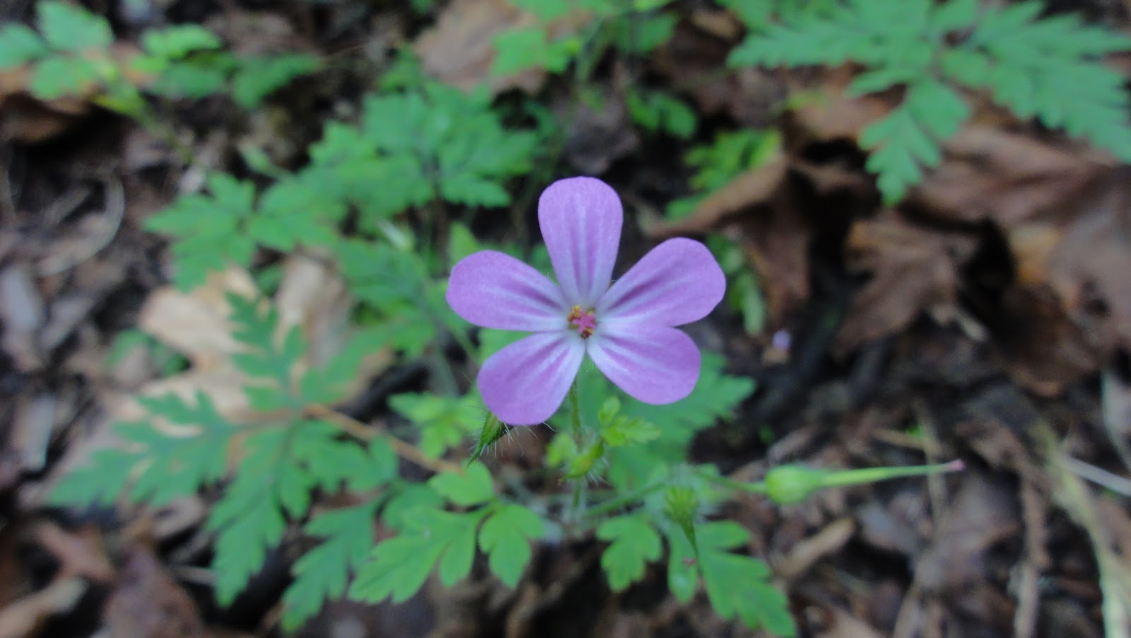
Wacky Trees on Ginormous (Presumed) Fault Scarp

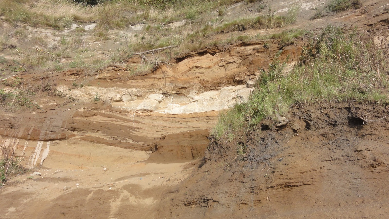
We’ll begin with a bit o’ scarp that I’ve been unable to confirm or deny as a fault scarp.  It certainly looks like a fault scarp.  In fact, the only thing that it doesn’t have in common with the known fault scarp at Seward Park is the fact it’s enormous and easily accessible.  There you are, walking the nice, wide, paved path around the boat launch area and Andrews Bay, and all of a sudden the hill gives way to a cliff.  It looks like the end of the drumlin was just sliced right off by a giant’s meat cleaver.  It’s dramatic and a little shocking.

By now, the non-geologists in the audience are probably wailing, “But Dana – what the fuck is a fault scarp?”  It is, quite simply put, what happens when, during an earthquake, one bit of earth either goes zipping up or another goes down (or possibly both at once, I suppose).  Here, you can easily create your own right there at home.  Hold your hands together like you’re praying.  Then aim them like you’re about to shoot somebody.  Let your left hand slide toward the floor a good inch or two, and you will see your right hand become a fault scarp justlikethat.  Neat, huh?

Here’s a nice, simple illustration showing you all the relevant bits:


So, you wanna know why there’s a ginormous fault scarp or two hanging about one of Seattle’s city parks?

I thought so.

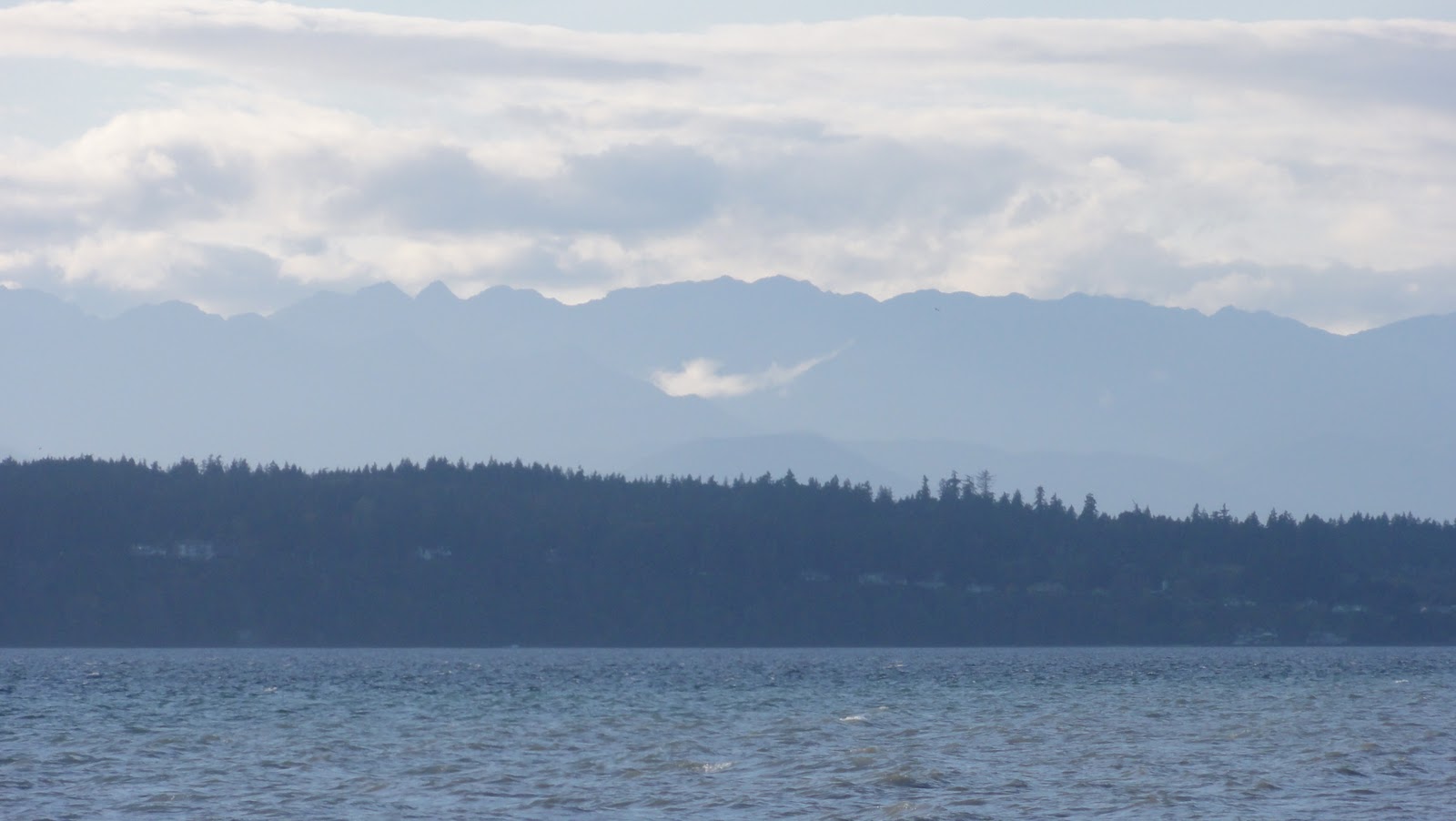
Welcome to the Seattle Fault Zone, my darlings.  You can read about my first adventures in it here.  On January 30th, 2009, it gifted us with a 4.5 magnitude earthquake, reminding us that we live in a very tectonically active area.  I mean, practically all of Seattle’s getting crunched and squished and tossed about like a cowboy on the back of a bronco standing on a wild bull standing on the deck of a ship in a hurricane.  People living near the San Andreas Fault don’t know how good they’ve got it.  All they’ve got to deal with is a nasty transverse boundary.  We get a subduction zone, and we’re dealing with no less than three tectonic plates all jockeying for position up here.  It leads to subduction zone earthquakes and volcanoes and tsunamis, oh my.

This enormous fault zone:


means that Seattle’s getting crushed in a north-south vice.  Nobody explains it better than Paul Talbert:

Why is western Washington being compressed? Although the part of the Pacific Ocean that lies offshore from western. Washington rests on the Juan de Fuca Plate, most of the Pacific lies over the Pacific plate, which is slowly moving northwest relative to the North American plate. As the Pacific Plate slides northward along the San Andreas Fault in California, it drags the edge of California northward, rotating western Oregon and squeezing western Washington up against the more stationary rocks of British Columbia. Combined with the northeast movement of the Juan de Fuca Plate, this motion causes compression and thrust -faulting in the Seattle area in the north-south direction.

And that, dear readers, causes things like this:

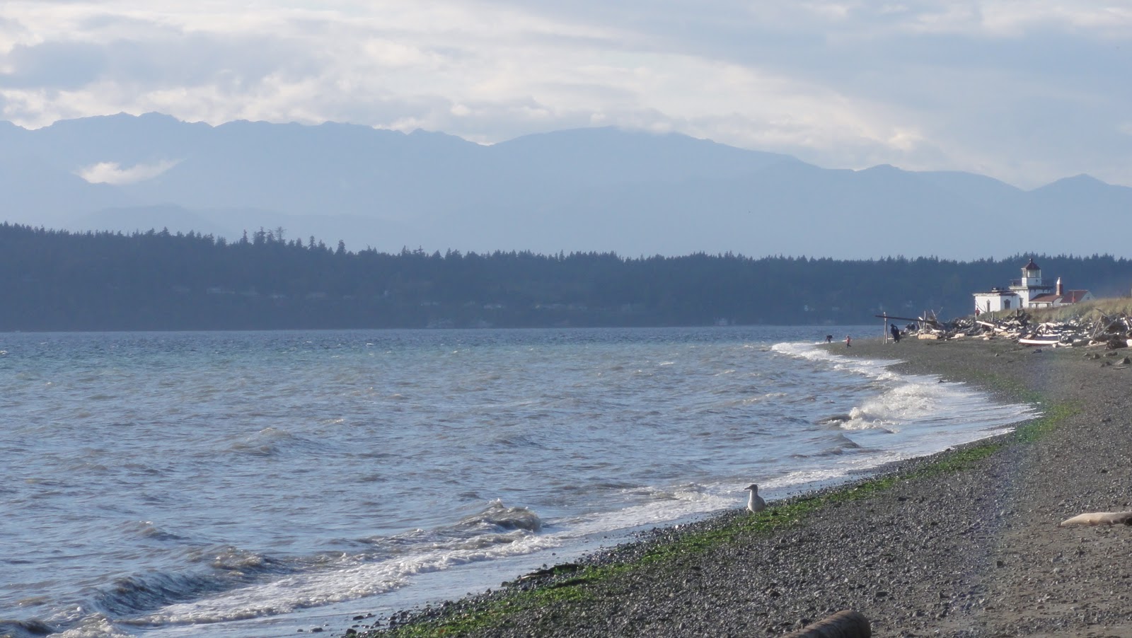
Probable Fault Scarp Dappled in Sunshine

The Seattle area’s prone to three different types of earthquakes, in fact.  The Big One the teevee yammers about every time they go on about megaquakes in the Pacific Northwest are the subduction zone or interplate earthquakes.  They’re the quakes you get when a subducting plate comes unstuck suddenly and causes a hellacious quake.  They’re called “megathrust” for a reason, and the last one we had hereabouts just over 300 years ago was powerful enough to cause a tsunami in Japan.  Then you’ve got your basic intraplate or Benioff zone earthquake, which occur within the subducting plate.  In this case, it’s the Juan de Fuca plate breaking at depths of around 25-100 kilometers (15-60ish miles).  We’ll discuss those in more detail at some future point, but if you’d like an example of one, look no further than the 2001 Nisqually earthquake that caused so much angst up here.  Locals still love to yammer about that one.

But it’s the third kind o’ quake that concerns us here, your standard-issue shallow crustal earthquake.  These go only skin-deep – roughly down to 30km (18mi), but don’t think shallow means gentle.  Washington State’s largest historic earthquake, the North Cascades earthquake, was probably shallow.  That didn’t stop it from being felt in four states and two Canadian provinces, now, did it?  And, being so close to the surface, they leave quite a mark.

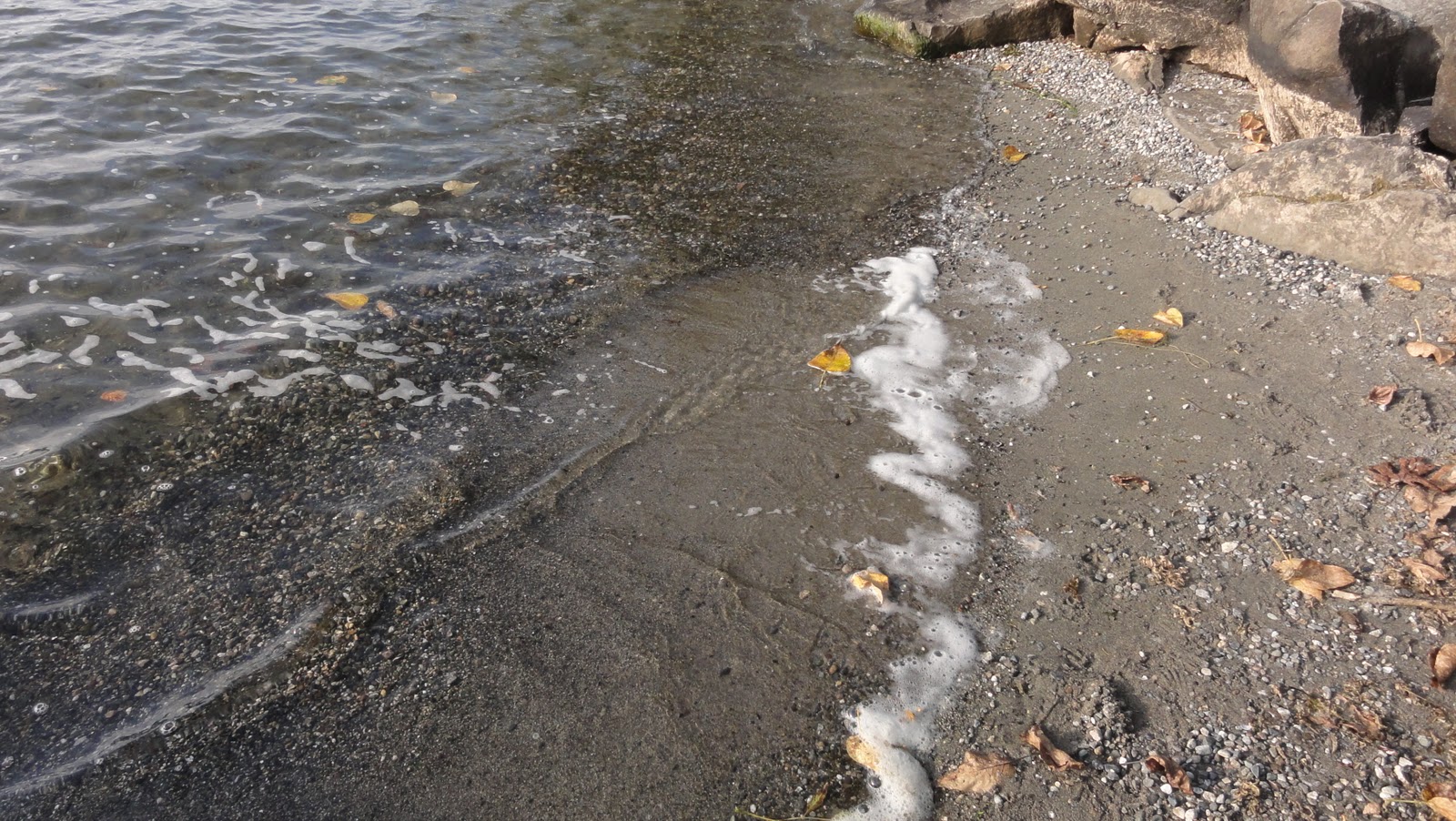
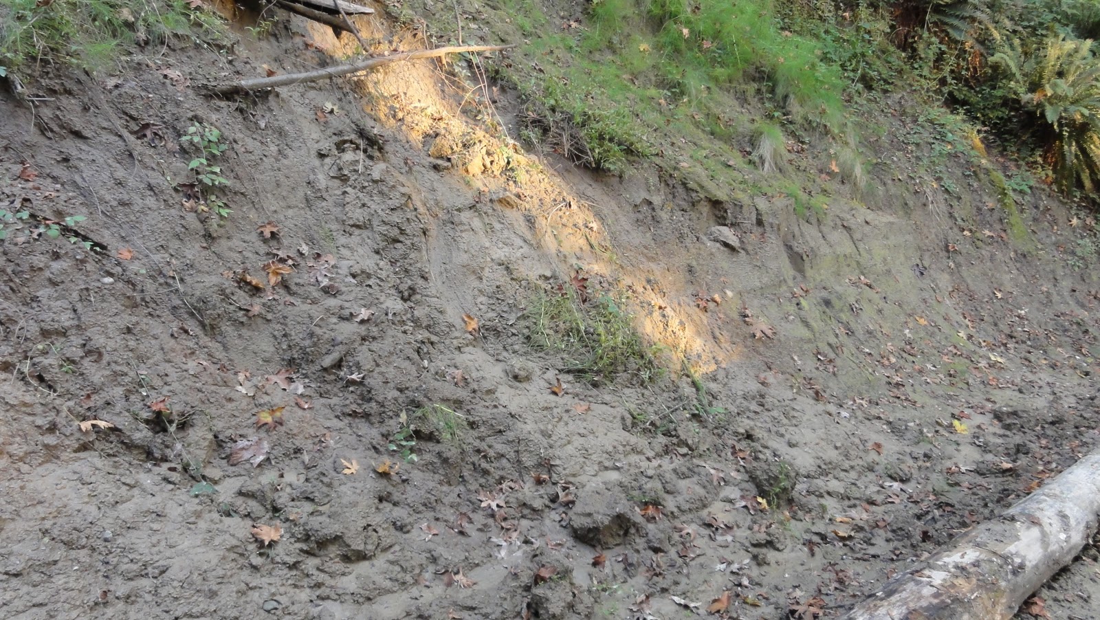
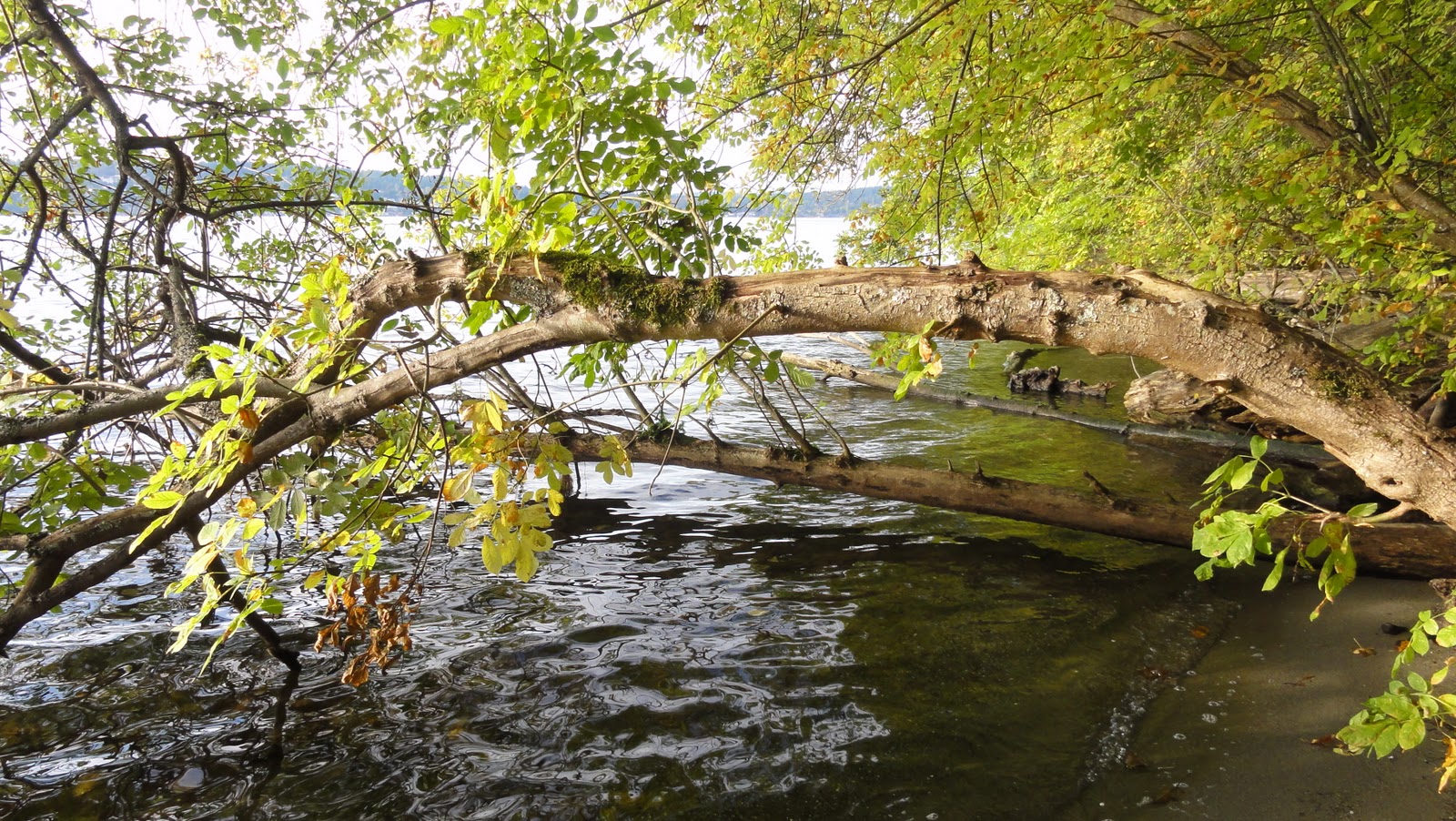
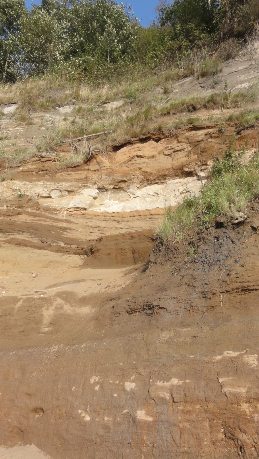
Fault Scarp Looming Over Park-Goers

About 1,100 years ago, something in the Seattle Fault Zone let rip, and sent bits of land careening up by 20 feet.  No less than three substantial tracts of forest went slip-sliding down right into Lake Washington, where they evaded logging for a thousand years before being discovered when the lake got lowered, and enterprising businessmen said, “Oooo, timber!”

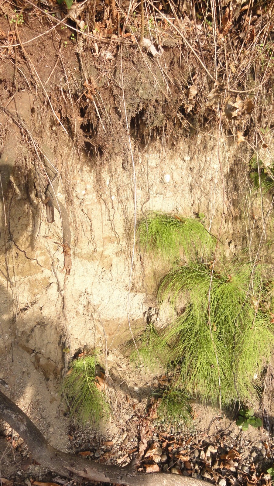
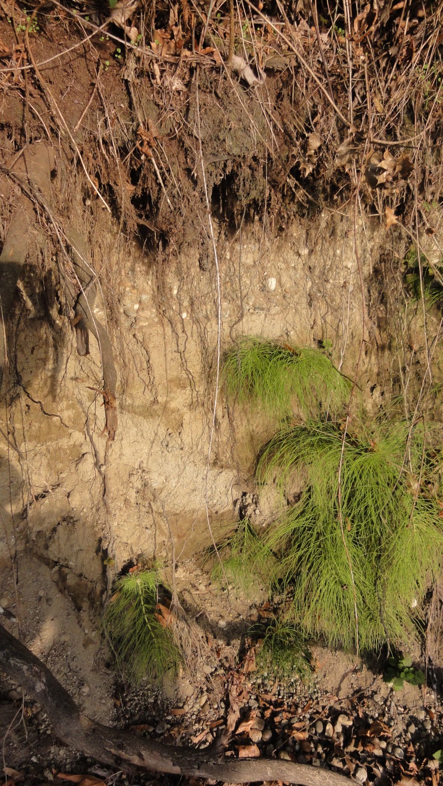
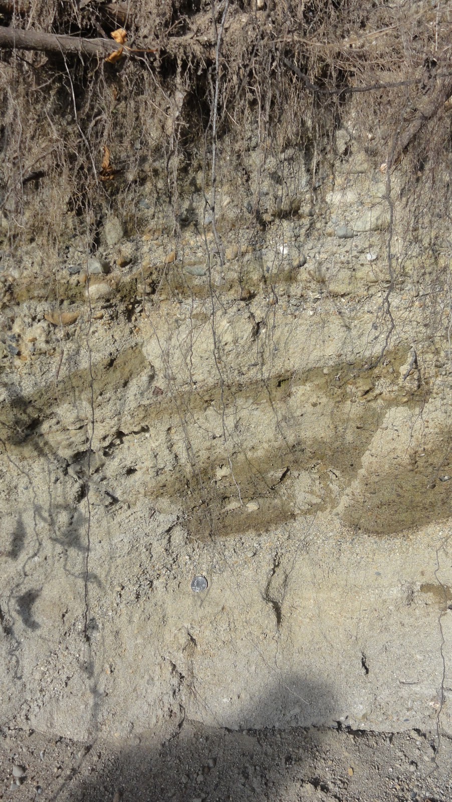
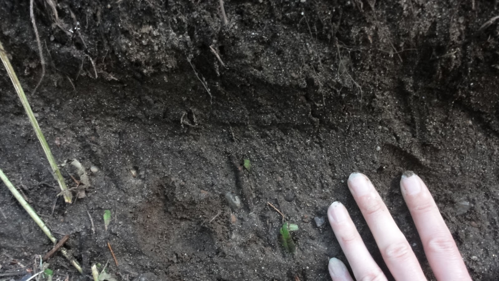
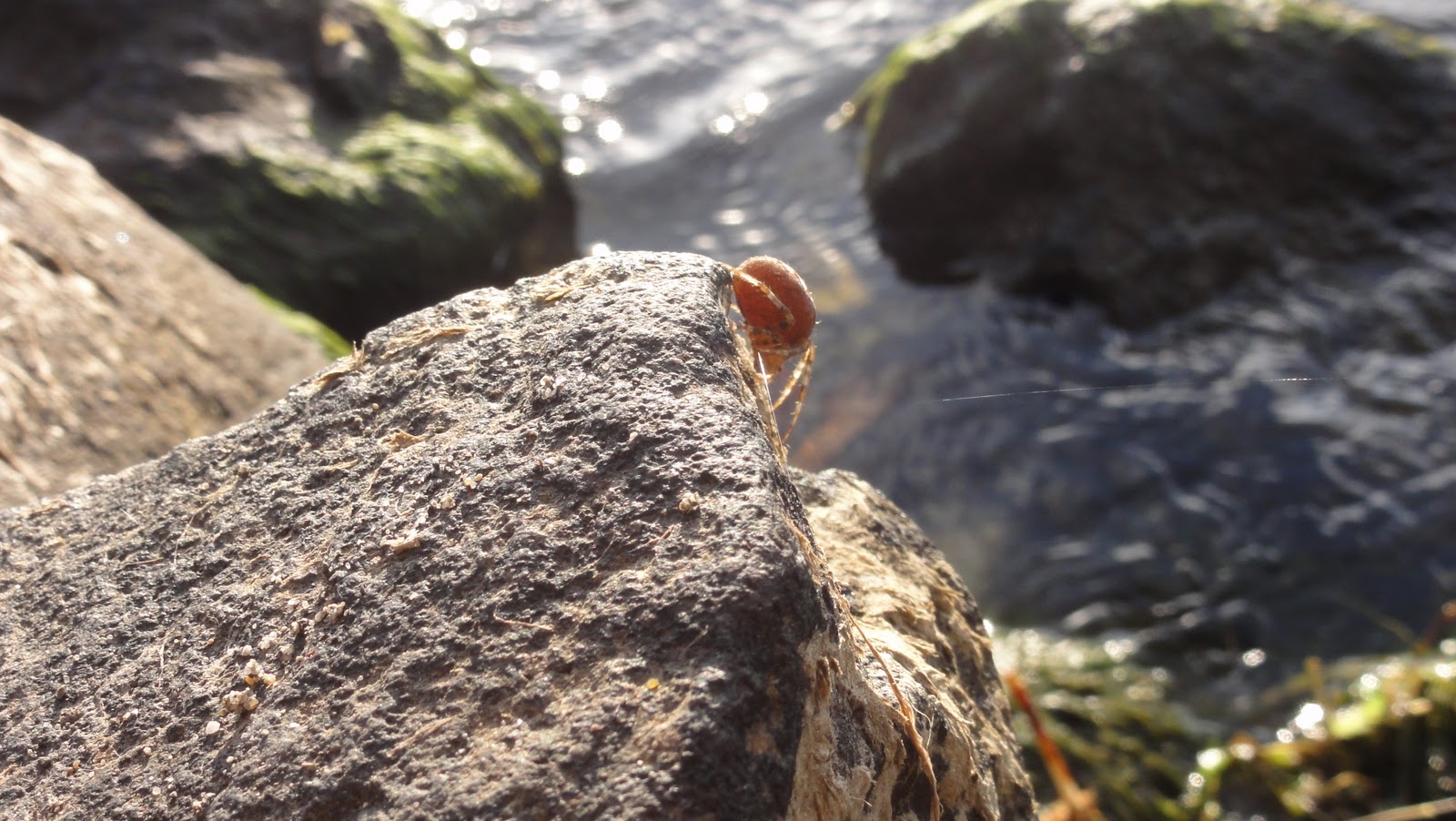
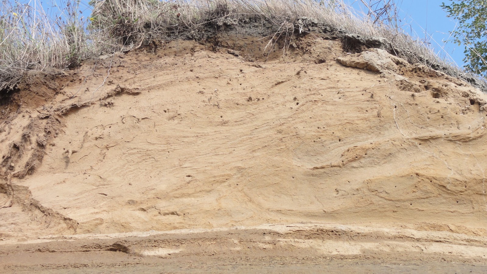
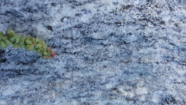
I haven’t got pictures of any sunken forests, considering they succumbed to the saw mill, and more importantly, I haven’t got an underwater camera, scuba gear, or any idea how to use any of the above.  But I have got a neat photo of roots growing in the suspected scarp:

Rooted

I have no idea how old these scarps are – they might be from 1,100 years ago, they could be in their mere hundreds.  It’s hard to find specific info on these very scarps.  But I can tell you that they’re on the side of the fault zone that’s going up while the other goes down (which means that bits of Seattle north of the I-90 have
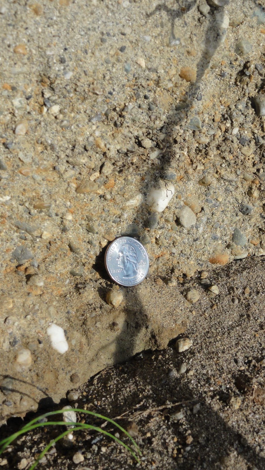
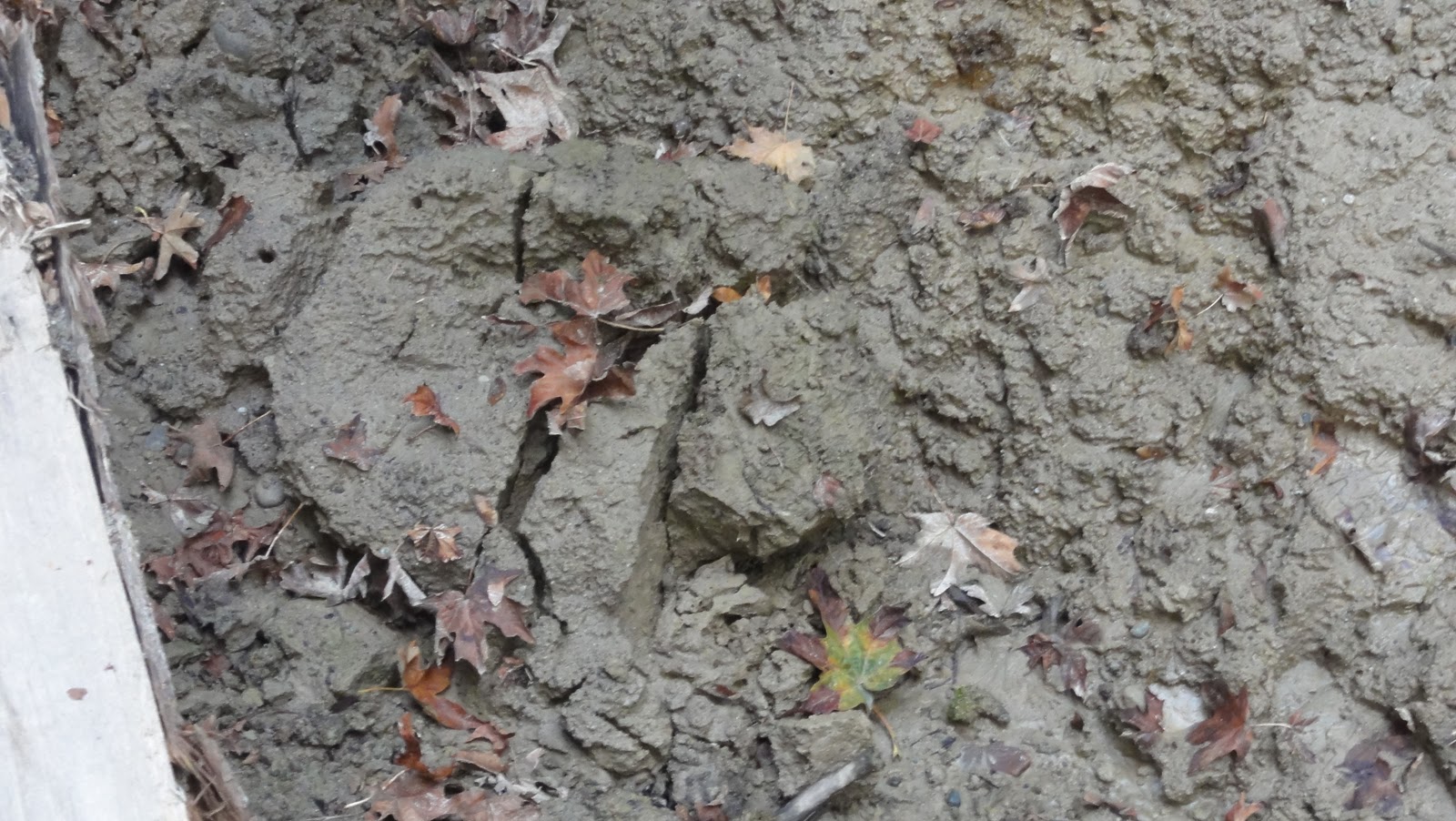
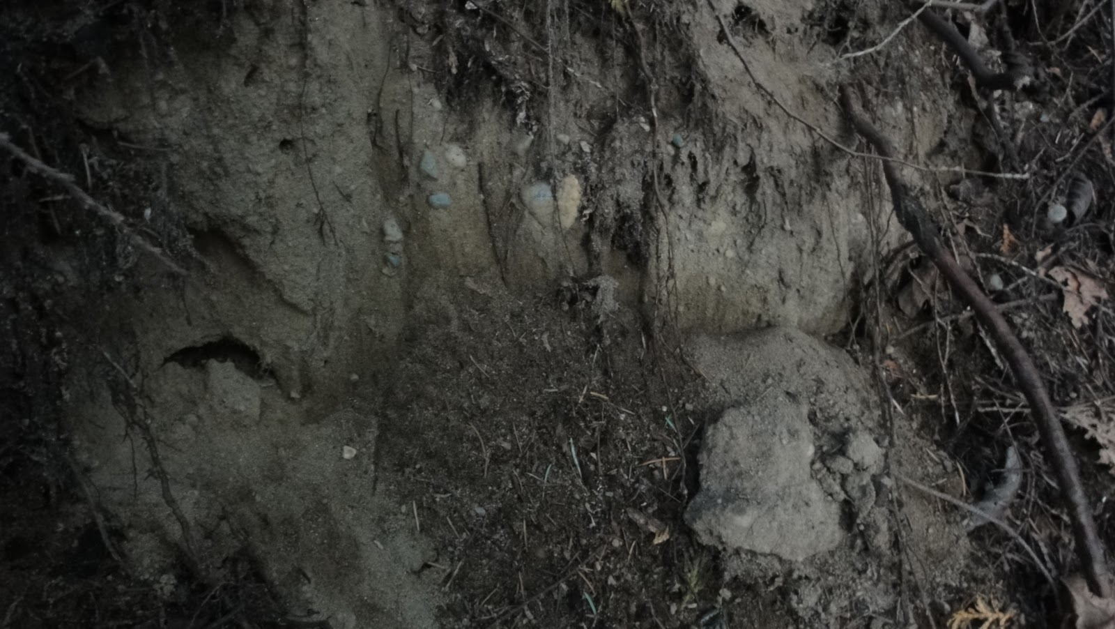
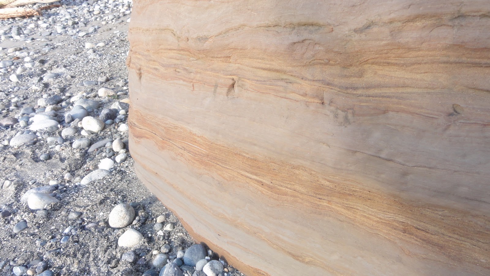
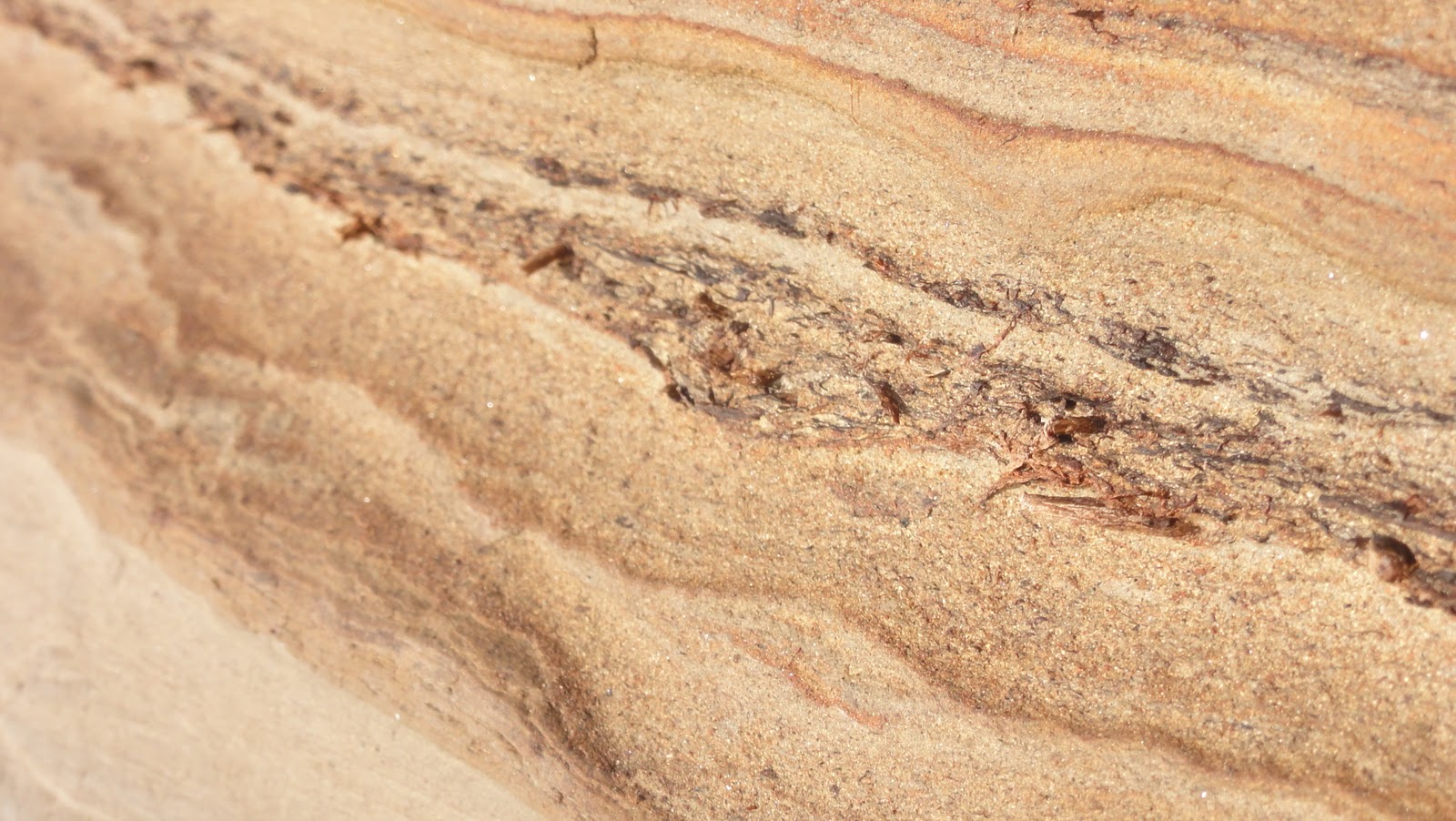
more to worry about than just global warming as far as sea level goes – the northerly bits have dropped 6 miles since the Seattle Fault Zone became active, so the next earthquake could cause parts of the city to become unexpectedly aquatic).  And I can’t tell you much about the formations the scarps are cut in to, but I can show you they have some pretty patterns:

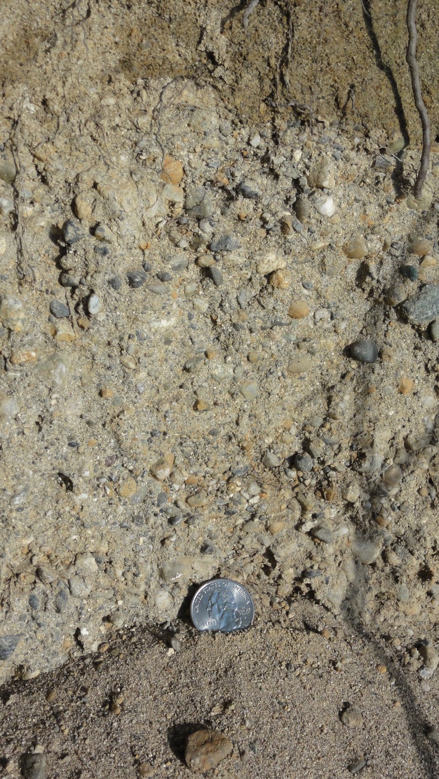
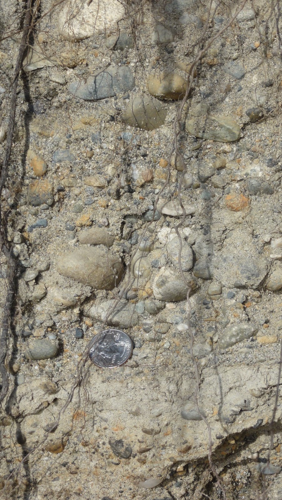
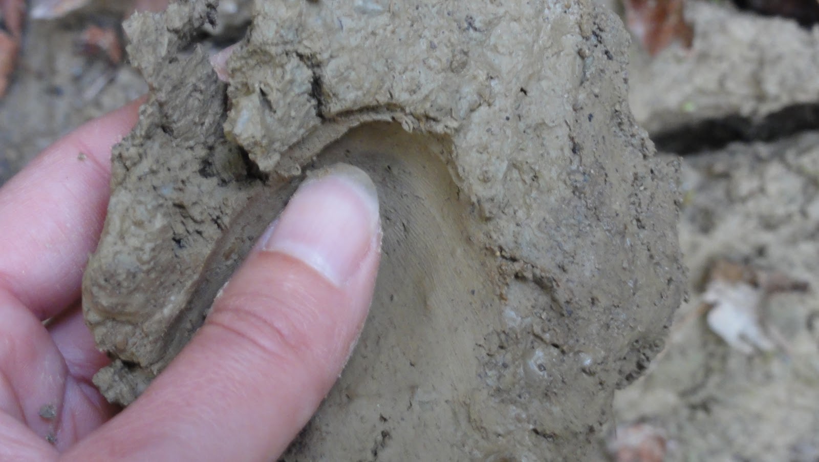
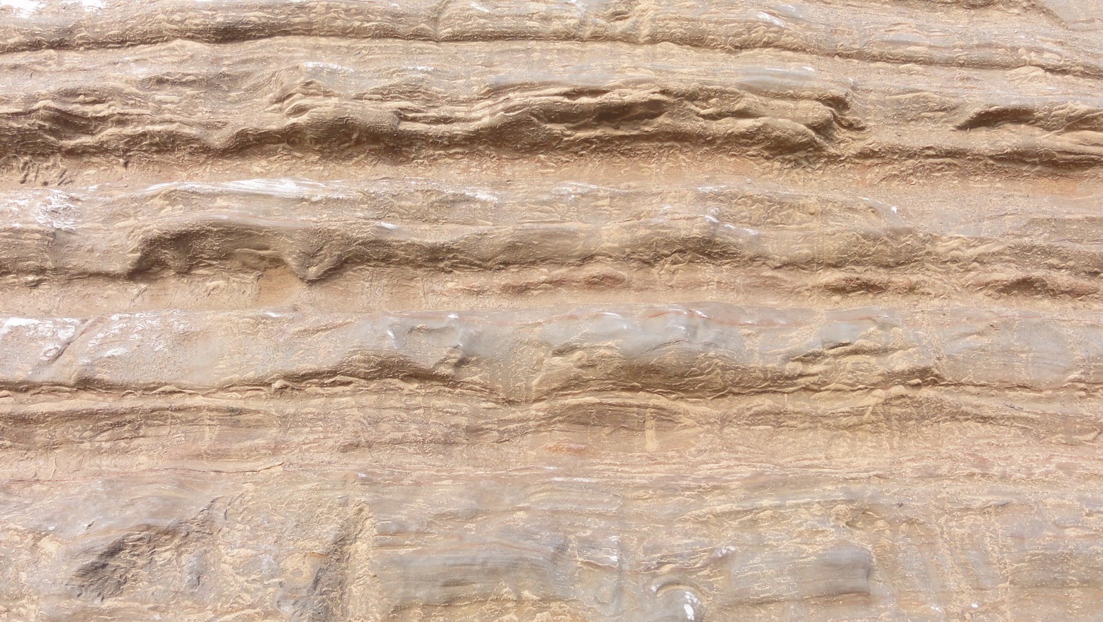
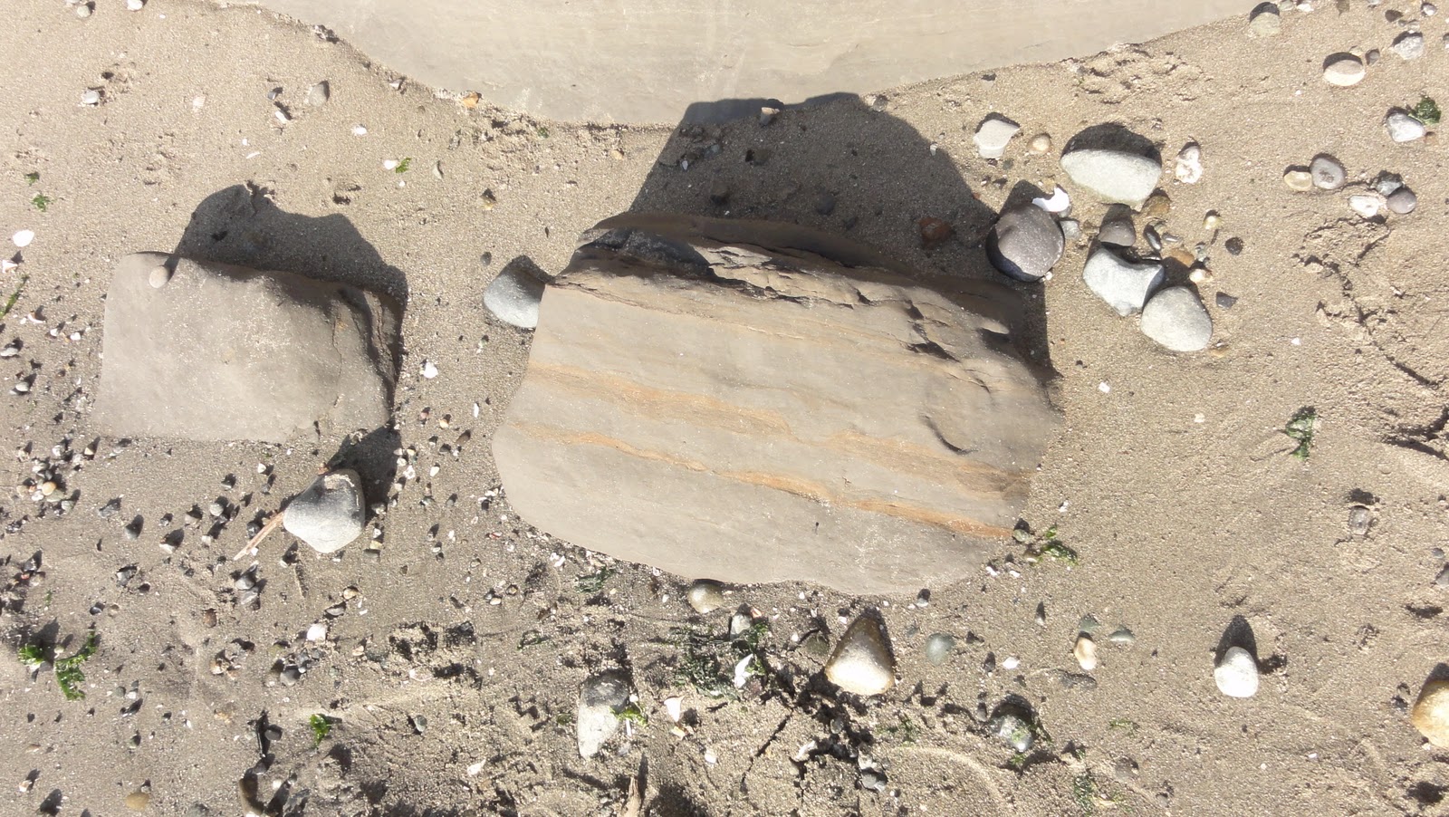
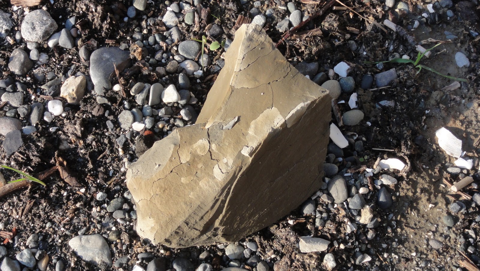
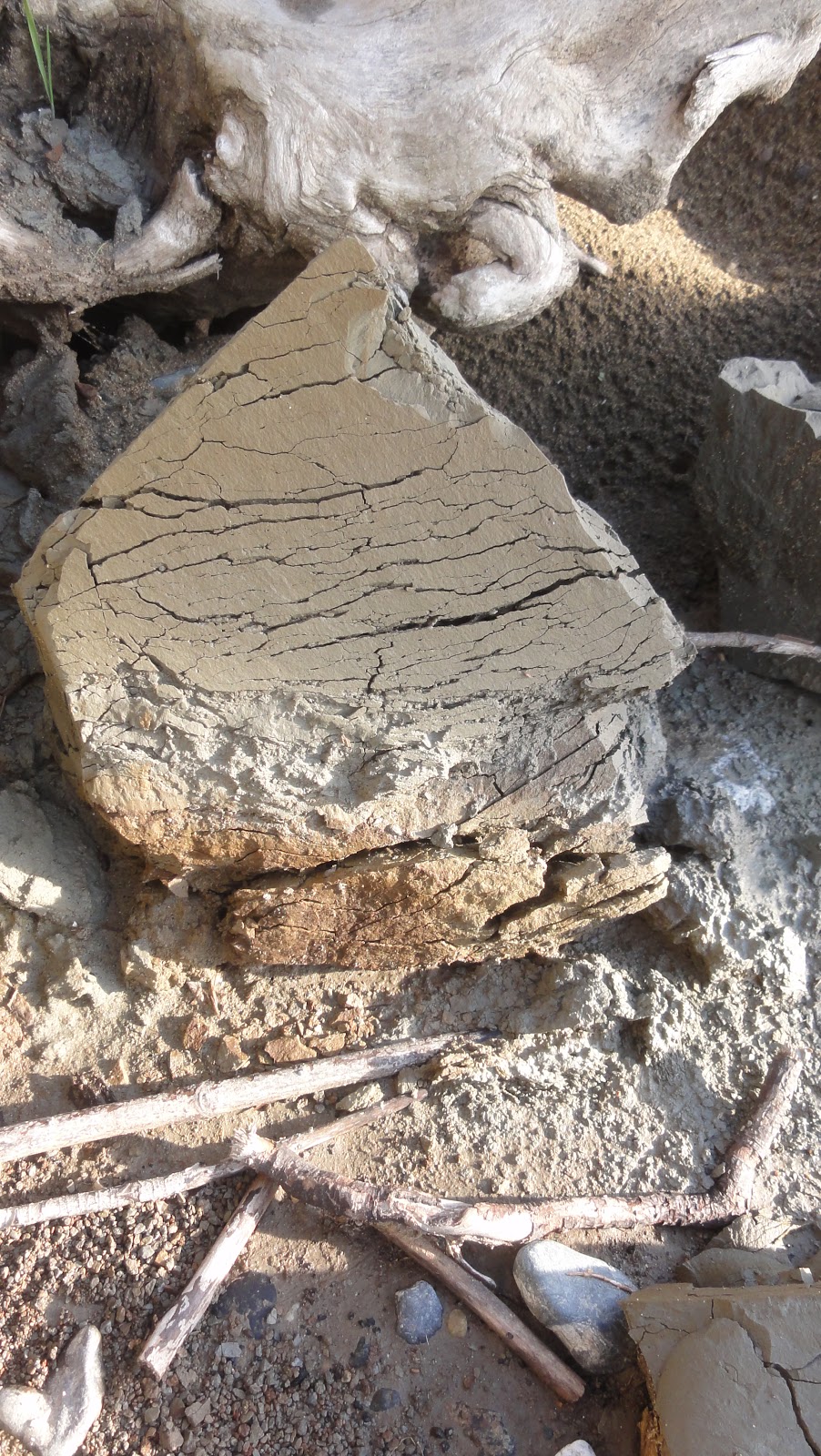
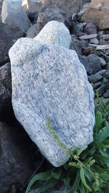
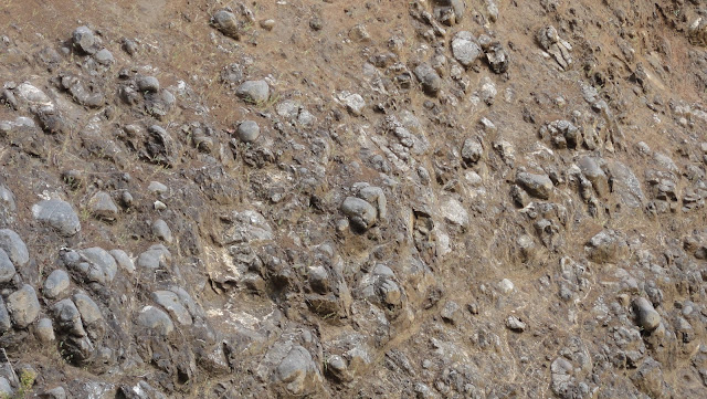
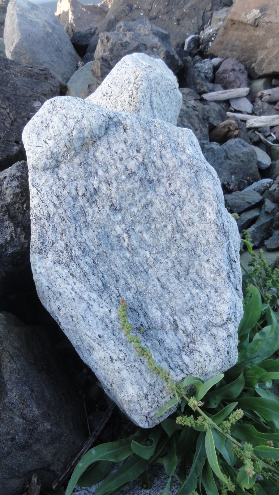
Patterns

There’s some bedrock I’ll babble about in our next installment, and we’ve got a bit on glacial erratics coming up, but for now, I’ll just show you some of what leads me to suspect we’re looking at either glacial deposits or old lahars.  It’s the great big boulders popping out of nowhere:

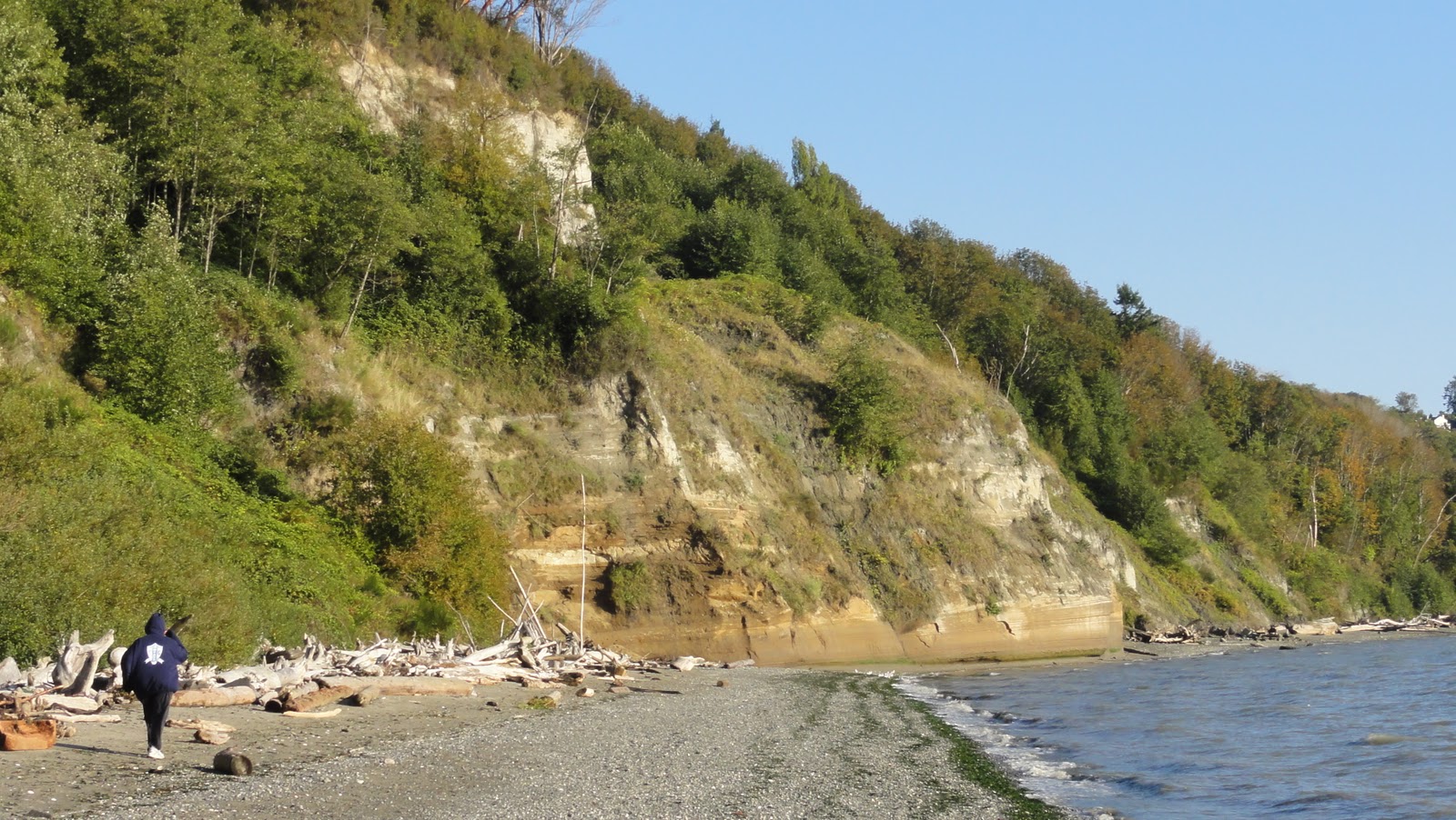
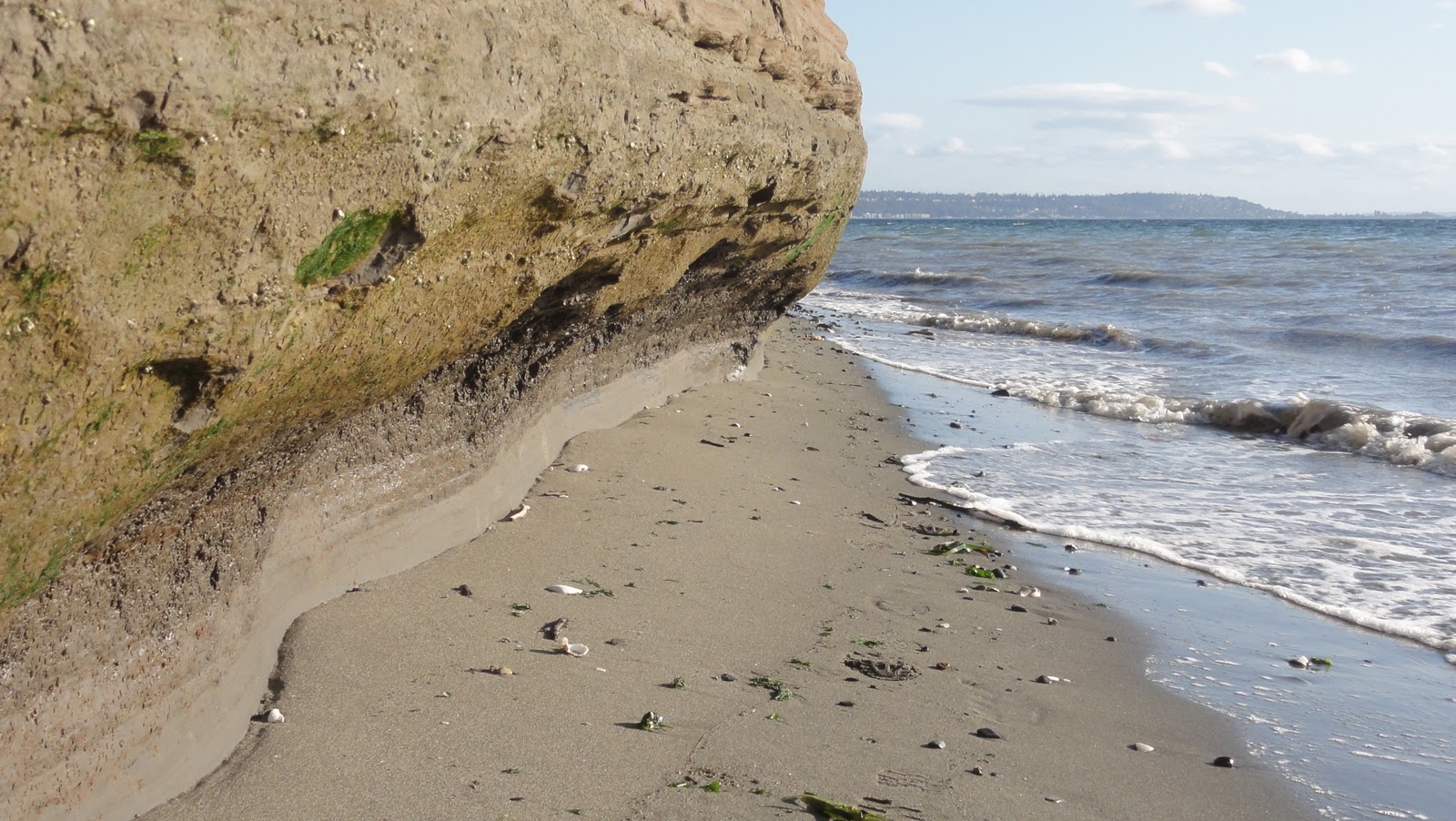
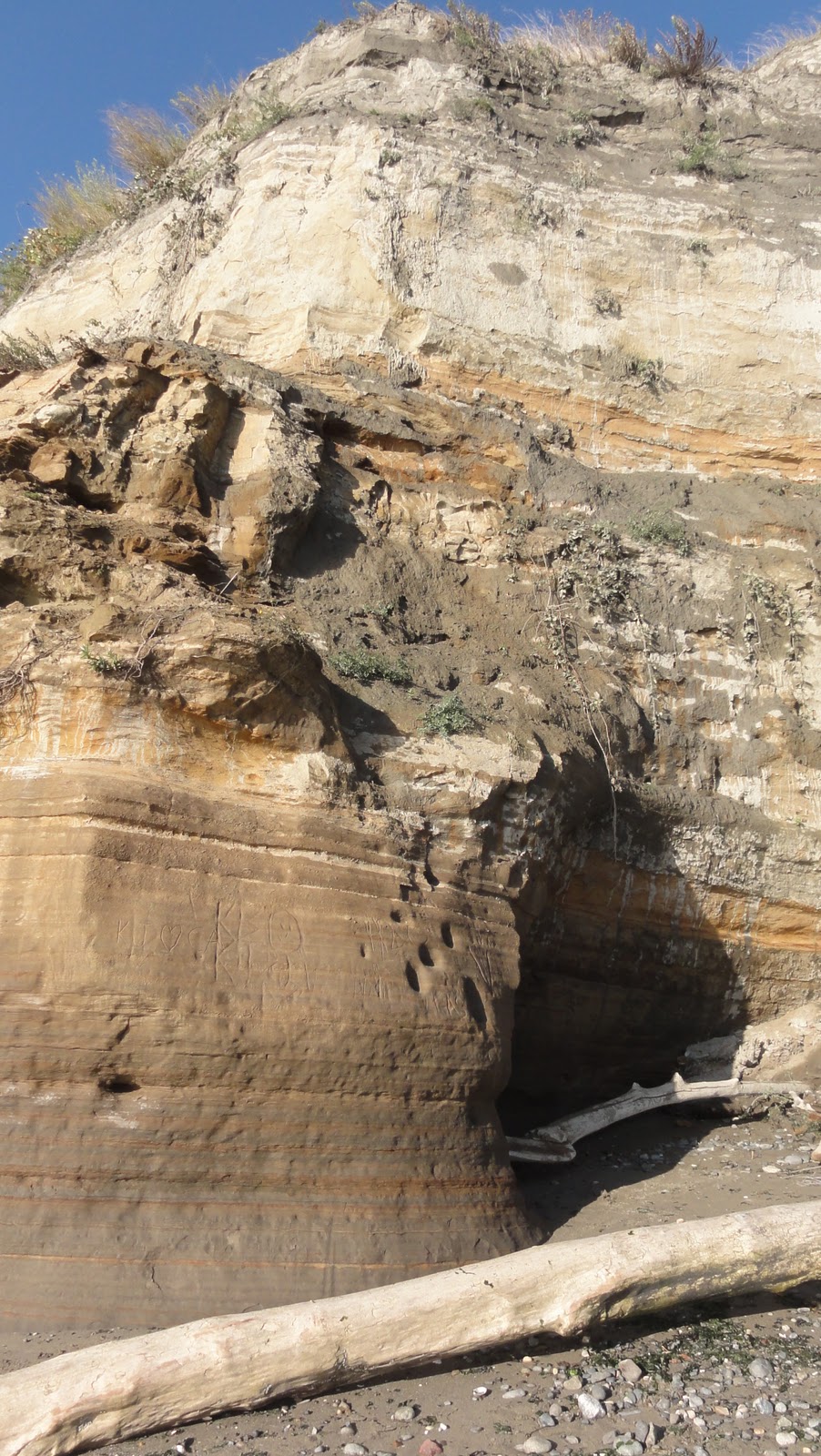
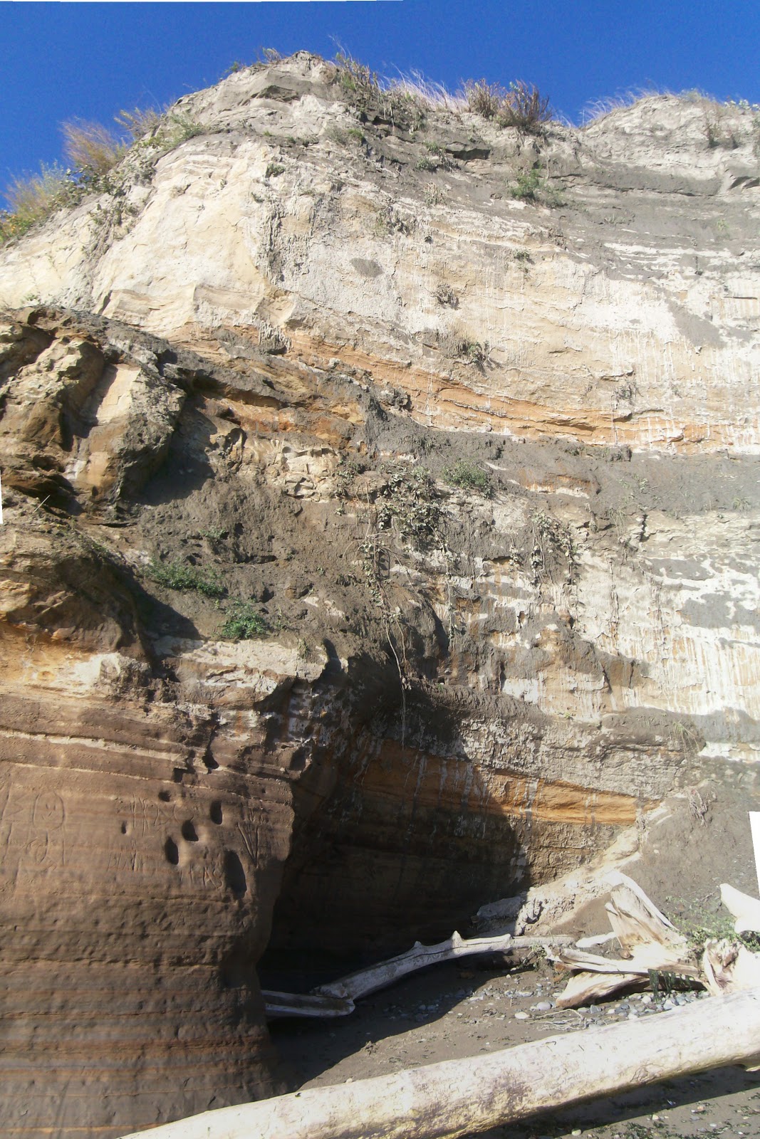
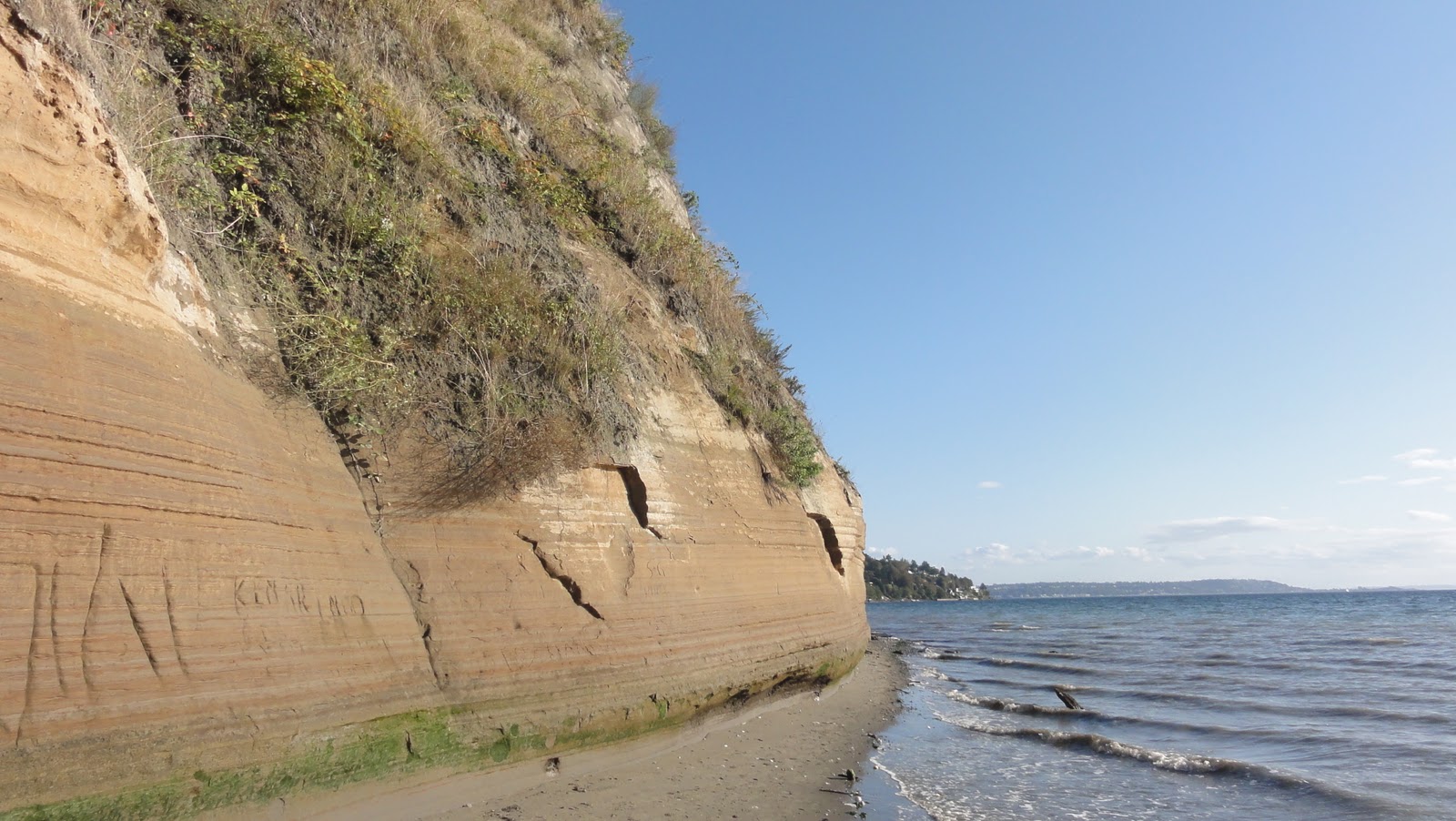
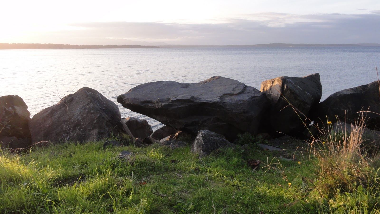
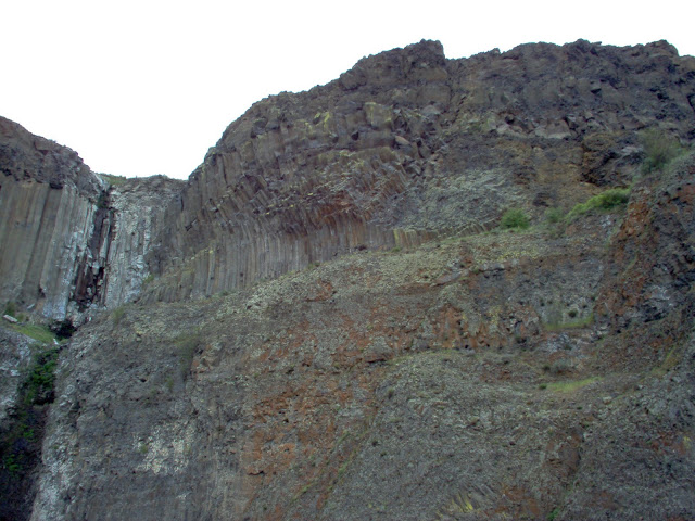
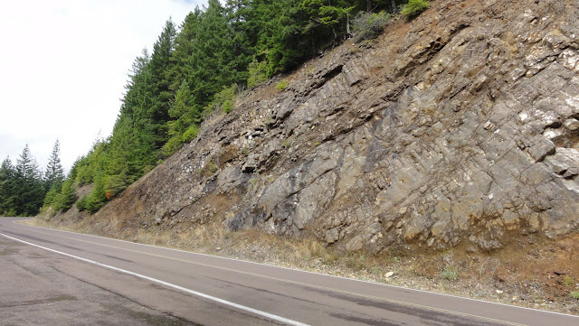
Boulder with Lichens

Up till now, we’ve dealt with a suspected scarp.  And you’ll see why it’s a good suspect once I show you a known offender:

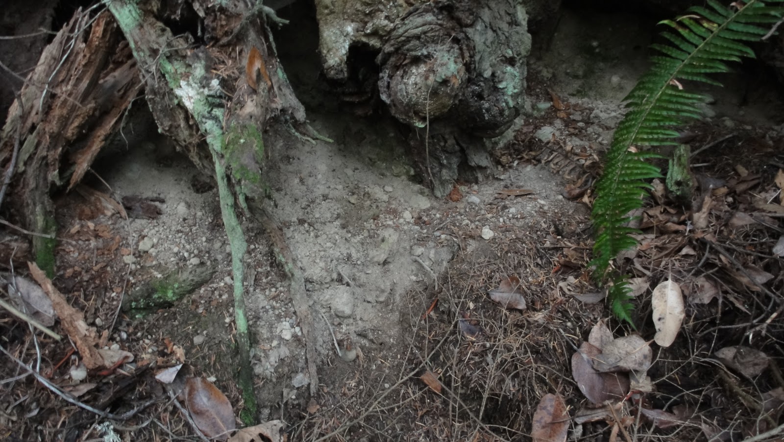
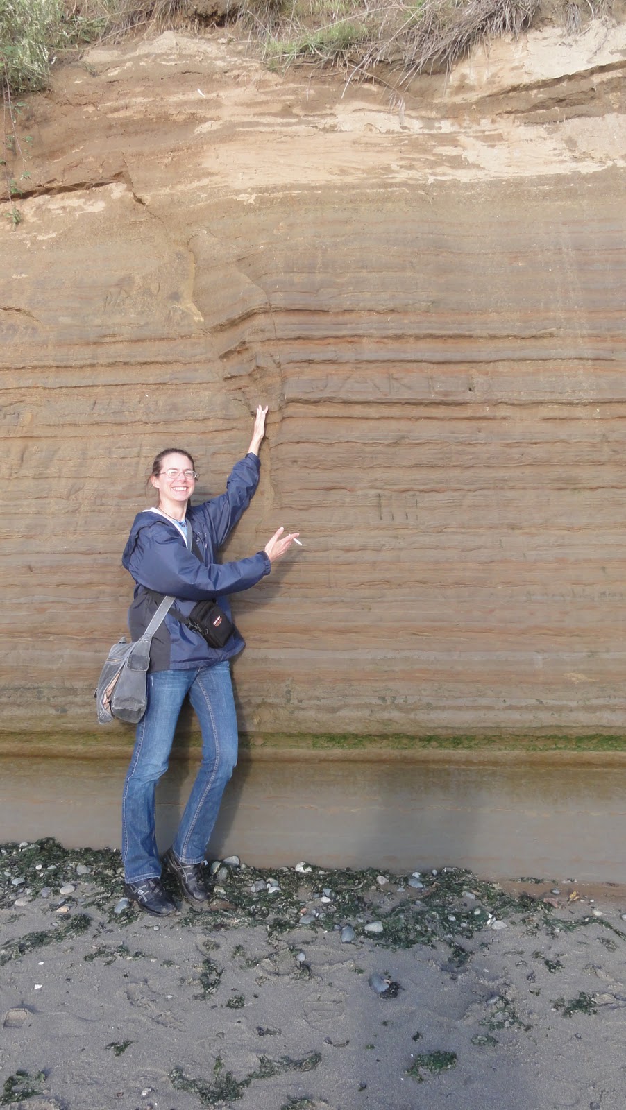
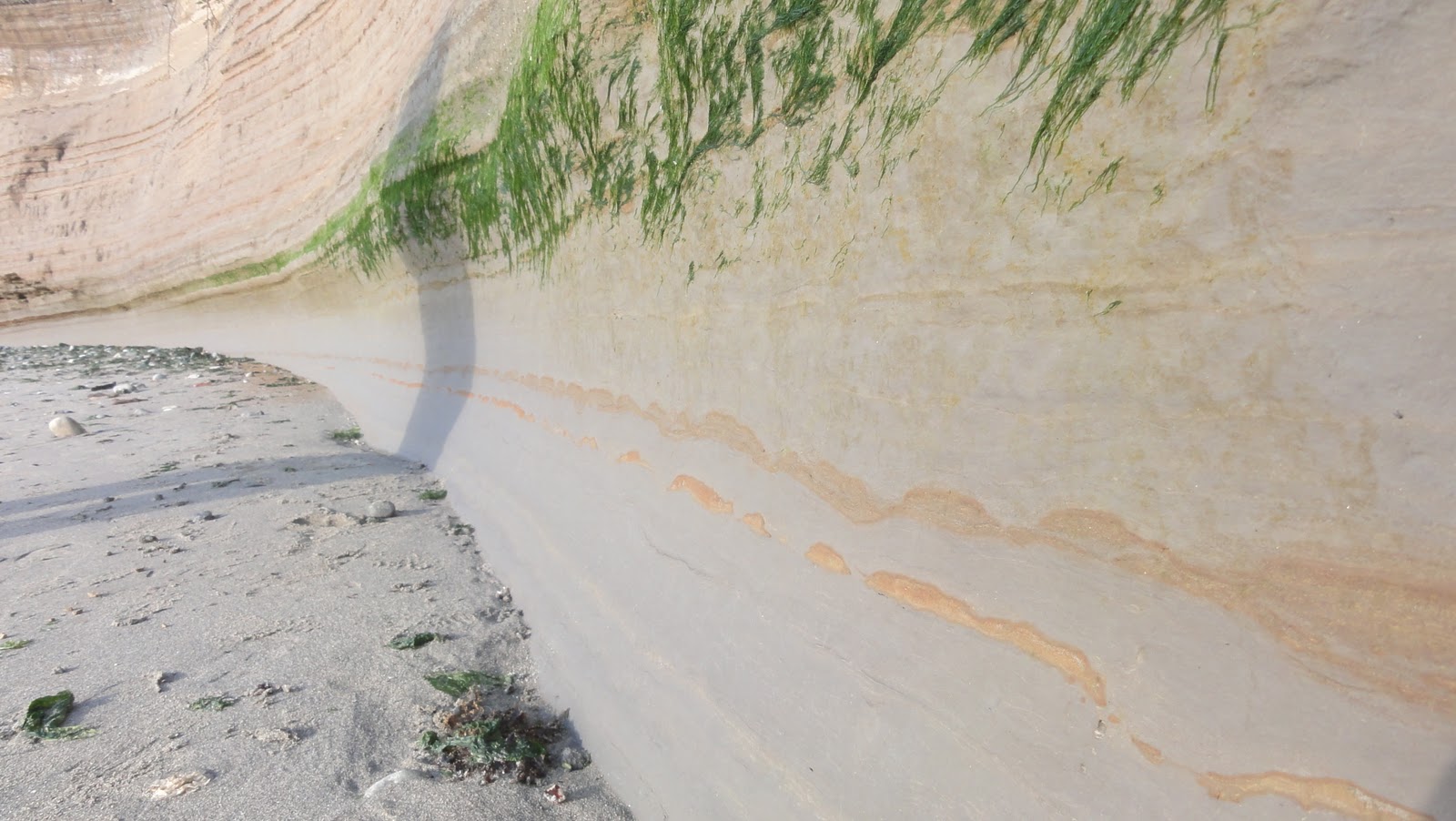
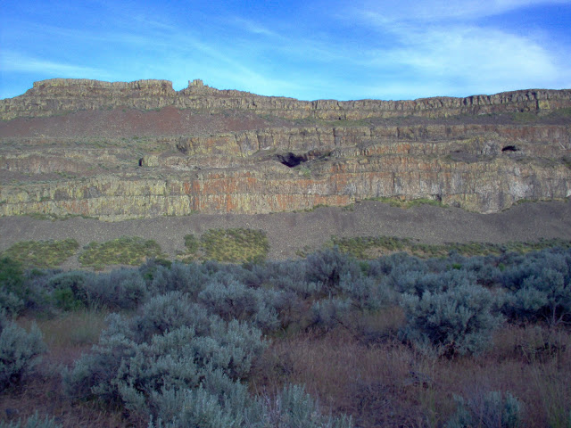
Undoubted, Indubitable Fault Scarp

Now, the folks who designed the path leading to it weren’t thinking clearly, and planted a whole bunch of vegetation between the old social trail and the new official trail to encourage people to stay put.  The only thing that accomplished was to make the geology nearly impossible to see because of all the damned biology.  But we can catch some good glimpses:

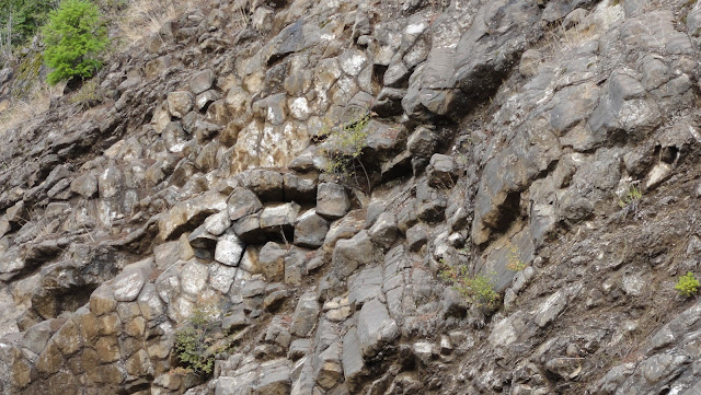
Closer Look

In fact, with a 10x optical zoom, we can practically touch the scarp face:

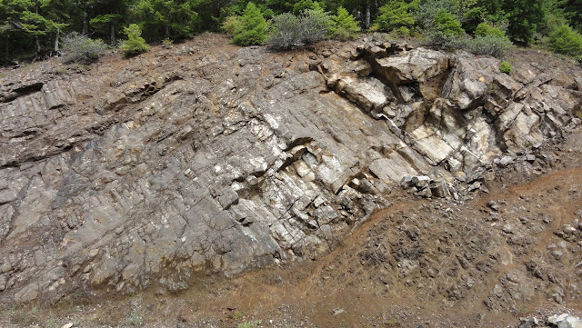
Even Closer Look

And then we can zoom out to take in the whole scene:

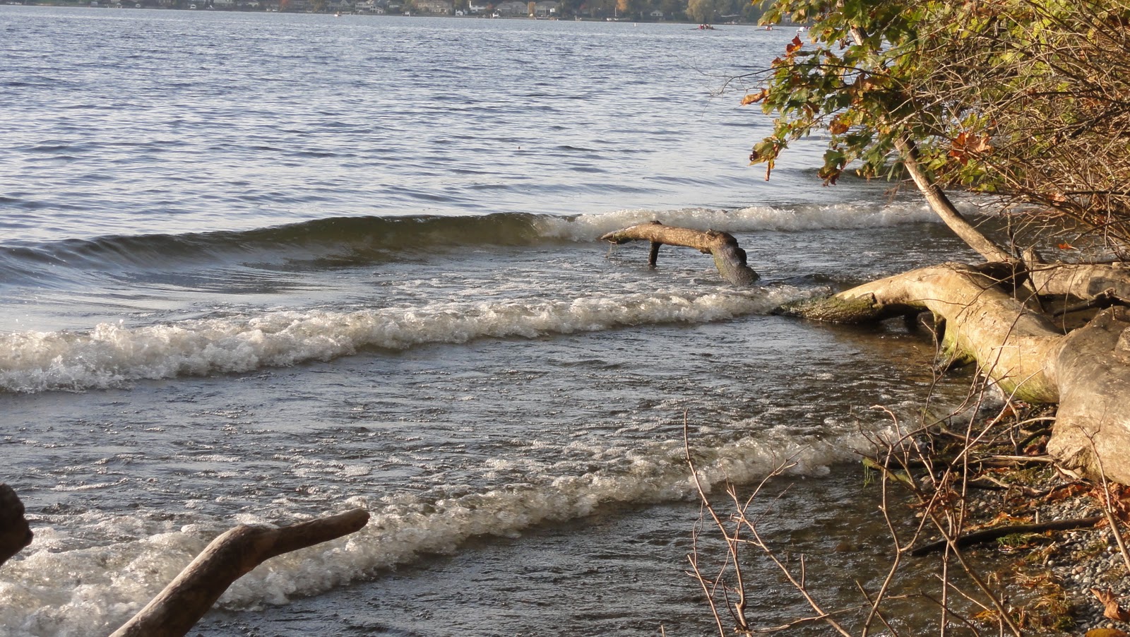
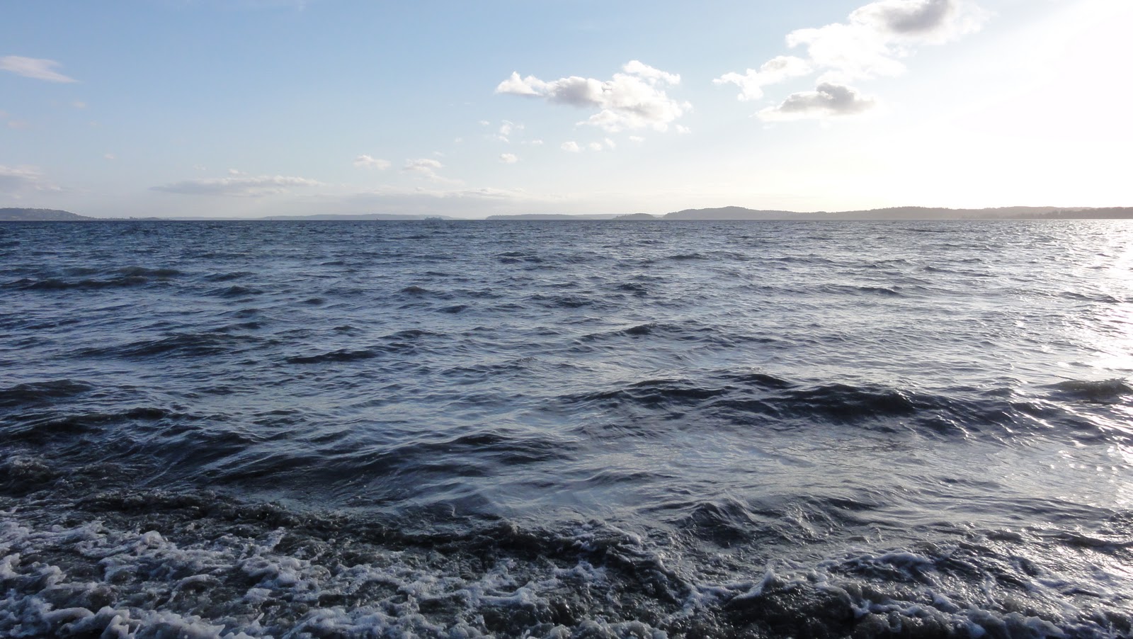
Geology Through the Biology

The thing’s at least 20, maybe 30 feet high.  Now, I have a few things for you to consider: 1. The Seattle Basin is shaped just right for containing seismic waves, ensuring we get shaken harder than one might expect.  2.  A fault crosses the bottom of Lake Washington from Seward Park to Mercer Island.  3.  The above photos show you that a lot of ground can move in a quake round these parts.  And 4. Have I mentioned the fault under Lake Washington yet?  The big, deep, filled-with-lotsa-water lake?  You can see what I’m getting at: those of us in the East Sound who laugh at all those tsunami-prone areas on the coasts should probably stop laughing just about now.  In fact, when that fault under the lake goes, we could be talking waves up to 18 feet high.  And the fact that it’ll technically be a seiche rather than a tsunami is no comfort at all.  We shall get very wet either way.

So.  Fault scarps in city parks, underwater forests, and inland tsunamis – anyone who thinks Seattle is a quiet place to live hasn’t paid attention to geology at all.  That’s why it’s a good idea for everyone to get their arses out to Seward Park, where they can stand dwarfed by a rather imposing example of just what happens when the ground round here lets rip.

And just think, we haven’t even talked about the ice and the implications of exposed bedrock yet….

Great Scarp! Seattle Has Faults!
{advertisement}

Touring Evergreen Hospital

Evergreen Hospital


Last month, I got to visit Evergreen as a patient.  This month, I got to poke around the place for fun and education.  Thanks to Sherry in the marketing department, my intrepid companion and I got to attach ourselves to a tour group who were there for professional reasons, rather than mere curiosity. 

I didn’t feel comfortable whipping out the camera like a raw tourist – I mean, we’re talking about the ER, where people aren’t exactly living the sort of memories they’ll want to relive later – but let’s see if I can get you inside anyway.  Picture yourselves in a comfortable waiting area with hardwood floors, nice chairs, and an artistic display of ceramic teapots.  Just don’t picture yourselves there for long.  Evergreen built one of the prettiest waiting areas I’ve ever seen in a hospital, but people don’t get to use it all that much.  They’re whisked back to exam rooms too quickly.  While we waited for the rest of the group to arrive, we got to watch the average length of time people spent in the waiting room.  It seems to be around 2.2 seconds.

Should you have to go, you’ll be met by helpful people who don’t even let you have a full, frantic look around for where you should go before they’re meeting you, asking what you need, and getting you into a small, glassed-in room where your temp’s taken, an ID bracelet slapped on your wrist, and then zipped back to a room.  They say Sunday’s their busiest day, so I may have to spend an afternoon in that waiting room just to see how much time that adds.  The way their system’s set up, I doubt a crowd ever builds up in there.

So what’s beyond Triage?  So glad you asked.  There are rooms designed to function well for all involved – patients, medical staff, and visitors.  Most rooms are semi-private – you don’t get ogled by every passer-by, but you’re within whimpering distance of helpful staff members.  You don’t have to stare at a lot of scary medical equipment.  The bottles of gas (like oxygen) are tastefully concealed behind a painting at the head of the bed.  Extraneous medical equipment’s kept to a minimum by carts: suture cart, pelvic exam cart, etc.  The proper cart’s rolled in instead of having huge banks of equipment stuffed in cabinets.  All very tidy, and leaves plenty of room for folks.  Your medical staff gets one half of the room – the one with the counter space and monitor.  Your visitors get the other, where coats and things can be hung.  You get enthroned in the middle.

Things are laid out in a sort of triangle, with everything simple to get to, and the staff in the center where they can keep an eye on everybody as they work.  But if you’re needing some serious solitude, there are special rooms for that, where all equipment is behind rollaway doors.  These are the rooms for the folks having a severe psychiatric episode, or the roaring drunk, where they can be watched carefully over monitors.  The windows of those rooms don’t face out into the busy main areas, which strikes me as a good idea. It gives people there a sense of connection to the outside world – there is, after all, a window instead of blank walls – but doesn’t give them views of things that might make them more excitable.  I’ve seen a fair few psychiatric setups, what with a mother who has bipolar disorder, and these are among the best.

We didn’t, alas, get to see the trauma rooms this visit, but we got to go play in the decontamination showers.  They’re in a room accessible from the outside.  Five you of can shower up at once before heading in to the hospital.  For some reason, the adjustable temp on the showers amused me.  I doubt I’ll be worried about the shower being too cold if I’m ever in some unfortunate circumstance where I’m having to be decontaminated.  But at least now I know where I’ll be if that day ever comes. 

I have to tell you, seeing the ER in its entirety eased a lot of nascent anxiety.  If a true emergency ever happens, the ER here is no longer an unknown quantity.  Should you get the opportunity, tour your own local hospital.  You’ll find a lot of very good people working hard to ensure their communities stay healthy. 

Evergreen’s doing an outstanding job of it.  So, you East Side residents – if you live near Kirkland and need excellent care, come on down!  You’ll be in wonderful hands.

Although you might have to go back to appreciate the waiting room after your emergency’s over.

Touring Evergreen Hospital

Wherein I Do Some Geology All By My Lonesome

Well, actually, my intrepid companion was there, but he paid more attention to the planes.

We’ve been to St. Edwards State Park before.  It’s one of my regular haunts – I try to get there at least once a summer.  Convenient, y’see, and some of the best pebble-hunting grounds around.  There’s a place at the end of the Grotto trail where you come on a nice sandy bit o’ beach, with riprap trapping nice pools of water with pebbles in.  It’s a fantastic place to linger on a summer afternoon.  Little cold for fall, though, which is too bad, because there’s nothing like rolling ye olde pants up to the knee and plunging into the pools in search of pretty pebbles.  Last year, I even found some bits of glorious gray schist washed up, which is rare around Lake Washington.  This time, I found a few calico pebbles and a foliated chunk of something-or-other that I might, someday, be able to identify for certain, lingering close enough to the water’s edge to prevent foot-freeze.

Here’s a view of mah pebbly beach with foamy waves:


But the pebbles weren’t half as exciting as being able to recognize geologic formations all by myself.

Usually, when I write up these missives, I have some sort of guide around.  I’ve got a book or a website that’s discussed the geology in enough detail for me to puzzle things out, and thus sound like I know what the fuck I’m talking about when I babble about them.  Not true in this case!  St. Edwards has too much damned biology hanging about to be a huge geologic draw.  You have to really hunt for areas of exposure.  Luckily, my intrepid companion found one whilst we were searching for a spot where we might be able to see the seaplanes land despite all the damned trees.  There’s a narrow break between the trees, a steep scramble, a little bench of beach, and if you turn around, glory be!  There’s some bare geology:


It’s even got pebbles in!


Okay, so what are we looking at?  Later exploration revealed it’s gotta be some of that yummy Olympia non-glacial stage stuff we talked about when exploring Discovery Park.  How do I know that?  We’ll get to the smoking gun a bit later.  For now, let’s savor the novelty of having actual dirt exposed in western Washington.  This bank has a few items of interest.  Such as these lovely pebbly layers:


Yes!  I finally remembered a quarter for scale!  Good thing I hadn’t spent it on junk food at work.


Isn’t that a pretty bit of white quartz down there in the bottom left?  As for what put the pebbles there, it would take further exploration – and possibly some malicious mischief done to interfering trees – to determine if those are old stream beds or lake shores.  But we do know, from work actual geologists have done, that these sediments were laid down in a flood plain before the glaciers came.  We get lots of sand, lots of pebbles, and some gravel:


And here’s a full view of the bank where all these lovely layers may be found:


I’ve never been so happy to see a plain ol’ dirt bank in my life.  Geology changes things.  It makes the ordinary stuff seem almost ethereal.  Even the drab bits of earth are beautiful when you know they’ve got a story to tell you.  Okay, so they’re having to speak to me in “See Spot deposit some gravel!” language right now, but the point is, I now understand that I’m seeing more than boring old rocks and dirt.

So how can I be sure that this is the famed Olympia non-glacial stage stuff?  Simple.  For one thing, we’re down close to sea level, and that’s where the Olympia etc. deposits are.  Secondly, there’s a ginormous freaking clue up the Seminary trail:


That, my darlings, is a big bare bank of our old friend the Lawton Clay.  And we know the Lawton’s resting above the Olympia etc.  Ergo, Olympia down below.  My intrepid companion just gave me a bemused look when I told him to strike everything I’d said about the previous bank possibly being Esperance Sand.  (I’d gotten my elevations and strata mixed up, until I saw this beautiful exposure.)  Then he watched me get dirty in the name of geology.  Sometimes, I wonder why he puts up with me.

All right, so if I fucked up badly enough to think Olympia etc. was Esperance, how can you trust my word this is the Lawton Clay?  Well, let’s do some field work.  Is it thick?  Check.  Is it gray?  Check.  Is it clay?


Certainly chunks apart like big blocks of wet, nearly-pure clay when it falls, don’t it?  But let’s pick up a chunk to see:


You could make bricks, pots, and little sculptures from this stuff.  It’s smooth and tacky and sticks to your fingers like all that lovely modeling clay you got to mix up and splat your friends with in elementary art classes.  Yup.  That surely do look like clay!

So, if that’s the Lawton, that means we were indeed busily putting quarters all over the Olympia etc. deposits, and further up the hill, we should find…


Could it possibly be…


Yes!  Esperance Sand!  Too bad we came upon it as the trees were busy filtering out very nearly all of the remaining sunlight, but at least Handheld Twilight mode allows us some decent view of things.  Glacial outwash, baby, yeah!


We can even see some pebbles in there.  Fun times!  And a triumphant moment.  Do you know how hard it is to find any exposure of this stuff along the trail?  Up there, where things flatten out, the damned biology has taken over every available space.  There’s just a few spots where a bit of over-steepened bank caves away from the roots, and then a glimpse, a mere glimpse, of glacial outwash goodness.

As for the Vashon Till, it’s still MIA.  Probably buried under 5 billion tons of bark.

So there you have it.  Actual geology, despite the best efforts of the biology to hog the spotlight.

Wherein I Do Some Geology All By My Lonesome

A Fine Fall Day

And why not take advantage of it?  Okay, so it wasn’t all that fine, but it wasn’t peeing down rain and/or freezing cold, and there appeared to be a cloud break in the offing, so ye olde intrepid companion and I ventured down to St. Edward State Park for a (possible) last adventure before the rains come.

I found some geology there, which I shall tell you about very soon.  For now, we continue the fine old tradition of posting the outtakes whilst I’m still too tired to think.


My first experience with epiphytes was at St. Edward.  Before then, I’d known in an abstract sort of way that shit could grow on other shit, but this was the first time I’d seen actual plants growing merrily on actual branches.  And the thickness of this forest – overwhelming.  When the seaplanes aren’t zipping overhead, there’s barely any sound, and what does reach you is muffled by all the biology.

This is not something people from Arizona are used to.


And such a variety of mushrooms!  Not that I can identify them yet, but we’ll get there someday.  For now, they’re just a bit o’ fun with fungi.  And yes, I had to go there.

More fun with fungi is required:


There was quite a profusion.  Hikers we met along the trail were rather surprised the frosts of the past few days hadn’t yet killed them.

Fall was definitely in the air, so thick you could smell it, and hear it as enormous dead leaves fell to the forest floor.  But that’s not to say all the flowers were gone.  A few plucky purple petals poked their way through the detritus, and laughed at cold weather.  They also laughed at my camera, which for some reason has difficulties with purple in low light conditions.  Finally managed this shot though:


That’s as good as it gets, folks.

A brisk hike down the ravine brings you to Lake Washington, where you can enjoy yourself amidst trees leaning into the water:


Down at the water’s edge, a very fat spider wandered over the rocks, looking for I know not what:


In the category of other things beginning with S, we also spied a couple of seaplanes:


Embiggen that one, and you’ll actually be able to read the writing on the side.  I loves my camera!


Fat little spiders were everywhere – definitely not an arachnophobe’s paradise.  I’m not sure if they were actually that fat, or carrying egg cases, but some of the patterns were lovely:


Nearly ended up wearing that one in my hair, because I was so busy trying to find interesting pebbles down at the water’s edge to pay attention to what happened to be lurking in the plants I was brushing against.  In the past, would’ve totally panicked.  Now, I just switch to macro mode.  The spiders and other insects so far haven’t particularly minded.

But we shall speak no more of spiders.  Let’s babble about boats instead.  This was an interesting one:


And the wake from the boat, which is the closest Lake Washington gets to surf on a calm day:


Some rowing teams were out on the water:


Some rowing teams were more unique than others:


We got back up the hill just about the time the sun neared sunset.  The old seminary building looked gorgeous, especially with the moon peeking over its shoulder:


Closeup of the moon and roof:


That lovely building’s turning 80 next year, although it still looks practically new.  I love its architecture, especially the balconies:


One last long look at the moon:


And then time to head home, make dinner, and watch the rest of season one of Castle.  Then suffer because we didn’t have season two.  Ah, well.  Something to look forward to next weekend, when it’s possible the rains will return and prevent further adventuring for this year. 

It’s not like I don’t still have 20 gajillion photos left over from prior adventures to keep us busy till spring or anything…

A Fine Fall Day

Do Ya Think I'm Bluffing, Punk? Well, Do Ya?

Yup.  We finally made it to the actual geology of Discovery Park.  Be amazed.  Be very amazed.

I don’t remember seeing South Bluff the first time I esplored, way back in 2000.  I’d abandoned my best friend to the vicissitudes of the big city, because he’d decided after our stint at Ravenna Park that he’d had enough of nature, thankseversomuch, and desired the wilds of a two-story Barnes and Noble.  I handed him the keys to the rental car, hopped a bus, and headed off to do me research.  I’d set an important scene at Discovery Park, y’see, and spent my time there busily trying to find locations that matched what I needed.  I did make it down to the beach, but all I remember from that excursion was the lighthouse, the washed-up jellyfish, and the baby seal – my first! – that posed so prettily for me.  I didn’t make it much further than the point – had to get back up the hill and catch the bus back to the hotel.

So the first time I saw this:


– was May 2007, after I’d moved up here for good and all. 

Geologists in the audience may begin salivating… now. 

I spent quite a bit of time with that bluff that sunny afternoon, long enough for the sunlight reflecting from both water and cliff to burn me a nice bright red.  I remember patting it, delighted with its patterns, the stolid solidness of it.  I’d seen the signs up top saying it was unstable, but it was hard to believe them at the time.  Sure, people could (and unfortunately did) carve all sorts of nonsense into it, but then, they did the same thing to the lithified dunes around Page, so it didn’t occur to me I wasn’t looking at rock so much as a coulda-been-rock-someday.  I’m not used to what amounts to mud forming a vertical cliff, y’see.  First bluff I’d ever seen in my life. 

Click to embiggen that photo.  Take a closer look at it.  Note the trees around its shoulders.  See how they lean every-which-way?  See how young they are?  This is our first hint that the “unstable bluff” signs weren’t lying.  Those trees occasionally get to take the ride of their young lives as the slopes below them go merrily slip-sliding into the sea.  Then they add to the driftwood population in Puget Sound.

Hard to believe you’re looking at a glacial landform, innit?  Allow me to show you it:


Okay, part of it.  And this isn’t really the glacial bit.  I can ‘splain.  Or at least sum up.

So this one time, before the Cordilleran Ice Sheet, there was this floodplain.  Puget Sound wasn’t so much as a gleam in a glacier’s ice back then, although the ice was gathering itself up in British Columbia and getting ready to make a run for the border.  What I’m playing Vanna with up above was laid down in warm climes between 22,400 and 18,400 years ago during a time known as the Olympia non-glacial stage.  When Canada next goes under the ice sheet, it appears we’ll have a while longer to enjoy our pleasant marine climate before we, also, are covered under several thousand feet of ice.  Woot!  Suck it, Canada!

It’s really lovely stuff.  Look at the pretty patterns:


And a closer look:


You can see the plant debis weathering out of the middle layer.  If you listen closely, above the crash of the surf, you will hear it cry, “I coulda been a fossil contenda!”

This stuff is hard.  When you pat it (yes, I pat rocks, you gotta problem with that?), it gives you a nice solid sandstony feel.  It’s not rock yet, but it’s certainly headed that way – some bits more than others:


This gives you a good view of what you’re dealing with – some bits are more sandy, some more silty, even though it’s weathered to a nearly uniform color.  Some bits are harder than others, and resisting erosion a little more successfully.  But I’ve got bad news for it.  The waves that lap up against the bluff at high tide are cutting the ground right out from under it:


That mushroom-cap appearance does not bode well for the bits of bluff above.  Here’s a closeup of what those nefarious waves are up to:


Oh, yes, indeed: a nice, smooth curve carved into the wanna-be rocks, which is just an invitation to gravity.  The bluffs are eroding away at the rate of around 80 feet per century.  Eventually, the Visitors Center’s gonna have a nice Sound-front view.  Elsewhere, some homeowners have already seen their property values decline right into the sea.  You want long-term stability, don’t build on a bluff.

And if you think that’s some impressive wave-action, check out the cave carved round the other side:

So, dear Olympia non-glacial stage sediments, this is your fate:


One day, the waves are going to cut your feet from under you, and gravity shall make sure you have a nice day on the beach, where you shall be resurrected as sand, perhaps one day to rise as a bluff once more. 

By now, my darlings, you might have noticed the lovely wavy patterns in all these photos.  Movement on the Seattle Fault may have something to do with it; so could ancient landsliding and that bloody great 3,000-foot thick glacier sliding over it.  Things that start out all straight and neat in nature routinely end up crinkled, just like my laundry.

Speaking of faults, I think I found a small one, and it’s not merely my personal fault of not using a damned iron.  The experts can tell us if I’m right:


Could just be funky erosion, I suppose – there’s not much offset that I can see – but it could also be a baby fault saying, “Oh, hey, I’m not-quite-lithified sediment, and there’s a shit-ton of weight on me!  Ow!”

And what, you may ask, is weighing so heavily upon our lovely Olympia non-glacial stage sediments, other than more Olympia non-glacial stage sediments?  Why, that would be the Lawton Clay!  Here’s a shot stitched together by my intrepid companion, a slightly larger version of the sea-cave shot above, showing the Lawton Clay bearing down upon our poor, innocent Olympia non-glacial etc:


The Lawton Clay is that forboding dark-gray stuff, although bits of it seem to have weathered white up there.  The Lawton’s got calcerous concretions and vivianite in it, some of which might provide those chalky-looking patches (although from what I understand, vivianite’s only chalky white when it’s fresh).  What you’re looking at up there is the footsteps of doom.  You see, this stuff probably got laid down in a maclargehuge lake.  And the reason for a lake being there is, the Puget Lobe of the advancing Cordilleran Ice Sheet had blocked the northward-flowing rivers that drained out the Strait of Juan de Fuca at the time.  It came closer, and closer, and…. left us with a slippery slope, that’s what.  Because, you see, the Lawton Clay likes to fall down and go boom.  See, I can prove it to you:


We found chunks of it all over the place.  And ’tis indeed clay – you could practically make pots with it.  Should you find yourself on the beach there, go ahead and pick some up.  You can chunk off bits quite easily and moosh them in your fingers.  Look, some of it’s even pre-chunked for you:


You might notice this clay’s rather prone to fragmentation.  And anyone who’s dealt with clay knows how slippery it gets when wet.  Now consider that a good part of the bluff’s trying to balance on it, and, well, you know – stuff happens:


Big part of the cliff fell down and went boom.  For some inexplicable reason, probably having to do with playing with clay, then photographing clay, then realizing “Oh, fuck, the tide’s gonna eat me if I don’t move!” I didn’t get a full-length view of the slide, but the above is the nice scarp, and down below here you can also see a nice clean shoulder of (probably bloody annoyed) Olympia etc., and then the very top of the talus slope formed by the slide:


Here’s a nice close-up of the light-colored bits freshly broken:

Respectable little landslide, that.  Wasn’t there last time I visited, and might not be there when I go back.  That’s the nature of the bluff.  It’s like a Thanksgiving turkey that nature keeps carving more bits off of.

When you get to the very tip-top of the bluff, you’ll see that the glacial story didn’t end at a bloody great lake depositing clay all over the place.  No, indeed.  You’ll find the Esperance Sand, a nice thick bit of glacial outwash deposited by meltwater streams flowing merrily south as the Puget Lobe advanced on Seattle with the coldest of intent.  There aren’t hugely good exposures from this angle at South Bluff – at least, not with the incoming tide driving you right against the cliff – but I do believe this is a nice bit of it:


Isn’t that bedding pattern lovely?

The Esperance Sand is, indeed, lots of sand and silt.  It got draped all over the landscape right around 18,000 and 15,500 years ago, before the glacier caught up to it and buried everything under a nice coating of thick, heavy Vashon Till.  A lot of that till has eroded away near the Sound here in Discovery Park, but there are still places where you can see it.  You’ll know it when you encounter it: it’s hard, weighty, dark-gray stuff filled with rocks.  In places, it’ll be overlain by yet more fluvial deposits left by yet more meltwater streams as the 3,000 foot ice sheet saw Olympia, said “I came, I saw, I’ve bloody well conquered enough of America, thankyooverymuch,” and headed back for Canada.

One thing I’m pretty sure most people don’t realize as they explore the nice, sandy, somewhat duney meadows atop South Bluff is that all this nice sand has nothing to do with the sea.  The sea wasn’t even there for a very long time, and when it was, didn’t hit the top of the bluffs.  No, that’s all stream work.

Amazing, innit?  So take a good, long look at ye olde bluff, because while it has a long and busy past, it’s got a short present and a non-existent future:


Tip o’ the shot glass to the Hiking Guide to Washington Geology and Landslides and Engineering Geology of the Seattle, Washington Area, without whom this post would’ve been impossible. 

Do Ya Think I'm Bluffing, Punk? Well, Do Ya?

Adventurous Outtakes

I shall not bore you with the sordid details of my life, but just say: it’s chaos here.  So no geology just yet.  I’ll have something up by Saturday, after carving out some research time.

In the meantime, let us have some outtakes from Monday’s outing.  My intrepid companion and I had plans.  Oh, yes.  I’d pick him up, and we’d have some lunch, and then watch a fuck of a lot of Castle.  But the weather didn’t cooperate.  No, instead of peeing down rain, or being cloudy and cold, it decided to be all sunny and sweet.  We ended up attempting a visit to Dash Point State Park.

It was closed.

So we drove up the shoreline, and ended up at Discovery Park instead.  Been meaning to get there since getting the new camera, after all, and when you want a spot o’ hiking and a bit o’ beach with perhaps a lighthouse and a view of the Olympics, there’s no better place to go:

West Point Lighthouse and the Olympic Mountains, Discovery Park


Okay, yes, I know, there are clouds, and I said it was sunny.  It was sunny.  I mean, there were whole patches of sky that looked suspiciously blue, and there were frequent glimpses of the evil yellow hurty thing, and some of my pictures show actual sunlight.  Evidence below the fold.

Just check out this shot of the Sound if you doubt:

Big Blue


In fact, there was enough sunshine to shine through a shell:

Shining Through


So, yes, there were clouds piling up over the Olympics:

Olympics Demonstrating Physics of Wet Air Masses and Mountains


But overall, we had remarkably few clouds to contend with, considering it’s Seattle in October.  Mount Rainier even managed an appearance:

Mount Rainier


 The lighthouse has always been a highlight – it fills the point and provides something interesting and historical to look at.  They’re in the midst of a restoral project, the exterior’s had all the lead paint stripped from it, and it’s shining very prettily now:

Lead-Free!


The interior should be finished by January or so, and then we’ll be able to go in and esplore.  For now, we have to content ourselves with leaning over the fence and shooting photos through the window:

Sneak Peek of the Lighthouse Interior


But who needs the interior of a lighthouse when you’ve got riprap?  Quite a few interesting rocks piled up around the point, mostly the usual piles of basaltic andesite and other local volcanics, but every once in a while, you’ll run into a very nice boulder of gneiss:

Nice Gneiss


The obligatory closeup of the gneissy goodness:

Macro-Gneiss


Some people hoard animals.  If I wasn’t living in an apartment, I’d probably be hoarding rocks like this. 

Eventually turned my attention away from the pretty rocks and noticed the sun silhouetting the lighthouse a bit:

Backlit Lighthouse


And out in the bay, a fishing trawler came home for the night, complete with an entourage of hungry seagulls:

Fishing Trawler aka Buffet


Still haven’t figured out what this barge was all about, but the late sunlight hitting it looks awfully pretty:

Industry Inaction


Arachnophobes should look away now, because I’m about to show an absolutely brilliant orb spider just hangin’ out in his beachfront web:

Beach Bum


You may wonder why I seem to have this obsession with spiders.  The reasons are thus: They sit still, and their webs look awesome.  This makes them a pleasure to photograph.  They seem good with it – I’ve not yet had one get upset.

Unfortunately, we couldn’t linger.  The sun sank:

Sinking Sun


And we got one more good one of the lighthouse:

Sundown and Lighthouse


And then it was time to haul our asses up the bluff so we’d not be caught in the woods after dark.

That’s it.  Very probably the last adventure of the summer season.  But I’ve got more than enough photos left from the summer’s outings to hold us through the dark, cold gloom.  In the cantina, summer never really ends.  We’ll just crank up the heat and use our imaginations.

Adventurous Outtakes

New Geology Coming Soon

Just got done putting over 200 miles on the car and a few miles on the legs.  After I’ve had a good sleep, I shall tell thee all about it.  In the meantime, here’s a photo from today’s outing:


And, while we’re at it, and because the cat doesn’t believe it’s bedtime yet, here’s a sneak peek at what I’ve got planned for ye:


There.  Now aren’t you glad I abandoned you with a very silly pre-loaded post instead of staying home today?  ;-)

New Geology Coming Soon

The Columns Became

Inspired by an incipient meme.

Columns were things that happened to other people.

That was the impression I got growing up in Arizona, anyway.  I thought they were rare and exquisite creatures, too exotic for my lowly home state.  I’d see images of things like Devils Tower and Giant’s Causeway in textbooks, and figure that was about it for volcanic columns in the world.  I could see things like block-and-ash flows, aa, pahoehoe, and cinder fields, but as far as crisp columns marching through a lava flow, I had no luck at all.  To this day, I’m not even sure if there’s anywhere in Arizona where you can see such a thing.  They certainly weren’t in evidence in the areas I tromped as a child.

So you can imagine my surprise when I moved up here to the Northwest and discovered columns are pretty much a dime a dozen.  Throw a rockhammer at a lava flow, and it probably won’t land too far away from a nice group of columns.  I’m still excited when I see them, though.

Ye olde introduction to columns has been a process of gradual revelation.  First came basalt.  Basalt was another revelation.  I’d known in a vague sort of way about things like the Deccan and Siberian Traps and our very own Columbia River Basalts, but for some reason, I hadn’t thought much about the appearance of flood basalts.  We had trickle basalts if we had anything, so I was used to basalt flows being small, thin creatures (though, believe me, they don’t seem small and thin when you’re scrambling around the aa at Sunset Crater.  My granddad lost his leg to that lava – true story.  It can be serious stuff indeed).  So early this summer, I stuffed ye olde intrepid companion in the car and went to have a look.

One’s first impression of Washington’s basalt provinces is massive.  Followed closely by, “I didn’t know there were so many columns in the entire world!”

Columns in the Columbia River Basalts, Columbia River, Vantage, WA


And what I saw at Vantage didn’t even begin to prepare me for the overwhelming columnness of the coulees.

Lake Lenore Caves, Grand Coulee, WA


Columns march into the distance on both sides of the coulee, layer upon layer of columns.  Columns, columns everywhere, and nary a Greek temple in sight.  It’s a bit overwhelming to someone who’d only seen such things in pictures before.

And what will really blow your mind is to realize that all of these tough columns of basalt got ripped, torn, gouged, maimed, and transported by Glacial Lake Missoula’s gargantuan floods.  Those caves up there?  They were plucked.  Water just yanked handfuls of columns right out of the walls. 

Consider my mind boggled.

And no school textbook had ever told me about the shenanigans columns get up to. 

Entablature, bent columns, and hanging waterfall, near Banks Lake in Grand Coulee, WA


All the pictures of columns I’d ever seen were straight, neat polygons that looked like they’d been carved by an overly-ambitious stonemason.  Not the stuff in Grand Coulee’s walls, nosir.  You had your textbook examples, but you also had bends, curves, and bizarre patterns that mystify me still:

Weird and wonderful columns, near Banks Lake, Grand Coulee, WA


And if only I’d had my excellent new camera then, I’d have actual good photos to show ye.  Ah, well.  You should really go see for yourselves anyway – there’s nothing like being surrounded by massive columns of basalt mile after mile to really pump you full of wonder.

So, okay.  I can just about get my head wrapped round this.  Take a big, thick sheet of basalt, let it cool; as it cools, it contracts.  Cracks form due to the contraction where bits are coolest and continue right down.  Geometrically, polygons make sense in this situation, so you end up with sometimes perfect hexagons, sometimes not – columns can be anything from 3-12 sided depending on the needs of the cooling mass.  It helps to imagine mud cracks, actually – as mud dries, you’ve probably noticed it forms particular shapes.  Imagine those shapes going down for many meters, and you’ve got a pretty good mental model of how columns formed.  The entablature’s a region where cooling went a little crazy, but it still makes sense: it’s still just hot stuff cracking as it cools.  Simple!  Except when you get right down to it, it’s not that simple.  If it was, it wouldn’t have taken people a great many years and a lot of scientific headscratching to begin to grasp.

Because, seriously, when you’re first faced with things like this, it’s all too easy to think giants must’ve done it.

The columns form some pretty bizarre shapes.  There’s one between Multnomah and Latourell Falls in the Columbia River Gorge that looks like a ginormous mushroom, in fact:

Mushroom on the scenic route


And Latourell Falls fall over some pretty crazy colonnades:

Latourell Falls carves its columns


So, there we were.  I’d just about gotten my head wrapped around the fact that large basaltic lava flows on land could and often did form columns during the cooling process.  But no one ever told me that other lava flows could form colonnades, and what really blew my mind was the fact you sometimes get them in welded tuff.  We’re talking hot volcanic ash, here.  Nothing like a lava flow.  ZOMG WTF?!

Columns in what is very probably the Stevens Ridge Formation, Mount Rainier, WA


Opportunistic little buggers will take any excuse to form up, won’t they just?

Then, just today, I find out they can be found in places like Shenandoah National Park, where they’re just about the last things I’d expect.  Seems they’re not so rare, after all.

In fact, I ran into some on our latest trek, when Lockwood hauled us up Mary’s Peak (see his photos and writeup of the following).

Columns in road cut on Mary’s Peak, OR


Here we were in the middle of a bunch of Eocene seafloor basalts, and suddenly, columns.  Pillows, I expected.  Breccia, natch.  But columns?  In seafloor basalts?  For some reason, I’d come to think of columns as exclusively landlubbers. 

Yet, here they were, born at the bottom of the sea, just like Spongebob Squarepants.  Amazing.

Another view of the roadcut


What’s astounding about this group is that some are seen side-on, in the more traditional orientation, and right next to them you’ve got what for all the world looks like a top view:

Columns on end


I’d love to tell you how that happened, but my mad geology skillz aren’t quite up to that task.

You even get some bonza spheroidal weathering up there that looks for all the world like pillows:

Not pillows, but erosion.


Now I know not to be deceived.

Regularity in nature fascinates us.  When good Mother Earth comes up with things that look like they were carefully chiseled by human hands (or giants’ hands, for that matter), we sit up and take especial notice.  There may come a day when I don’t squee with delight when confronted with yet more columns, but perhaps not.  Knowing those little bastards, they’ll have some new surprise in store just when I think I’ve seen all there is to see.  What Louis Kahn wrote of architecture can just as easily be applied to geology:

“Consider the momentous event in architecture when the wall parted and the column became.”

The Columns Became

Captain's Log Supplemental: Mary's Peak I

Boy, I’ve got a lot to learn.  This is the takeaway lesson from going into the field with Lockwood.  I know a fair amount more about geology than the average layperson, but what I know is a thimble of whiskey compared to a distillery when you set me alongside someone who’s actually done this shit for a living. 

I wish now I’d recorded audio while we were out there, because I didn’t retain much of what he said – I’m one of those people who needs to read and write as well as do before I’ve really grasped something.  Good thing, then, that he’s writing up our adventures.  I shall be stepping into the role of faithful assistant, letting him do the talking whilst handing up useful supplemental photos.

He’s begun with one of the most fascinating bits of big black rock I’ve ever seen: hyaloclastite.  Look, I’m from Arizona, people.  There haven’t been oceans there in nearly a hundred million years.  A good number of our rivers haven’t even got water in them.  As far as basalts erupted on the sea floor, you won’t get a good many exposures, if there even are any.  Hawaiian-style volcanic island complexes accreted to the continent?  Don’t make me laugh.  We get the occasional pillows, and that’s about it as far as basalt meets water goes.  Suffice it to say, my knowledge of what basalt does when confronted with large bodies of water is a bit lacking.

I’d never even heard of hyaloclastite before Lockwood took us to touch some:


Is that or is that not lovely?

Here’s an even closer-up closeup:


As Lockwood mentioned, this particular block of explosive basalt goodness stands at the intersection of two faults.  As if it’s life hadn’t been hard enough already!  This is the first time I got to touch something I knew beyond doubt was slickensided, which I have to say was probably more exciting than it strictly should be.  There’s just something about tracing the striations on a rock that’s been polished by a fault that delights.

Here’s the left side, which has the dipping striations:


And a closeup of the more horizontal side:


And if you look really, really closely around the hyaloclastite, you might find a baby pillow or two (thumb for scale):


So precious!  I still think we should’ve collected one to send to Callan.

And, just for perspective:


You can see how very nearly square this outcrop is.  Okay, rectangular.  And it’s one of those things most travelers will drive past without a second glance.  It’s just a big chunk of boring black rock – until you get to know it.

A little ways down, you can find the sill Lockwood mentioned.  I did get a good shot of the columnar joints overlying it:


And here’s the contact between the basalt sill and the sediment that tells us we’re not dealing with a flow:


Clean and sharp, that is – aside from the fact it’s old, weathered, and has got lichen growing all over it.  But if you enlarge, you can still see how nicely they contact each other, without a trace of basal breccia to be seen.

(And, my dear George, if that rock hammer looks familiar, that’s because it’s yours.  It finally got to go pound rocks!  An excellent job it did, too.)

So, there ye go – a tiny portion of a day in the field with Lockwood, in which I mostly gave him deer-in-the-headlights looks every time he asked a question.  It will be a long time before I can stare at an unknown rock face and speak with confidence on its possible origins.  It’s a good thing he’s got more field trips in store, because the only way to truly learn this stuff is to get out and do it.  Someday, when I’m rich and famous, I shall even drag him to Hawaii, where we can see the kinds of basalts that form so much of Mary’s Peak’s volcanic features erupting right before our very eyes.

Captain's Log Supplemental: Mary's Peak I

Beachscape

Been catching up on sleep, reading, and Twitter.  Also contending with a brain that no longer wants to think complex thoughts, a cat who thinks she’s freezing to death (and therefore insists on cuddles), and a general desire to do nothing much at all.  Sometimes, inactivity is bliss.

So, in lieu of substantive blogging, another lovely photo for ye:

Beachscape at Holman Vista


Sand dunes are quite amazing.  It’s hard not to think of them as alive, somehow. 

Speaking of amazing, Dan McShane has a pair of posts up showing some remarkable erosion at Cape Shoalwater.  They really bring home the fact that, ultimately, what we build and the landscapes we build on are temporary – some more so than others.

Beachscape