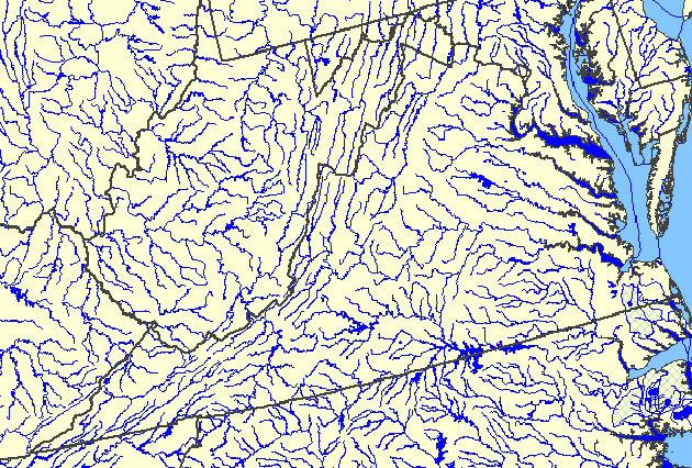
I got curious, for some reason I don’t remember, about what causes one river to flow into another, so I did some Google-work and found a big ol’ source on rivers in Virginia. I love this one graphic:
(Source: USGS National Atlas)
Rivers rivers everywhere!
Look closer to home and try to make sense of the Green river. Or is it the White? Or the Black? Or the Puyallup? Near Seattle it’s the Duwamish.
The stretch I grew up along was definitely the Green. But up around Auburn it’s the White, and the Puyallup, and down towards Tukwila it’s the Black for a short stretch. I’ve hiked along it from Tukwila to Puyallup, and could never figure out where the transition was. Geographically, that is. The Green was where I caught steelhead, the White was, well, white because of all the silt coming down out of the Cascades.
I guess part of the confusion was because it changed course several times before it got all dammed up in the 50s.
Funny you mention it, I was just idly looking at a Seattle map the other day and was surprised to see that the Green was the Duwamish farther north. Here I’d been thinking they were two different rivers all this time.
Just as a bit of trivia, the New River in North Carolina is one of the oldest rivers in the Piedmont.
Golly.
I’ve been using topo-maps in my work for 40+ years.
I feel like I’ve always known this about Rivers and streams and creeks and possibly cricks.
LOTS of past course changes in the Green/White/Duwamish drainage. Before Lake Washington was lowered, the Green flowed into it and the Duwamish, IIRC, flowed out separately. The entire Southcenter area was a marsh. Further south, in or near Orting, the White River used to flow into the Green but is now a tributary of the Puyallup. Some of that is natural, much is not.
Here’s an excellent little map from Wikipedia:
http://en.wikipedia.org/wiki/Duwamish_River#/media/File:Duwamishvalley1899-1959.png
What causes one river to flow into another? Elevation changes. You’re welcome.
And what I should have added: the really interesting question is “What caused the elevation changes?” ‘Cause a topo map that’s all wrinkles like the Duwamish basin has a lot of geologic story behind it, as Dana keeps illustrating for our collective edification.